Marshall Topo Map Michigan
To zoom in, hover over the map of Marshall
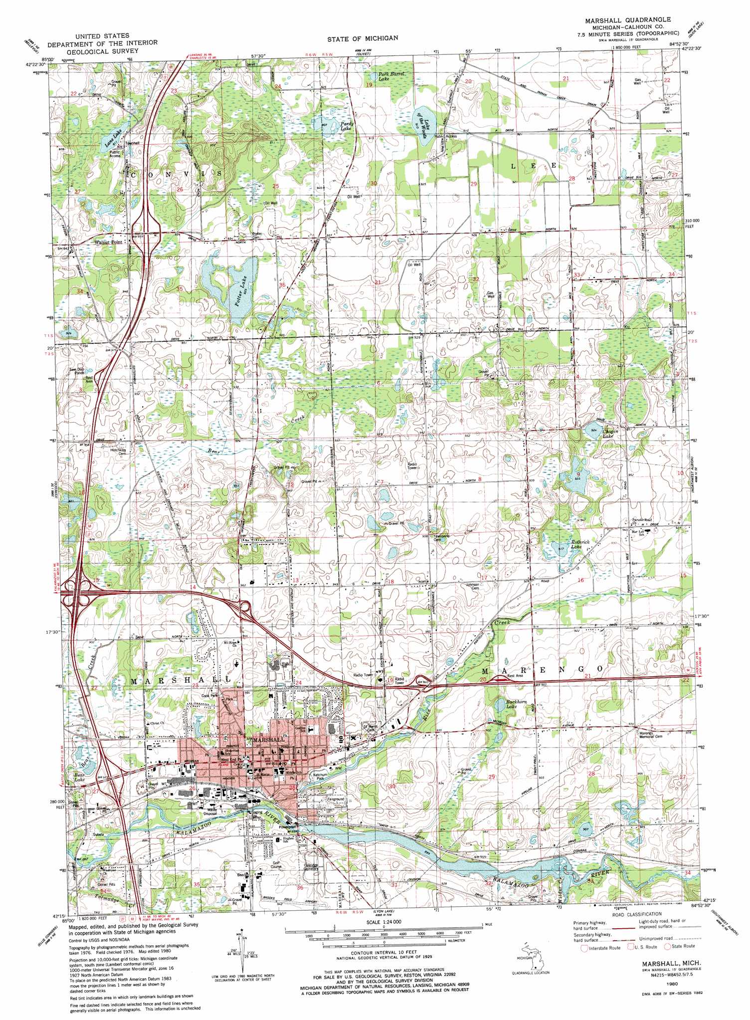
USGS Topo Quad 42084c8 - 1:24,000 scale
| Topo Map Name: | Marshall |
| USGS Topo Quad ID: | 42084c8 |
| Print Size: | ca. 21 1/4" wide x 27" high |
| Southeast Coordinates: | 42.25° N latitude / 84.875° W longitude |
| Map Center Coordinates: | 42.3125° N latitude / 84.9375° W longitude |
| U.S. State: | MI |
| Filename: | o42084c8.jpg |
| Download Map JPG Image: | Marshall topo map 1:24,000 scale |
| Map Type: | Topographic |
| Topo Series: | 7.5´ |
| Map Scale: | 1:24,000 |
| Source of Map Images: | United States Geological Survey (USGS) |
| Alternate Map Versions: |
Marshall MI 1980, updated 1980 Download PDF Buy paper map Marshall MI 2011 Download PDF Buy paper map Marshall MI 2014 Download PDF Buy paper map Marshall MI 2017 Download PDF Buy paper map |
1:24,000 Topo Quads surrounding Marshall
Maple Grove |
Nashville |
Chester |
Charlotte |
Eaton Rapids |
Bedford |
Bellevue |
Olivet |
Duck Lake |
Springport |
Battle Creek |
Ceresco |
Marshall |
Northwest Albion |
Northeast Albion |
East Leroy |
Ellis Corners |
Lyon Lake |
Southwest Albion |
Southeast Albion |
Union City |
Burlington |
Tekonsha |
Litchfield |
Mosherville |
> Back to 42084a1 at 1:100,000 scale
> Back to 42084a1 at 1:250,000 scale
> Back to U.S. Topo Maps home
Marshall topo map: Gazetteer
Marshall: Airports
Brooks Field elevation 286m 938′Marshall: Canals
State and Indian Creek Drain elevation 280m 918′Marshall: Lakes
Bear Lake elevation 273m 895′Buckhorn Lake elevation 275m 902′
Chapin Lake elevation 281m 921′
Lake of the Woods elevation 279m 915′
Lane Lake elevation 279m 915′
Pardy Lake elevation 275m 902′
Pork Barrel Lake elevation 279m 915′
Potter Lake elevation 283m 928′
Rothrick Lake elevation 279m 915′
Marshall: Parks
Cook Park elevation 290m 951′Ketchum Park elevation 274m 898′
Marshall: Populated Places
Marshall elevation 279m 915′Walnut Point elevation 286m 938′
Marshall: Streams
Bear Creek elevation 268m 879′Rice Creek elevation 273m 895′
Talmadge Creek elevation 268m 879′
Wilder Creek elevation 274m 898′
Marshall digital topo map on disk
Buy this Marshall topo map showing relief, roads, GPS coordinates and other geographical features, as a high-resolution digital map file on DVD:
Northern Illinois, Northern Indiana & Southwestern Michigan
Buy digital topo maps: Northern Illinois, Northern Indiana & Southwestern Michigan