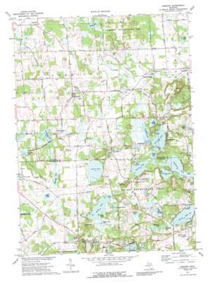
Gregory Topo Map Michigan
To zoom in, hover over the map of Gregory
USGS Topo Quad 42084d1 - 1:24,000 scale
| Topo Map Name: | Gregory |
| USGS Topo Quad ID: | 42084d1 |
| Print Size: | ca. 21 1/4" wide x 27" high |
| Southeast Coordinates: | 42.375° N latitude / 84° W longitude |
| Map Center Coordinates: | 42.4375° N latitude / 84.0625° W longitude |
| U.S. State: | MI |
| Filename: | o42084d1.jpg |
| Download Map JPG Image: | Gregory topo map 1:24,000 scale |
| Map Type: | Topographic |
| Topo Series: | 7.5´ |
| Map Scale: | 1:24,000 |
| Source of Map Images: | United States Geological Survey (USGS) |
| Alternate Map Versions: |
Gregory MI 1973, updated 1977 Download PDF Buy paper map Gregory MI 1973, updated 1989 Download PDF Buy paper map Gregory MI 1973, updated 1989 Download PDF Buy paper map Gregory MI 1996, updated 1999 Download PDF Buy paper map Gregory MI 2011 Download PDF Buy paper map Gregory MI 2014 Download PDF Buy paper map Gregory MI 2017 Download PDF Buy paper map |
1:24,000 Topo Quads surrounding Gregory
> Back to 42084a1 at 1:100,000 scale
> Back to 42084a1 at 1:250,000 scale
> Back to U.S. Topo Maps home
Gregory topo map: Gazetteer
Gregory: Airports
Carriage Lane Airport elevation 277m 908′Richmond Field elevation 281m 921′
Gregory: Canals
Anderson Drain elevation 274m 898′County Ditch Number Seven elevation 277m 908′
Gregory: Lakes
Avery Lake elevation 289m 948′Blind Lake elevation 269m 882′
Boyce Lake elevation 275m 902′
Bruin Lake elevation 270m 885′
Burkhart Lake elevation 284m 931′
Clark Lake elevation 288m 944′
Cranberry Lake elevation 269m 882′
Dead Lake elevation 282m 925′
Eagle Lake elevation 275m 902′
Ellsworth Lake elevation 275m 902′
Gosling Lake elevation 272m 892′
Halfmoon Lake elevation 270m 885′
Joslin Lake elevation 276m 905′
McIntyre Lake elevation 275m 902′
Mud Lake elevation 275m 902′
North Lake elevation 284m 931′
Patterson Lake elevation 270m 885′
Sayles Lake elevation 269m 882′
Sharp Lake elevation 278m 912′
Sheets Lake elevation 286m 938′
Snyder Lake elevation 276m 905′
South Lake elevation 275m 902′
Sullivan Lake elevation 275m 902′
Sullivan Lakes elevation 278m 912′
Twamley Lake elevation 285m 935′
Watson Lake elevation 270m 885′
Wild Goose Lake elevation 282m 925′
Williamsville Lake elevation 276m 905′
Woodburn Lake elevation 270m 885′
Gregory: Parks
Gregory State Game Area elevation 301m 987′Unadilla State Wildlife Area elevation 275m 902′
Gregory: Populated Places
Anderson elevation 278m 912′Bullis Crossing elevation 277m 908′
Chalkerville elevation 272m 892′
Gregory elevation 286m 938′
Kaiserville elevation 271m 889′
Lyndon Center elevation 305m 1000′
Plainfield elevation 291m 954′
Unadilla elevation 275m 902′
Williamsville elevation 280m 918′
Gregory: Streams
Livermore Creek elevation 270m 885′Portage Creek elevation 269m 882′
Unadilla Stockbridge Drain elevation 275m 902′
Gregory: Summits
Prospect Hill elevation 319m 1046′Shanahan Hill elevation 317m 1040′
Gregory digital topo map on disk
Buy this Gregory topo map showing relief, roads, GPS coordinates and other geographical features, as a high-resolution digital map file on DVD:
Northern Illinois, Northern Indiana & Southwestern Michigan
Buy digital topo maps: Northern Illinois, Northern Indiana & Southwestern Michigan


