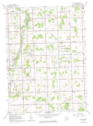
Aurelius Topo Map Michigan
To zoom in, hover over the map of Aurelius
USGS Topo Quad 42084e5 - 1:24,000 scale
| Topo Map Name: | Aurelius |
| USGS Topo Quad ID: | 42084e5 |
| Print Size: | ca. 21 1/4" wide x 27" high |
| Southeast Coordinates: | 42.5° N latitude / 84.5° W longitude |
| Map Center Coordinates: | 42.5625° N latitude / 84.5625° W longitude |
| U.S. State: | MI |
| Filename: | o42084e5.jpg |
| Download Map JPG Image: | Aurelius topo map 1:24,000 scale |
| Map Type: | Topographic |
| Topo Series: | 7.5´ |
| Map Scale: | 1:24,000 |
| Source of Map Images: | United States Geological Survey (USGS) |
| Alternate Map Versions: |
Aurelius MI 1965, updated 1967 Download PDF Buy paper map Aurelius MI 1965, updated 1974 Download PDF Buy paper map Aurelius MI 2011 Download PDF Buy paper map Aurelius MI 2014 Download PDF Buy paper map Aurelius MI 2017 Download PDF Buy paper map |
1:24,000 Topo Quads surrounding Aurelius
> Back to 42084e1 at 1:100,000 scale
> Back to 42084a1 at 1:250,000 scale
> Back to U.S. Topo Maps home
Aurelius topo map: Gazetteer
Aurelius: Airports
Bergeon Field elevation 275m 902′Aurelius: Canals
Abbott Drain elevation 267m 875′Aurelius and Delhi Drain elevation 266m 872′
Blakslee Drain elevation 268m 879′
County Line Drain elevation 265m 869′
Gretton Drain elevation 273m 895′
Hart Branch elevation 272m 892′
Hemans Drain elevation 281m 921′
Holley and Day Drain elevation 268m 879′
Kenfield Drain elevation 273m 895′
Marshall and Hayes Drain elevation 277m 908′
Oaks Drain elevation 280m 918′
Osborne Drain elevation 273m 895′
Topliff Drain elevation 276m 905′
West Aurelius Drain elevation 274m 898′
Wright and Potter Drain elevation 274m 898′
Aurelius: Lakes
Mud Lake elevation 277m 908′Aurelius: Parks
Columbia Creek Park elevation 273m 895′Grand River County Park elevation 260m 853′
Aurelius: Populated Places
Aurelius elevation 297m 974′North Aurelius elevation 279m 915′
Petrieville elevation 268m 879′
Aurelius: Post Offices
Petreville Post Office (historical) elevation 268m 879′Aurelius: Streams
Columbia Creek elevation 258m 846′Fowler Drain elevation 274m 898′
Skinner Extension Drain elevation 258m 846′
Aurelius digital topo map on disk
Buy this Aurelius topo map showing relief, roads, GPS coordinates and other geographical features, as a high-resolution digital map file on DVD:
Northern Illinois, Northern Indiana & Southwestern Michigan
Buy digital topo maps: Northern Illinois, Northern Indiana & Southwestern Michigan


