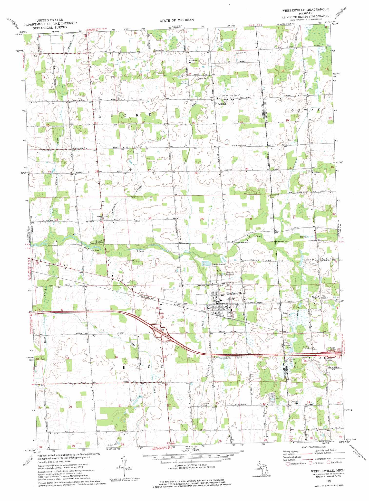
Webberville Topo Map Michigan
To zoom in, hover over the map of Webberville
USGS Topo Quad 42084f2 - 1:24,000 scale
| Topo Map Name: | Webberville |
| USGS Topo Quad ID: | 42084f2 |
| Print Size: | ca. 21 1/4" wide x 27" high |
| Southeast Coordinates: | 42.625° N latitude / 84.125° W longitude |
| Map Center Coordinates: | 42.6875° N latitude / 84.1875° W longitude |
| U.S. State: | MI |
| Filename: | o42084f2.jpg |
| Download Map JPG Image: | Webberville topo map 1:24,000 scale |
| Map Type: | Topographic |
| Topo Series: | 7.5´ |
| Map Scale: | 1:24,000 |
| Source of Map Images: | United States Geological Survey (USGS) |
| Alternate Map Versions: |
Webberville MI 1973, updated 1977 Download PDF Buy paper map Webberville MI 2011 Download PDF Buy paper map Webberville MI 2014 Download PDF Buy paper map Webberville MI 2017 Download PDF Buy paper map |
1:24,000 Topo Quads surrounding Webberville
Price |
Laingsburg |
Owosso South |
Corunna |
Durand |
Bath |
Shaftsburg |
Perry |
Corunna Se |
Byron |
East Lansing |
Williamston |
Webberville |
Fowlerville |
Oak Grove |
Mason |
Dansville |
Millville |
Parkers Corners |
Howell |
Leslie |
Pleasant Lake |
Stockbridge |
Gregory |
Pinckney |
> Back to 42084e1 at 1:100,000 scale
> Back to 42084a1 at 1:250,000 scale
> Back to U.S. Topo Maps home
Webberville topo map: Gazetteer
Webberville: Parks
Browell Roadside Park elevation 268m 879′Webberville: Populated Places
Bell Oak elevation 280m 918′Webberville elevation 271m 889′
Webberville: Streams
Dietz Creek elevation 264m 866′Doan Creek elevation 264m 866′
Kalamink Creek elevation 265m 869′
Squaw Creek elevation 264m 866′
Sullivan Creek elevation 265m 869′
West Branch Red Cedar River elevation 268m 879′
Wolf Creek elevation 265m 869′
Webberville digital topo map on disk
Buy this Webberville topo map showing relief, roads, GPS coordinates and other geographical features, as a high-resolution digital map file on DVD:
Northern Illinois, Northern Indiana & Southwestern Michigan
Buy digital topo maps: Northern Illinois, Northern Indiana & Southwestern Michigan