Eagle Topo Map Michigan
To zoom in, hover over the map of Eagle
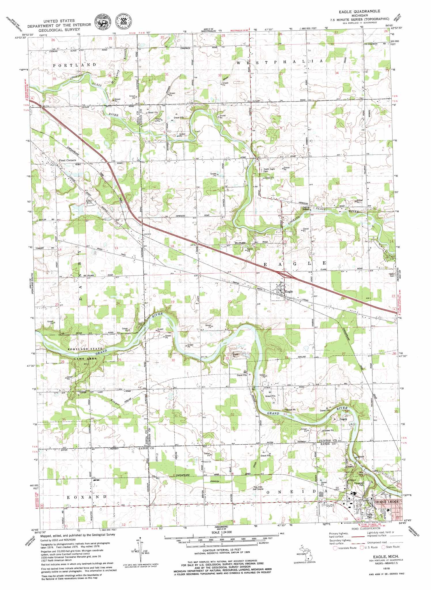
USGS Topo Quad 42084g7 - 1:24,000 scale
| Topo Map Name: | Eagle |
| USGS Topo Quad ID: | 42084g7 |
| Print Size: | ca. 21 1/4" wide x 27" high |
| Southeast Coordinates: | 42.75° N latitude / 84.75° W longitude |
| Map Center Coordinates: | 42.8125° N latitude / 84.8125° W longitude |
| U.S. State: | MI |
| Filename: | o42084g7.jpg |
| Download Map JPG Image: | Eagle topo map 1:24,000 scale |
| Map Type: | Topographic |
| Topo Series: | 7.5´ |
| Map Scale: | 1:24,000 |
| Source of Map Images: | United States Geological Survey (USGS) |
| Alternate Map Versions: |
Eagle MI 1978, updated 1979 Download PDF Buy paper map Eagle MI 2011 Download PDF Buy paper map Eagle MI 2014 Download PDF Buy paper map Eagle MI 2017 Download PDF Buy paper map |
1:24,000 Topo Quads surrounding Eagle
Shiloh |
Palo |
Hubbardston |
Maple Rapids |
Saint Johns North |
Ionia |
Portland North |
Wasphalia |
Riley |
Saint Johns South |
Woodbury |
Portland South |
Eagle |
Wacousta |
Lansing North |
Saubee Lake |
Hoytville |
Needmore |
Dimondale |
Lansing South |
Nashville |
Chester |
Charlotte |
Eaton Rapids |
Aurelius |
> Back to 42084e1 at 1:100,000 scale
> Back to 42084a1 at 1:250,000 scale
> Back to U.S. Topo Maps home
Eagle topo map: Gazetteer
Eagle: Canals
Johnson Drain elevation 255m 836′Kramer Drain elevation 232m 761′
Eagle: Crossings
Interchange 84 elevation 233m 764′Eagle: Parks
Fitzgerald Park elevation 256m 839′Fitzgerald Park Historical Marker elevation 256m 839′
Joshua Simmons II Historical Marker elevation 238m 780′
Lincoln Brick Park elevation 257m 843′
Oak Park elevation 258m 846′
Eagle: Populated Places
Eagle elevation 254m 833′Frost Corners elevation 247m 810′
Grand Ledge Ravines Mobile Home Park elevation 259m 849′
Eagle: Post Offices
Eagle Post Office elevation 255m 836′North Eagle Post Office (historical) elevation 247m 810′
River Bend Post Office (historical) elevation 259m 849′
Eagle: Streams
Derbyshire Lee Branch elevation 244m 800′Frayer Creek elevation 231m 757′
McCausey Branch elevation 223m 731′
Sandstone Creek elevation 241m 790′
Eagle digital topo map on disk
Buy this Eagle topo map showing relief, roads, GPS coordinates and other geographical features, as a high-resolution digital map file on DVD:
Northern Illinois, Northern Indiana & Southwestern Michigan
Buy digital topo maps: Northern Illinois, Northern Indiana & Southwestern Michigan