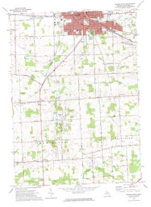
Owosso South Topo Map Michigan
To zoom in, hover over the map of Owosso South
USGS Topo Quad 42084h2 - 1:24,000 scale
| Topo Map Name: | Owosso South |
| USGS Topo Quad ID: | 42084h2 |
| Print Size: | ca. 21 1/4" wide x 27" high |
| Southeast Coordinates: | 42.875° N latitude / 84.125° W longitude |
| Map Center Coordinates: | 42.9375° N latitude / 84.1875° W longitude |
| U.S. State: | MI |
| Filename: | o42084h2.jpg |
| Download Map JPG Image: | Owosso South topo map 1:24,000 scale |
| Map Type: | Topographic |
| Topo Series: | 7.5´ |
| Map Scale: | 1:24,000 |
| Source of Map Images: | United States Geological Survey (USGS) |
| Alternate Map Versions: |
Owosso South MI 1972, updated 1975 Download PDF Buy paper map Owosso South MI 1972, updated 1975 Download PDF Buy paper map Owosso South MI 2011 Download PDF Buy paper map Owosso South MI 2014 Download PDF Buy paper map Owosso South MI 2017 Download PDF Buy paper map |
1:24,000 Topo Quads surrounding Owosso South
> Back to 42084e1 at 1:100,000 scale
> Back to 42084a1 at 1:250,000 scale
> Back to U.S. Topo Maps home
Owosso South topo map: Gazetteer
Owosso South: Airports
Owosso Community Airport elevation 223m 731′Owosso South: Canals
Drury Drain elevation 237m 777′Owosso Drain elevation 225m 738′
Owosso South: Lakes
Cummings Lakes elevation 243m 797′Hopkins Lake elevation 233m 764′
Manitou Lake elevation 238m 780′
Owosso South: Parks
Bentley Park elevation 224m 734′Birthplace of Thomas Edmund Dewey Historical Marker elevation 222m 728′
Collamer Park elevation 237m 777′
Comstock Cabin Historical Marker elevation 221m 725′
Curwood Castle Historical Marker elevation 220m 721′
Curwood Castle Park elevation 220m 721′
First Congregational Church and Society Historical Marker elevation 226m 741′
Grand Avenue Park elevation 226m 741′
Grove Holman Park elevation 231m 757′
Hugh McCurdy Historical Marker elevation 226m 741′
Hugh Parker Field elevation 225m 738′
Kiwanis Park elevation 220m 721′
Lions Park elevation 224m 734′
Maple River Historical Marker elevation 247m 810′
McCurdy Park elevation 226m 741′
Mitchell Softball Fields elevation 223m 731′
Rosevear Park elevation 225m 738′
Stuart Coutts Pavilion elevation 223m 731′
Willman Field elevation 221m 725′
Owosso South: Populated Places
Bennington elevation 243m 797′Candlewick Court Mobile Home Park elevation 225m 738′
Five Points elevation 238m 780′
Middletown elevation 227m 744′
Owosso elevation 222m 728′
Owosso Trailer Park elevation 239m 784′
Pittsburg elevation 261m 856′
Owosso South: Post Offices
Bennington Post Office (historical) elevation 243m 797′Hartwellville Post Office (historical) elevation 265m 869′
Owosso Post Office elevation 226m 741′
Pittsburg Post Office (historical) elevation 262m 859′
Owosso South: Streams
Spring Brook elevation 225m 738′Owosso South digital topo map on disk
Buy this Owosso South topo map showing relief, roads, GPS coordinates and other geographical features, as a high-resolution digital map file on DVD:
Northern Illinois, Northern Indiana & Southwestern Michigan
Buy digital topo maps: Northern Illinois, Northern Indiana & Southwestern Michigan


