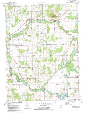
Burlington Topo Map Michigan
To zoom in, hover over the map of Burlington
USGS Topo Quad 42085a1 - 1:24,000 scale
| Topo Map Name: | Burlington |
| USGS Topo Quad ID: | 42085a1 |
| Print Size: | ca. 21 1/4" wide x 27" high |
| Southeast Coordinates: | 42° N latitude / 85° W longitude |
| Map Center Coordinates: | 42.0625° N latitude / 85.0625° W longitude |
| U.S. State: | MI |
| Filename: | o42085a1.jpg |
| Download Map JPG Image: | Burlington topo map 1:24,000 scale |
| Map Type: | Topographic |
| Topo Series: | 7.5´ |
| Map Scale: | 1:24,000 |
| Source of Map Images: | United States Geological Survey (USGS) |
| Alternate Map Versions: |
Burlington MI 1982, updated 1982 Download PDF Buy paper map Burlington MI 2011 Download PDF Buy paper map Burlington MI 2014 Download PDF Buy paper map Burlington MI 2016 Download PDF Buy paper map |
1:24,000 Topo Quads surrounding Burlington
> Back to 42085a1 at 1:100,000 scale
> Back to 42084a1 at 1:250,000 scale
> Back to U.S. Topo Maps home
Burlington topo map: Gazetteer
Burlington: Airports
Kaufmans Landing Strip elevation 284m 931′Burlington: Flats
Cherry Flats elevation 282m 925′Burlington: Lakes
Craig Lake elevation 281m 921′Dow Lake elevation 285m 935′
Fox Lake elevation 283m 928′
Girard Lake elevation 283m 928′
Heart Lake elevation 285m 935′
Hodunk Pond elevation 281m 921′
Hubbard Lake elevation 283m 928′
Musser Lake elevation 283m 928′
Olney Lake elevation 282m 925′
Pork Barrel Lake elevation 283m 928′
Round Lake elevation 283m 928′
Stancers Pond elevation 278m 912′
Vincent Lake elevation 284m 931′
Wilder Lake elevation 286m 938′
Burlington: Parks
Angel Cove Park elevation 284m 931′Methodist Episcopal Church Historical Marker elevation 290m 951′
Riverbend County Park elevation 275m 902′
Burlington: Populated Places
Burlington elevation 284m 931′Girard elevation 291m 954′
Hodunk elevation 284m 931′
Burlington: Post Offices
Girard Post Office (historical) elevation 291m 954′Hodunk Post Office (historical) elevation 284m 931′
Burlington: Streams
Hog Creek elevation 280m 918′North Branch Hog Creek elevation 285m 935′
South Branch Hog Creek elevation 288m 944′
Burlington: Summits
Dixon Hall elevation 333m 1092′Stony Point Hill elevation 295m 967′
Burlington digital topo map on disk
Buy this Burlington topo map showing relief, roads, GPS coordinates and other geographical features, as a high-resolution digital map file on DVD:
Northern Illinois, Northern Indiana & Southwestern Michigan
Buy digital topo maps: Northern Illinois, Northern Indiana & Southwestern Michigan


