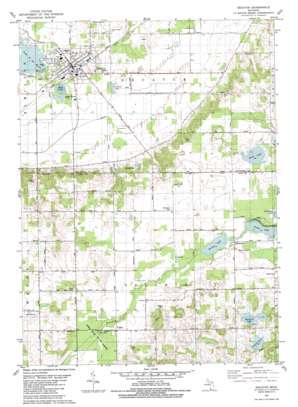
Decatur Topo Map Michigan
To zoom in, hover over the map of Decatur
USGS Topo Quad 42085a8 - 1:24,000 scale
| Topo Map Name: | Decatur |
| USGS Topo Quad ID: | 42085a8 |
| Print Size: | ca. 21 1/4" wide x 27" high |
| Southeast Coordinates: | 42° N latitude / 85.875° W longitude |
| Map Center Coordinates: | 42.0625° N latitude / 85.9375° W longitude |
| U.S. State: | MI |
| Filename: | o42085a8.jpg |
| Download Map JPG Image: | Decatur topo map 1:24,000 scale |
| Map Type: | Topographic |
| Topo Series: | 7.5´ |
| Map Scale: | 1:24,000 |
| Source of Map Images: | United States Geological Survey (USGS) |
| Alternate Map Versions: |
Decatur MI 1981, updated 1982 Download PDF Buy paper map Decatur MI 2011 Download PDF Buy paper map Decatur MI 2014 Download PDF Buy paper map Decatur MI 2016 Download PDF Buy paper map |
1:24,000 Topo Quads surrounding Decatur
> Back to 42085a1 at 1:100,000 scale
> Back to 42084a1 at 1:250,000 scale
> Back to U.S. Topo Maps home
Decatur topo map: Gazetteer
Decatur: Canals
Dowagiac Drain elevation 227m 744′Red Run elevation 232m 761′
Spring Creek elevation 227m 744′
Decatur: Forests
Fred Russ State Forest elevation 259m 849′Decatur: Lakes
Bunker Lake elevation 262m 859′Copley Lake elevation 276m 905′
Cowham Lake elevation 279m 915′
Finch Lake elevation 263m 862′
Lake of the Woods elevation 229m 751′
Mud Lake elevation 230m 754′
Pickerel Lake elevation 225m 738′
Swift Lake elevation 269m 882′
Decatur: Parks
Decatur Township Hall Historical Marker elevation 240m 787′Fred Russ Forest Park elevation 259m 849′
Newton House Historical Marker elevation 261m 856′
Woolfe Park elevation 230m 754′
Decatur: Populated Places
Decatur elevation 240m 787′Nicholsville elevation 268m 879′
Volinia elevation 262m 859′
Decatur: Post Offices
Decatur Post Office elevation 239m 784′Picket's Corner Post Office (historical) elevation 280m 918′
Prairie Ronde Post Office (historical) elevation 269m 882′
Volinia Post Office (historical) elevation 262m 859′
Decatur digital topo map on disk
Buy this Decatur topo map showing relief, roads, GPS coordinates and other geographical features, as a high-resolution digital map file on DVD:
Northern Illinois, Northern Indiana & Southwestern Michigan
Buy digital topo maps: Northern Illinois, Northern Indiana & Southwestern Michigan


