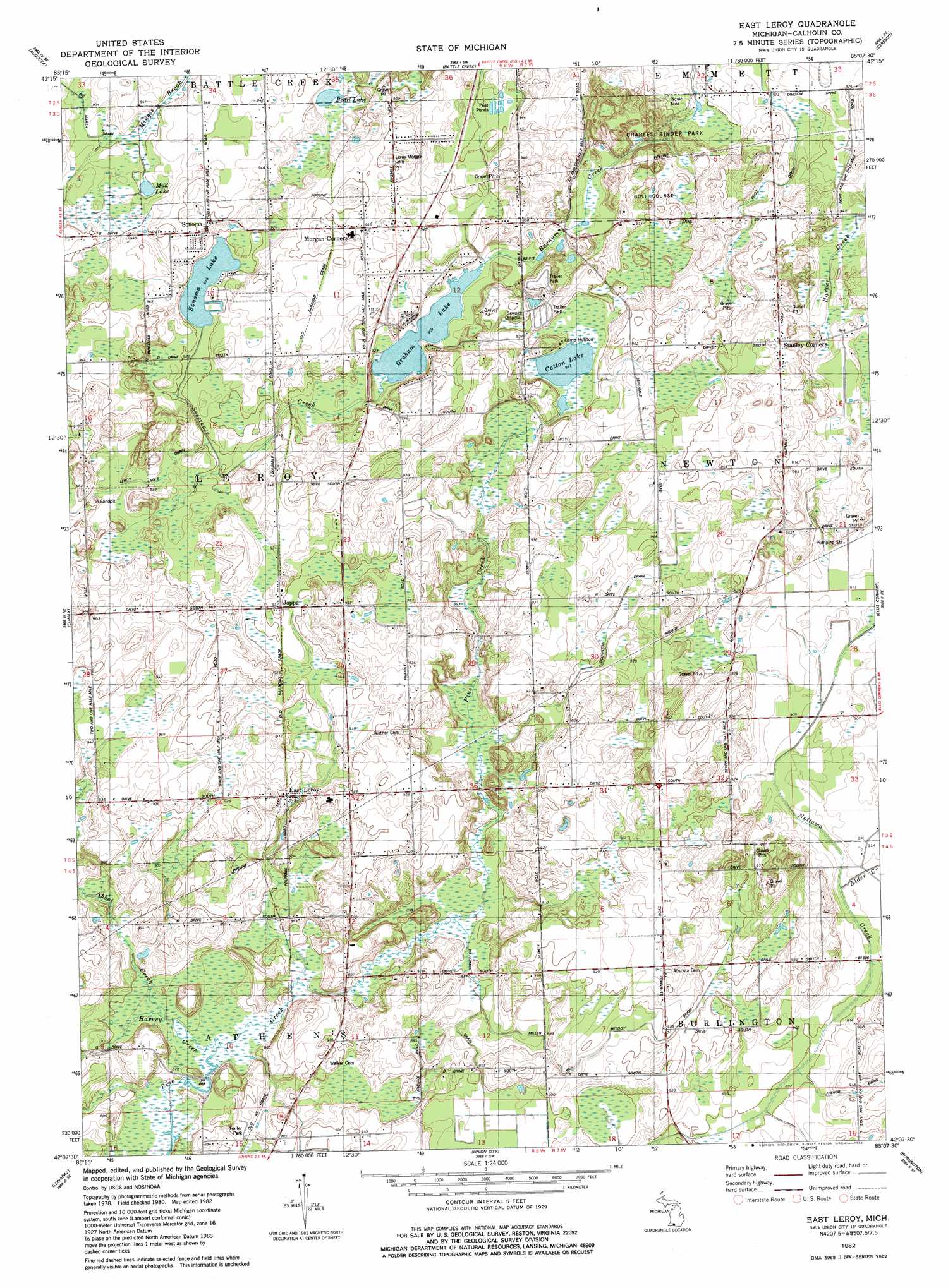
East Leroy Topo Map Michigan
To zoom in, hover over the map of East Leroy
USGS Topo Quad 42085b2 - 1:24,000 scale
| Topo Map Name: | East Leroy |
| USGS Topo Quad ID: | 42085b2 |
| Print Size: | ca. 21 1/4" wide x 27" high |
| Southeast Coordinates: | 42.125° N latitude / 85.125° W longitude |
| Map Center Coordinates: | 42.1875° N latitude / 85.1875° W longitude |
| U.S. State: | MI |
| Filename: | o42085b2.jpg |
| Download Map JPG Image: | East Leroy topo map 1:24,000 scale |
| Map Type: | Topographic |
| Topo Series: | 7.5´ |
| Map Scale: | 1:24,000 |
| Source of Map Images: | United States Geological Survey (USGS) |
| Alternate Map Versions: |
East Leroy MI 1982, updated 1982 Download PDF Buy paper map East Leroy MI 2011 Download PDF Buy paper map East Leroy MI 2014 Download PDF Buy paper map East Leroy MI 2016 Download PDF Buy paper map |
1:24,000 Topo Quads surrounding East Leroy
Delton |
Banfield |
Bedford |
Bellevue |
Olivet |
Galesburg |
Augusta |
Battle Creek |
Ceresco |
Marshall |
Adams Park |
Climax |
East Leroy |
Ellis Corners |
Lyon Lake |
Mendon |
Leonidas |
Union City |
Burlington |
Tekonsha |
Nottawa |
Colon |
Bronson North |
Coldwater West |
Coldwater East |
> Back to 42085a1 at 1:100,000 scale
> Back to 42084a1 at 1:250,000 scale
> Back to U.S. Topo Maps home
East Leroy topo map: Gazetteer
East Leroy: Canals
French Drain elevation 279m 915′Houghton Drain elevation 281m 921′
Miller and Melody Drain elevation 279m 915′
Waterman Drain elevation 267m 875′
East Leroy: Lakes
Cotton Lake elevation 279m 915′Graham Lake elevation 276m 905′
Mud Lake elevation 281m 921′
Pearl Lake elevation 282m 925′
Sonoma Lake elevation 279m 915′
East Leroy: Parks
Charles Binder Park elevation 274m 898′East Leroy: Populated Places
East Leroy elevation 279m 915′Joppa elevation 284m 931′
Morgan Corners elevation 288m 944′
Sonoma elevation 290m 951′
Stanley Corners elevation 296m 971′
East Leroy: Streams
Alder Creek elevation 274m 898′Severence Creek elevation 276m 905′
East Leroy digital topo map on disk
Buy this East Leroy topo map showing relief, roads, GPS coordinates and other geographical features, as a high-resolution digital map file on DVD:
Northern Illinois, Northern Indiana & Southwestern Michigan
Buy digital topo maps: Northern Illinois, Northern Indiana & Southwestern Michigan