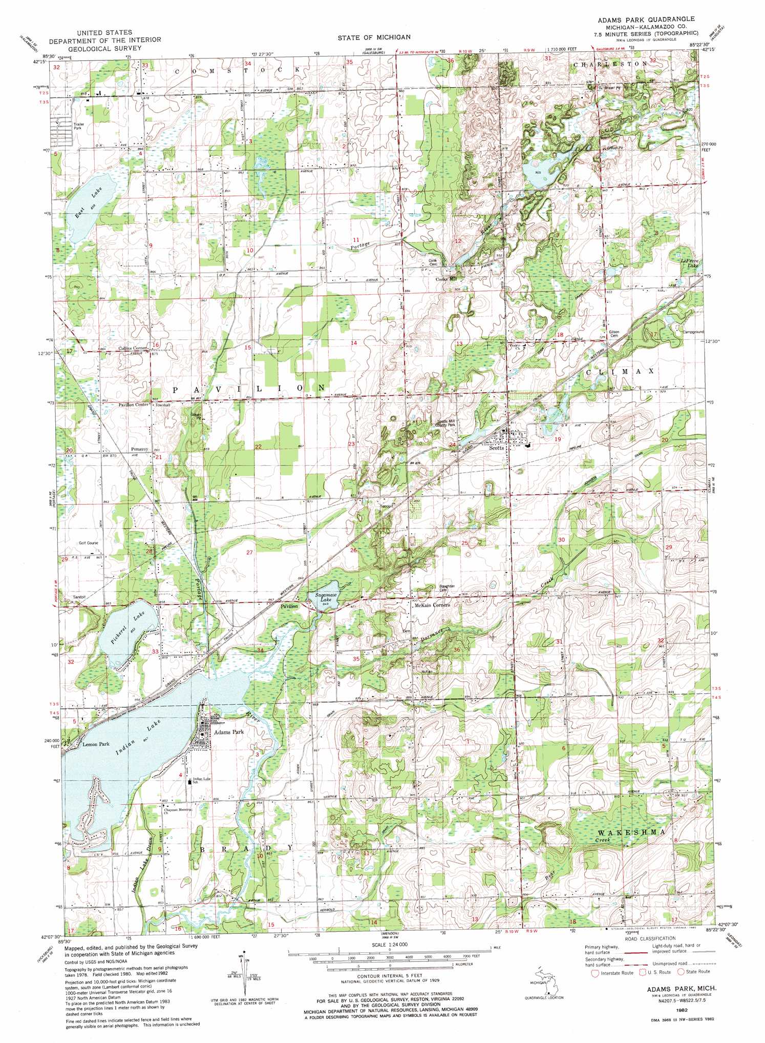
Adams Park Topo Map Michigan
To zoom in, hover over the map of Adams Park
USGS Topo Quad 42085b4 - 1:24,000 scale
| Topo Map Name: | Adams Park |
| USGS Topo Quad ID: | 42085b4 |
| Print Size: | ca. 21 1/4" wide x 27" high |
| Southeast Coordinates: | 42.125° N latitude / 85.375° W longitude |
| Map Center Coordinates: | 42.1875° N latitude / 85.4375° W longitude |
| U.S. State: | MI |
| Filename: | o42085b4.jpg |
| Download Map JPG Image: | Adams Park topo map 1:24,000 scale |
| Map Type: | Topographic |
| Topo Series: | 7.5´ |
| Map Scale: | 1:24,000 |
| Source of Map Images: | United States Geological Survey (USGS) |
| Alternate Map Versions: |
Adams Park MI 1982, updated 1982 Download PDF Buy paper map Adams Park MI 2011 Download PDF Buy paper map Adams Park MI 2014 Download PDF Buy paper map Adams Park MI 2016 Download PDF Buy paper map |
1:24,000 Topo Quads surrounding Adams Park
Otsego |
Kalamazoo Ne |
Delton |
Banfield |
Bedford |
Kalamazoo Sw |
Kalamazoo |
Galesburg |
Augusta |
Battle Creek |
Schoolcraft Nw |
Portage |
Adams Park |
Climax |
East Leroy |
Schoolcraft |
Vicksburg |
Mendon |
Leonidas |
Union City |
Three Rivers West |
Three Rivers East |
Nottawa |
Colon |
Bronson North |
> Back to 42085a1 at 1:100,000 scale
> Back to 42084a1 at 1:250,000 scale
> Back to U.S. Topo Maps home
Adams Park topo map: Gazetteer
Adams Park: Airports
East Lake Airport elevation 263m 862′Adams Park: Canals
Asher Drain elevation 262m 859′Indian Lake Drain elevation 259m 849′
Reinbold Drain elevation 264m 866′
Adams Park: Lakes
East Lake elevation 261m 856′Indian Lake elevation 258m 846′
Pickerel Lake elevation 260m 853′
Sagamaw Lake elevation 258m 846′
Adams Park: Parks
Scotts Mill County Park elevation 278m 912′Adams Park: Populated Places
Adams Park elevation 262m 859′Collins Corner elevation 267m 875′
Cooks Mill elevation 269m 882′
Lemon Park elevation 260m 853′
Pavilion elevation 264m 866′
Pavillion Center elevation 266m 872′
Pomeroy elevation 264m 866′
Scotts elevation 279m 915′
Adams Park: Post Offices
Pavilion Post Office (historical) elevation 264m 866′Adams Park: Streams
Dorrance Creek elevation 258m 846′Adams Park digital topo map on disk
Buy this Adams Park topo map showing relief, roads, GPS coordinates and other geographical features, as a high-resolution digital map file on DVD:
Northern Illinois, Northern Indiana & Southwestern Michigan
Buy digital topo maps: Northern Illinois, Northern Indiana & Southwestern Michigan