Augusta Topo Map Michigan
To zoom in, hover over the map of Augusta
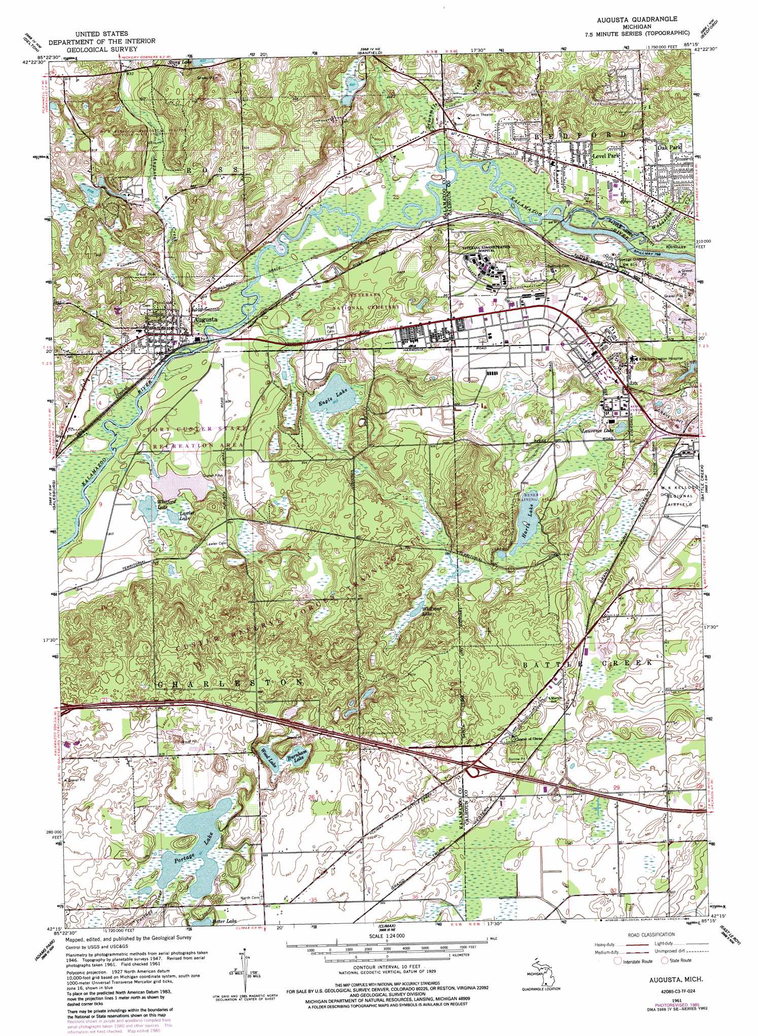
USGS Topo Quad 42085c3 - 1:24,000 scale
| Topo Map Name: | Augusta |
| USGS Topo Quad ID: | 42085c3 |
| Print Size: | ca. 21 1/4" wide x 27" high |
| Southeast Coordinates: | 42.25° N latitude / 85.25° W longitude |
| Map Center Coordinates: | 42.3125° N latitude / 85.3125° W longitude |
| U.S. State: | MI |
| Filename: | o42085c3.jpg |
| Download Map JPG Image: | Augusta topo map 1:24,000 scale |
| Map Type: | Topographic |
| Topo Series: | 7.5´ |
| Map Scale: | 1:24,000 |
| Source of Map Images: | United States Geological Survey (USGS) |
| Alternate Map Versions: |
Augusta MI 1947, updated 1955 Download PDF Buy paper map Augusta MI 1961, updated 1962 Download PDF Buy paper map Augusta MI 1961, updated 1968 Download PDF Buy paper map Augusta MI 1961, updated 1973 Download PDF Buy paper map Augusta MI 1961, updated 1985 Download PDF Buy paper map Augusta MI 1998, updated 1999 Download PDF Buy paper map Augusta MI 2011 Download PDF Buy paper map Augusta MI 2014 Download PDF Buy paper map Augusta MI 2016 Download PDF Buy paper map |
1:24,000 Topo Quads surrounding Augusta
Orangeville |
Cloverdale |
Dowling |
Maple Grove |
Nashville |
Kalamazoo Ne |
Delton |
Banfield |
Bedford |
Bellevue |
Kalamazoo |
Galesburg |
Augusta |
Battle Creek |
Ceresco |
Portage |
Adams Park |
Climax |
East Leroy |
Ellis Corners |
Vicksburg |
Mendon |
Leonidas |
Union City |
Burlington |
> Back to 42085a1 at 1:100,000 scale
> Back to 42084a1 at 1:250,000 scale
> Back to U.S. Topo Maps home
Augusta topo map: Gazetteer
Augusta: Airports
Custer Main Heliport elevation 269m 882′W K Kellogg Airport elevation 282m 925′
Augusta: Lakes
Burnham Lake elevation 284m 931′Eagle Lake elevation 244m 800′
Harts Lake elevation 269m 882′
Lawler Lake elevation 242m 793′
Lawrence Lake elevation 266m 872′
Portage Lake elevation 284m 931′
Whitford Lake elevation 242m 793′
Whitman Lake elevation 267m 875′
Wood Lake elevation 284m 931′
Augusta: Parks
Barn Theatre Historical Marker elevation 259m 849′Fort Custer State Park elevation 274m 898′
Park Theatre Historical Marker elevation 244m 800′
Augusta: Populated Places
Augusta elevation 246m 807′Level Park elevation 252m 826′
Oak Park elevation 253m 830′
Augusta: Streams
Augusta Creek elevation 239m 784′Sevenmile Creek elevation 243m 797′
Wabascon Creek elevation 241m 790′
Augusta digital topo map on disk
Buy this Augusta topo map showing relief, roads, GPS coordinates and other geographical features, as a high-resolution digital map file on DVD:
Northern Illinois, Northern Indiana & Southwestern Michigan
Buy digital topo maps: Northern Illinois, Northern Indiana & Southwestern Michigan