Kalamazoo Sw Topo Map Michigan
To zoom in, hover over the map of Kalamazoo Sw
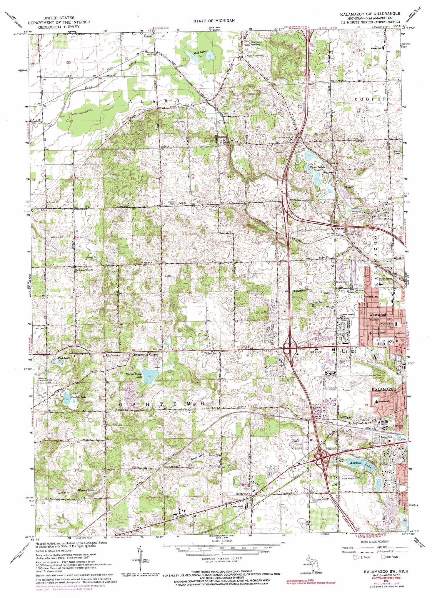
USGS Topo Quad 42085c6 - 1:24,000 scale
| Topo Map Name: | Kalamazoo Sw |
| USGS Topo Quad ID: | 42085c6 |
| Print Size: | ca. 21 1/4" wide x 27" high |
| Southeast Coordinates: | 42.25° N latitude / 85.625° W longitude |
| Map Center Coordinates: | 42.3125° N latitude / 85.6875° W longitude |
| U.S. State: | MI |
| Filename: | o42085c6.jpg |
| Download Map JPG Image: | Kalamazoo Sw topo map 1:24,000 scale |
| Map Type: | Topographic |
| Topo Series: | 7.5´ |
| Map Scale: | 1:24,000 |
| Source of Map Images: | United States Geological Survey (USGS) |
| Alternate Map Versions: |
Kalamazoo SW MI 1967, updated 1969 Download PDF Buy paper map Kalamazoo SW MI 1967, updated 1974 Download PDF Buy paper map Kalamazoo SW MI 1967, updated 1974 Download PDF Buy paper map Kalamazoo SW MI 2011 Download PDF Buy paper map Kalamazoo SW MI 2014 Download PDF Buy paper map Kalamazoo SW MI 2016 Download PDF Buy paper map |
1:24,000 Topo Quads surrounding Kalamazoo Sw
Millgrove |
Allegan |
Martin |
Orangeville |
Cloverdale |
Bloomingdale |
Merson |
Otsego |
Kalamazoo Ne |
Delton |
Gobles West |
Gobles East |
Kalamazoo Sw |
Kalamazoo |
Galesburg |
Paw Paw |
Lawton |
Schoolcraft Nw |
Portage |
Adams Park |
Decatur |
Marcellus |
Schoolcraft |
Vicksburg |
Mendon |
> Back to 42085a1 at 1:100,000 scale
> Back to 42084a1 at 1:250,000 scale
> Back to U.S. Topo Maps home
Kalamazoo Sw topo map: Gazetteer
Kalamazoo Sw: Crossings
Interchange 36 elevation 276m 905′Interchange 38 elevation 296m 971′
Interchange 41 elevation 259m 849′
Kalamazoo Sw: Lakes
Asylum Lake elevation 264m 866′Bonnie Castle Lake elevation 278m 912′
Dustin Lake elevation 257m 843′
Mud Lake elevation 246m 807′
Mud Lakes elevation 233m 764′
Twin Lakes elevation 257m 843′
Wyman Lake elevation 269m 882′
Kalamazoo Sw: Parks
Harris Family Historical Marker elevation 289m 948′Kalamazoo Region Historical Marker elevation 287m 941′
Kalamazoo Sw: Populated Places
Doughertys Corners elevation 294m 964′Oshtemo elevation 295m 967′
Westwood elevation 287m 941′
Kalamazoo Sw: Post Offices
Williams Post Office (historical) elevation 234m 767′Kalamazoo Sw: Swamps
South Lake elevation 270m 885′Kalamazoo Sw digital topo map on disk
Buy this Kalamazoo Sw topo map showing relief, roads, GPS coordinates and other geographical features, as a high-resolution digital map file on DVD:
Northern Illinois, Northern Indiana & Southwestern Michigan
Buy digital topo maps: Northern Illinois, Northern Indiana & Southwestern Michigan