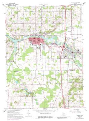
Otsego Topo Map Michigan
To zoom in, hover over the map of Otsego
USGS Topo Quad 42085d6 - 1:24,000 scale
| Topo Map Name: | Otsego |
| USGS Topo Quad ID: | 42085d6 |
| Print Size: | ca. 21 1/4" wide x 27" high |
| Southeast Coordinates: | 42.375° N latitude / 85.625° W longitude |
| Map Center Coordinates: | 42.4375° N latitude / 85.6875° W longitude |
| U.S. State: | MI |
| Filename: | o42085d6.jpg |
| Download Map JPG Image: | Otsego topo map 1:24,000 scale |
| Map Type: | Topographic |
| Topo Series: | 7.5´ |
| Map Scale: | 1:24,000 |
| Source of Map Images: | United States Geological Survey (USGS) |
| Alternate Map Versions: |
Otsego MI 1967, updated 1969 Download PDF Buy paper map Otsego MI 1967, updated 1974 Download PDF Buy paper map Otsego MI 1967, updated 1988 Download PDF Buy paper map Otsego MI 2011 Download PDF Buy paper map Otsego MI 2014 Download PDF Buy paper map Otsego MI 2016 Download PDF Buy paper map |
1:24,000 Topo Quads surrounding Otsego
> Back to 42085a1 at 1:100,000 scale
> Back to 42084a1 at 1:250,000 scale
> Back to U.S. Topo Maps home
Otsego topo map: Gazetteer
Otsego: Airports
Otsego-Plainwell Municipal Airport elevation 220m 721′Otsego: Crossings
Interchange 44 elevation 290m 951′Interchange 49 elevation 222m 728′
Interchange 50 elevation 221m 725′
Otsego: Dams
Otsego Dam elevation 204m 669′Plainwell Dam elevation 215m 705′
Otsego: Lakes
Barbour Lake elevation 224m 734′Hipps Lake elevation 224m 734′
Murry Lake elevation 222m 728′
Ruppert Lake elevation 217m 711′
Otsego: Parks
Hicks Park elevation 219m 718′North Side Park elevation 224m 734′
Otsego Methodist Church Historical Marker elevation 217m 711′
Sherwood Park elevation 219m 718′
Thurl Cook Park elevation 222m 728′
Otsego: Populated Places
Alamo elevation 238m 780′Gun River Mobile Estates elevation 221m 725′
Gun River West Mobile Home Park elevation 223m 731′
Otsego elevation 216m 708′
Plainwell elevation 222m 728′
Watson's Mobile Home Park elevation 222m 728′
Otsego: Post Offices
Alamo Post Office (historical) elevation 238m 780′Dent Post Office (historical) elevation 236m 774′
Otsego Post Office elevation 216m 708′
Plainwell Post Office elevation 220m 721′
Otsego: Streams
Gun River elevation 213m 698′Pine Creek elevation 208m 682′
Otsego digital topo map on disk
Buy this Otsego topo map showing relief, roads, GPS coordinates and other geographical features, as a high-resolution digital map file on DVD:
Northern Illinois, Northern Indiana & Southwestern Michigan
Buy digital topo maps: Northern Illinois, Northern Indiana & Southwestern Michigan


