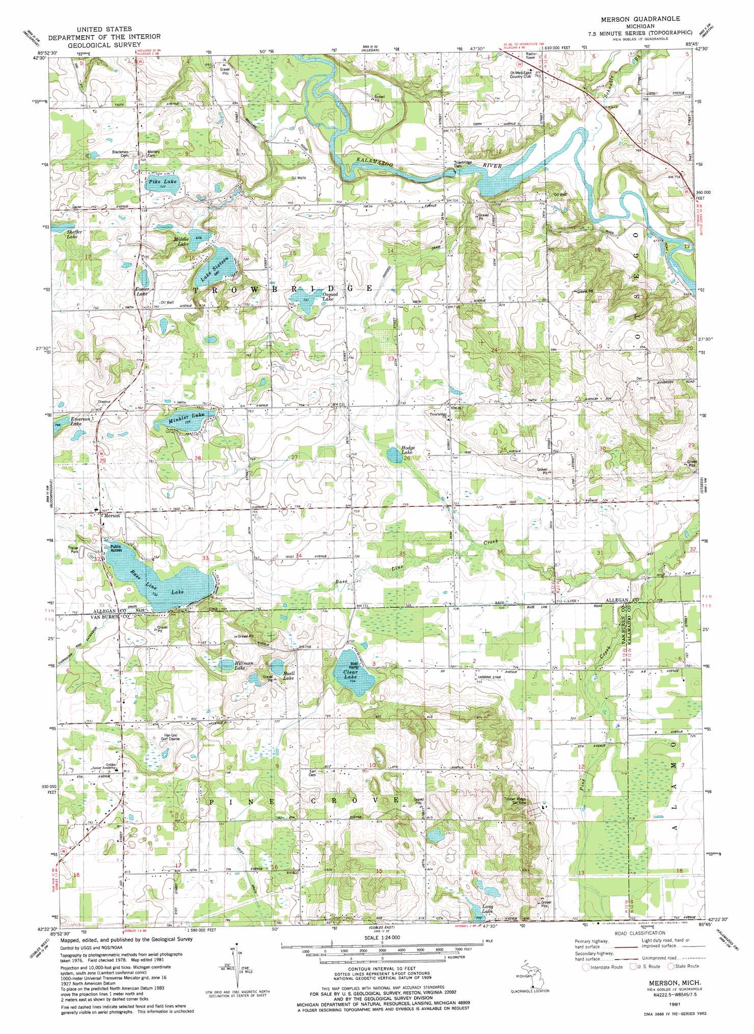
Merson Topo Map Michigan
To zoom in, hover over the map of Merson
USGS Topo Quad 42085d7 - 1:24,000 scale
| Topo Map Name: | Merson |
| USGS Topo Quad ID: | 42085d7 |
| Print Size: | ca. 21 1/4" wide x 27" high |
| Southeast Coordinates: | 42.375° N latitude / 85.75° W longitude |
| Map Center Coordinates: | 42.4375° N latitude / 85.8125° W longitude |
| U.S. State: | MI |
| Filename: | o42085d7.jpg |
| Download Map JPG Image: | Merson topo map 1:24,000 scale |
| Map Type: | Topographic |
| Topo Series: | 7.5´ |
| Map Scale: | 1:24,000 |
| Source of Map Images: | United States Geological Survey (USGS) |
| Alternate Map Versions: |
Merson MI 1981, updated 1982 Download PDF Buy paper map Merson MI 2011 Download PDF Buy paper map Merson MI 2014 Download PDF Buy paper map Merson MI 2016 Download PDF Buy paper map |
1:24,000 Topo Quads surrounding Merson
Hamilton West |
Hamilton East |
Burnips |
Wayland |
Bowens Mill |
Fennville |
Millgrove |
Allegan |
Martin |
Orangeville |
Pullman |
Bloomingdale |
Merson |
Otsego |
Kalamazoo Ne |
Bangor |
Gobles West |
Gobles East |
Kalamazoo Sw |
Kalamazoo |
Lawrence |
Paw Paw |
Lawton |
Schoolcraft Nw |
Portage |
> Back to 42085a1 at 1:100,000 scale
> Back to 42084a1 at 1:250,000 scale
> Back to U.S. Topo Maps home
Merson topo map: Gazetteer
Merson: Canals
Veley Drain elevation 233m 764′Merson: Lakes
Base Line Lake elevation 223m 731′Buell Lake elevation 224m 734′
Clear Lake elevation 224m 734′
Foster Lake elevation 218m 715′
Hillman Lake elevation 233m 764′
Hodge Lake elevation 218m 715′
Lake Sixteen elevation 207m 679′
Long Lake elevation 235m 770′
Middle Lake elevation 207m 679′
Minkler Lake elevation 225m 738′
Osgood Lake elevation 223m 731′
Pike Lake elevation 221m 725′
Sheffer Lake elevation 217m 711′
Merson: Populated Places
Merson elevation 232m 761′Merson: Post Offices
Merson Post Office (historical) elevation 232m 761′Merson: Streams
Base Line Creek elevation 212m 695′Osgood Drain elevation 204m 669′
Schnable Brook elevation 203m 666′
Merson digital topo map on disk
Buy this Merson topo map showing relief, roads, GPS coordinates and other geographical features, as a high-resolution digital map file on DVD:
Northern Illinois, Northern Indiana & Southwestern Michigan
Buy digital topo maps: Northern Illinois, Northern Indiana & Southwestern Michigan