Lawrence Topo Map Michigan
To zoom in, hover over the map of Lawrence
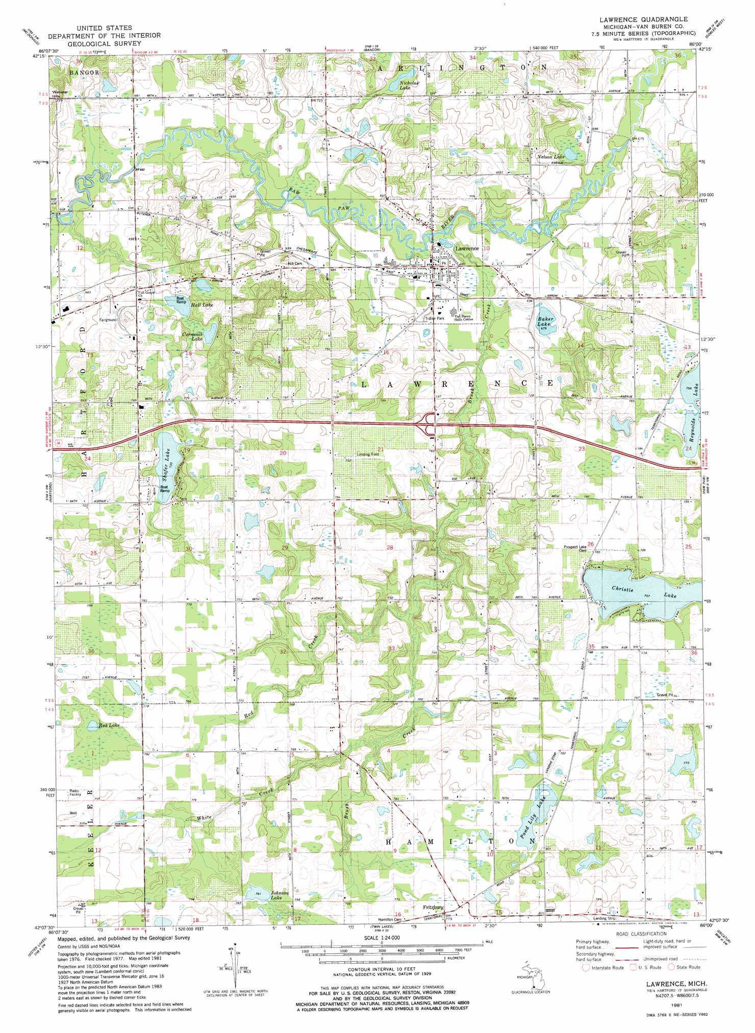
USGS Topo Quad 42086b1 - 1:24,000 scale
| Topo Map Name: | Lawrence |
| USGS Topo Quad ID: | 42086b1 |
| Print Size: | ca. 21 1/4" wide x 27" high |
| Southeast Coordinates: | 42.125° N latitude / 86° W longitude |
| Map Center Coordinates: | 42.1875° N latitude / 86.0625° W longitude |
| U.S. State: | MI |
| Filename: | o42086b1.jpg |
| Download Map JPG Image: | Lawrence topo map 1:24,000 scale |
| Map Type: | Topographic |
| Topo Series: | 7.5´ |
| Map Scale: | 1:24,000 |
| Source of Map Images: | United States Geological Survey (USGS) |
| Alternate Map Versions: |
Lawrence MI 1981, updated 1982 Download PDF Buy paper map Lawrence MI 2011 Download PDF Buy paper map Lawrence MI 2014 Download PDF Buy paper map Lawrence MI 2017 Download PDF Buy paper map |
1:24,000 Topo Quads surrounding Lawrence
South Haven |
Lacota |
Pullman |
Bloomingdale |
Merson |
Covert |
Mcdonald |
Bangor |
Gobles West |
Gobles East |
Coloma |
Hartford |
Lawrence |
Paw Paw |
Lawton |
Sodus |
Sister Lakes |
Twin Lakes |
Decatur |
Marcellus |
Berrien Springs |
Sumnerville |
Dowagiac |
Vandalia |
Jones |
> Back to 42086a1 at 1:100,000 scale
> Back to 42086a1 at 1:250,000 scale
> Back to U.S. Topo Maps home
Lawrence topo map: Gazetteer
Lawrence: Crossings
Interchange 52 elevation 229m 751′Lawrence: Lakes
Baker Lake elevation 207m 679′Christie Lake elevation 231m 757′
Cornwall Lake elevation 211m 692′
Hall Lake elevation 211m 692′
Johnson Lake elevation 232m 761′
Nelson Lake elevation 203m 666′
Nicholas Lake elevation 211m 692′
Pond Lily Lake elevation 235m 770′
Red Lake elevation 239m 784′
Reynolds Lake elevation 230m 754′
Shafer Lake elevation 222m 728′
Lawrence: Parks
Van Buren County Poorhouse Historical Marker elevation 217m 711′Lawrence: Populated Places
Fritzburg elevation 237m 777′Lawrence elevation 210m 688′
Lawrence Mobile Home Park elevation 211m 692′
Lawrence: Post Offices
Lawrence Post Office elevation 208m 682′Prospect Lake Post Office (historical) elevation 236m 774′
Lawrence: Streams
Brush Creek elevation 203m 666′Red Creek elevation 215m 705′
White Creek elevation 220m 721′
Lawrence digital topo map on disk
Buy this Lawrence topo map showing relief, roads, GPS coordinates and other geographical features, as a high-resolution digital map file on DVD:
Northern Illinois, Northern Indiana & Southwestern Michigan
Buy digital topo maps: Northern Illinois, Northern Indiana & Southwestern Michigan