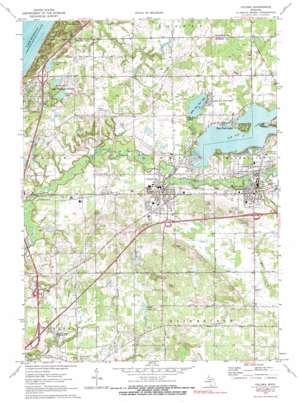
Coloma Topo Map Michigan
To zoom in, hover over the map of Coloma
USGS Topo Quad 42086b3 - 1:24,000 scale
| Topo Map Name: | Coloma |
| USGS Topo Quad ID: | 42086b3 |
| Print Size: | ca. 21 1/4" wide x 27" high |
| Southeast Coordinates: | 42.125° N latitude / 86.25° W longitude |
| Map Center Coordinates: | 42.1875° N latitude / 86.3125° W longitude |
| U.S. State: | MI |
| Filename: | o42086b3.jpg |
| Download Map JPG Image: | Coloma topo map 1:24,000 scale |
| Map Type: | Topographic |
| Topo Series: | 7.5´ |
| Map Scale: | 1:24,000 |
| Source of Map Images: | United States Geological Survey (USGS) |
| Alternate Map Versions: |
Coloma MI 1970, updated 1973 Download PDF Buy paper map Coloma MI 1970, updated 1990 Download PDF Buy paper map Coloma MI 2011 Download PDF Buy paper map Coloma MI 2014 Download PDF Buy paper map Coloma MI 2017 Download PDF Buy paper map |
1:24,000 Topo Quads surrounding Coloma
South Haven |
Lacota |
Pullman |
||
Covert |
Mcdonald |
Bangor |
||
Benton Heights |
Coloma |
Hartford |
Lawrence |
|
Stevensville |
Benton Harbor |
Sodus |
Sister Lakes |
Twin Lakes |
Bridgman |
Baroda |
Berrien Springs |
Sumnerville |
Dowagiac |
> Back to 42086a1 at 1:100,000 scale
> Back to 42086a1 at 1:250,000 scale
> Back to U.S. Topo Maps home
Coloma topo map: Gazetteer
Coloma: Airports
Ringer Landing Strip elevation 221m 725′Watervliet Municipal Airport elevation 201m 659′
Coloma: Crossings
Interchange 1 elevation 199m 652′Interchange 34 elevation 211m 692′
Interchange 39 elevation 203m 666′
Interchange 41 elevation 203m 666′
Interchange 7 elevation 194m 636′
Coloma: Lakes
Harris Lake elevation 190m 623′Hibbard Lake elevation 187m 613′
Jacobs Chapel Lake elevation 187m 613′
Kibler Lake elevation 214m 702′
Little Paw Paw Lake elevation 190m 623′
Paw Paw Lake elevation 189m 620′
Coloma: Parks
Deer Forest Park elevation 202m 662′Flaherty Park elevation 194m 636′
FOP Sports Park elevation 205m 672′
Forest Beach Park elevation 194m 636′
Hayes Park elevation 193m 633′
Lions Club Park elevation 194m 636′
Randall Park elevation 196m 643′
Coloma: Populated Places
Coloma elevation 205m 672′Hillview Mobile Estates elevation 208m 682′
Lake Michigan Beach elevation 202m 662′
Little Paw Paw Lake elevation 199m 652′
Paw Paw Lake elevation 199m 652′
Pleasant View Mobile Home Park elevation 201m 659′
Ravine View Estates Mobile Home Park elevation 218m 715′
Watervliet elevation 198m 649′
Coloma: Post Offices
Coloma Post Office elevation 202m 662′Hagar Shores Post Office (historical) elevation 202m 662′
Lake Point Post Office (historical) elevation 194m 636′
Pawpaw Lake Post Office (historical) elevation 199m 652′
Watervliet Post Office elevation 199m 652′
Coloma: Streams
Mill Creek elevation 190m 623′Ryno Drain elevation 191m 626′
Yellow Creek elevation 187m 613′
Coloma digital topo map on disk
Buy this Coloma topo map showing relief, roads, GPS coordinates and other geographical features, as a high-resolution digital map file on DVD:
Northern Illinois, Northern Indiana & Southwestern Michigan
Buy digital topo maps: Northern Illinois, Northern Indiana & Southwestern Michigan


