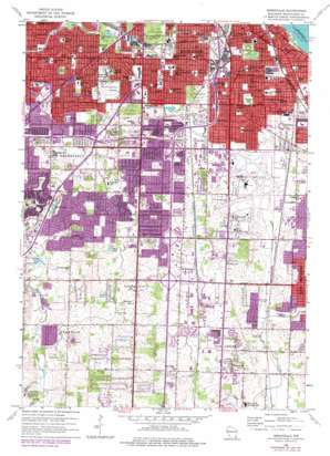
Greendale Topo Map Wisconsin
To zoom in, hover over the map of Greendale
USGS Topo Quad 42087h8 - 1:24,000 scale
| Topo Map Name: | Greendale |
| USGS Topo Quad ID: | 42087h8 |
| Print Size: | ca. 21 1/4" wide x 27" high |
| Southeast Coordinates: | 42.875° N latitude / 87.875° W longitude |
| Map Center Coordinates: | 42.9375° N latitude / 87.9375° W longitude |
| U.S. State: | WI |
| Filename: | o42087h8.jpg |
| Download Map JPG Image: | Greendale topo map 1:24,000 scale |
| Map Type: | Topographic |
| Topo Series: | 7.5´ |
| Map Scale: | 1:24,000 |
| Source of Map Images: | United States Geological Survey (USGS) |
| Alternate Map Versions: |
Greendale WI 1958, updated 1960 Download PDF Buy paper map Greendale WI 1958, updated 1972 Download PDF Buy paper map Greendale WI 1958, updated 1977 Download PDF Buy paper map Greendale WI 2010 Download PDF Buy paper map Greendale WI 2013 Download PDF Buy paper map Greendale WI 2016 Download PDF Buy paper map |
1:24,000 Topo Quads surrounding Greendale
> Back to 42087e1 at 1:100,000 scale
> Back to 42086a1 at 1:250,000 scale
> Back to U.S. Topo Maps home
Greendale topo map: Gazetteer
Greendale: Airports
All-State Equipment Company Heliport elevation 235m 770′General Mitchell International Airport elevation 204m 669′
Saint Lukes Medical Center Heliport elevation 199m 652′
Greendale: Crossings
Interchange 314A elevation 195m 639′Interchange 314B elevation 214m 702′
Interchange 316 elevation 210m 688′
Interchange 317 elevation 218m 715′
Interchange 318 elevation 228m 748′
Interchange 319 elevation 228m 748′
Interchange 320 elevation 226m 741′
Interchange 7 elevation 235m 770′
Interchange 8 elevation 235m 770′
Interchange 9 elevation 216m 708′
Greendale: Lakes
Mud Lake elevation 229m 751′Scout Lake elevation 225m 738′
Greendale: Parks
Adams Play Field elevation 197m 646′Armour Park elevation 232m 761′
Camelot Park elevation 204m 669′
Centennial Park elevation 231m 757′
Cleveland Park elevation 187m 613′
College Park elevation 227m 744′
Cooper Park elevation 228m 748′
Copernicus Park elevation 229m 751′
Cudahy Woods State Natural Area elevation 213m 698′
Greenlawn Park elevation 221m 725′
Grobschmidt Park elevation 239m 784′
Hamilton Dell Park elevation 229m 751′
Henry Miller Park elevation 216m 708′
Holler Park elevation 210m 688′
Holt Playfield elevation 211m 692′
Humboldt Park elevation 195m 639′
Jackson Park elevation 199m 652′
Kilmer Park elevation 234m 767′
Kinnickinnic Park elevation 189m 620′
Kinnickinnic River Parkway elevation 205m 672′
Kinnickinnic Sports Center elevation 202m 662′
Lucas Park elevation 219m 718′
Lyons Park elevation 225m 738′
Maitland Park elevation 225m 738′
Manitoba Park elevation 218m 715′
Manor Marquette Park elevation 210m 688′
Mitchell Airport Park elevation 222m 728′
Morgan Park elevation 198m 649′
Ohio Playfield elevation 204m 669′
Pulaski Park elevation 187m 613′
Riverton Meadows Neighborhood Park elevation 208m 682′
Saveland Park elevation 209m 685′
Scott Lake Park elevation 231m 757′
South Shore Park elevation 178m 583′
Southlawn Park elevation 207m 679′
Tippecanoe Park elevation 201m 659′
Whitman Park elevation 239m 784′
Whittier Park elevation 208m 682′
Wilson Park elevation 201m 659′
Zablocki Park elevation 217m 711′
Greendale: Populated Places
Greendale elevation 225m 738′Saint Francis elevation 211m 692′
Greendale: Post Offices
Bay View Saint Francis Station Milwaukee Post Office elevation 190m 623′Greendale Post Office elevation 225m 738′
Layton Park Station Milwaukee Post Office (historical) elevation 203m 666′
Tuckaway Branch Milwaukee Post Office elevation 238m 780′
Greendale digital topo map on disk
Buy this Greendale topo map showing relief, roads, GPS coordinates and other geographical features, as a high-resolution digital map file on DVD:
Northern Illinois, Northern Indiana & Southwestern Michigan
Buy digital topo maps: Northern Illinois, Northern Indiana & Southwestern Michigan


