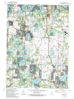
Wauconda Topo Map Illinois
To zoom in, hover over the map of Wauconda
USGS Topo Quad 42088c2 - 1:24,000 scale
| Topo Map Name: | Wauconda |
| USGS Topo Quad ID: | 42088c2 |
| Print Size: | ca. 21 1/4" wide x 27" high |
| Southeast Coordinates: | 42.25° N latitude / 88.125° W longitude |
| Map Center Coordinates: | 42.3125° N latitude / 88.1875° W longitude |
| U.S. State: | IL |
| Filename: | o42088c2.jpg |
| Download Map JPG Image: | Wauconda topo map 1:24,000 scale |
| Map Type: | Topographic |
| Topo Series: | 7.5´ |
| Map Scale: | 1:24,000 |
| Source of Map Images: | United States Geological Survey (USGS) |
| Alternate Map Versions: |
Wauconda IL 1960, updated 1962 Download PDF Buy paper map Wauconda IL 1960, updated 1962 Download PDF Buy paper map Wauconda IL 1960, updated 1973 Download PDF Buy paper map Wauconda IL 1960, updated 1979 Download PDF Buy paper map Wauconda IL 1960, updated 1981 Download PDF Buy paper map Wauconda IL 1993, updated 1993 Download PDF Buy paper map Wauconda IL 1998, updated 2003 Download PDF Buy paper map Wauconda IL 2012 Download PDF Buy paper map Wauconda IL 2015 Download PDF Buy paper map |
1:24,000 Topo Quads surrounding Wauconda
> Back to 42088a1 at 1:100,000 scale
> Back to 42088a1 at 1:250,000 scale
> Back to U.S. Topo Maps home
Wauconda topo map: Gazetteer
Wauconda: Airports
Oak Knoll Farm Airport elevation 235m 770′Wauconda: Bays
Myers Bay elevation 224m 734′Pistakee Bay elevation 225m 738′
Wauconda: Bridges
Burton Bridge elevation 223m 731′Wauconda: Canals
Lily Lake Drain elevation 225m 738′Wauconda: Dams
Island Lake Dam elevation 226m 741′Wauconda: Lakes
Bangs Lake elevation 236m 774′Brandenburg Lake elevation 225m 738′
Defiance Lake elevation 224m 734′
Fish Lake elevation 229m 751′
Griswold Lake elevation 224m 734′
Lac Louette elevation 225m 738′
Lily Lake elevation 228m 748′
Redhead Lake elevation 224m 734′
Slocum Lake elevation 224m 734′
Sullivan Lake elevation 226m 741′
Tomahawk Lake elevation 226m 741′
Wilderness Lake elevation 226m 741′
Wooster Lake elevation 226m 741′
Wauconda: Parks
Cook Memorial Park elevation 241m 790′Cotton Creek Marsh Nature Preserve elevation 223m 731′
Indian Ridge County Park elevation 228m 748′
Kettle Moraine Nature Preserve elevation 223m 731′
Lagoon Park elevation 238m 780′
Lakewood County Forest Preserve elevation 236m 774′
Larkdale Park elevation 238m 780′
Moraine Hills State Park elevation 229m 751′
Oakwood Hills Fen Nature Preserve elevation 232m 761′
Park Lane Nature Park elevation 227m 744′
Pistakee Bog Nature Preserve elevation 224m 734′
Volo Bog State Nature Preserve elevation 230m 754′
Wauconda: Populated Places
Burtons Bridge elevation 225m 738′Colby Point elevation 226m 741′
Eastwood Manor elevation 233m 764′
Ferndale elevation 225m 738′
Fox River Shores elevation 233m 764′
Holiday Hills elevation 226m 741′
Island Lake elevation 238m 780′
Lakemoor elevation 232m 761′
Lilymoor elevation 232m 761′
Long Lake elevation 229m 751′
Mylith Park elevation 227m 744′
Volo elevation 242m 793′
Wauconda elevation 245m 803′
Williams Park elevation 229m 751′
Wilson elevation 232m 761′
Wauconda: Reservoirs
Island Lake elevation 226m 741′Wauconda: Streams
Cotton Creek elevation 224m 734′Dutch Creek elevation 223m 731′
Mutton Creek elevation 232m 761′
Wauconda: Swamps
Cotton Creek Marsh elevation 223m 731′Leatherleaf Bog elevation 227m 744′
Pike Marsh elevation 223m 731′
Volo Bog elevation 230m 754′
Warrior Marsh elevation 227m 744′
Wauconda: Trails
Fox River Trail elevation 225m 738′Lake Defiance Nature Trail elevation 228m 748′
Lake Defiance Trail elevation 230m 754′
Leather Leaf Bog Trail elevation 233m 764′
Tamarack View Trail elevation 231m 757′
Volo Bog Interpretive Trail elevation 231m 757′
Wauconda digital topo map on disk
Buy this Wauconda topo map showing relief, roads, GPS coordinates and other geographical features, as a high-resolution digital map file on DVD:
Northern Illinois, Northern Indiana & Southwestern Michigan
Buy digital topo maps: Northern Illinois, Northern Indiana & Southwestern Michigan


