Garden Prairie Topo Map Illinois
To zoom in, hover over the map of Garden Prairie
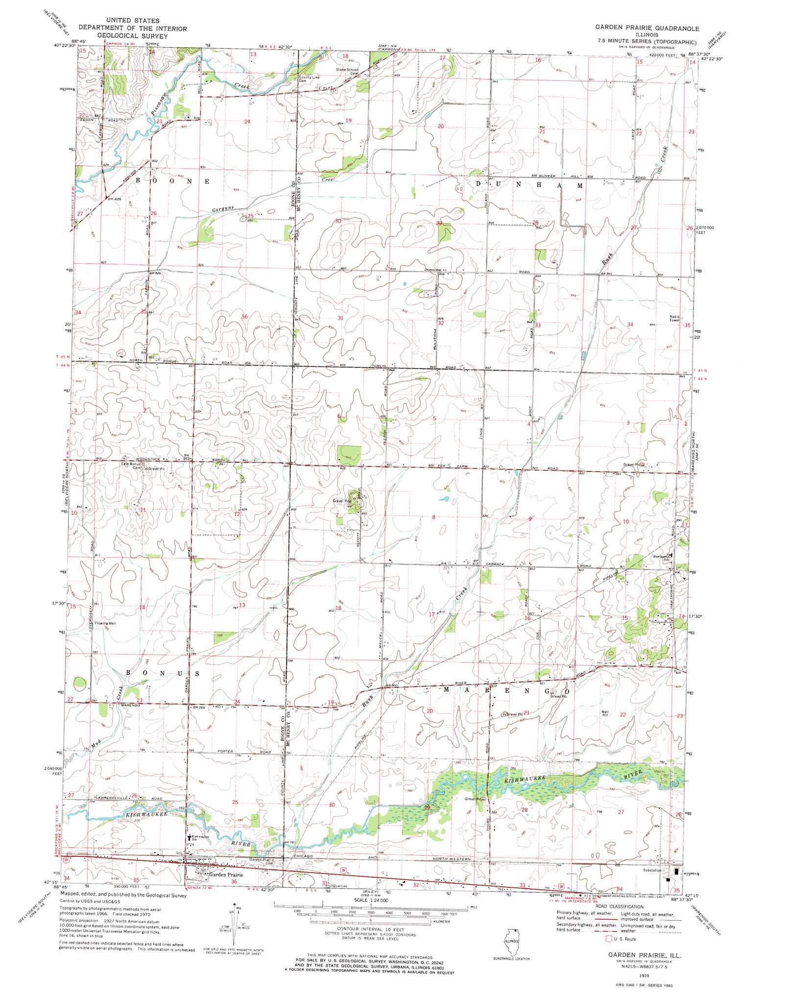
USGS Topo Quad 42088c6 - 1:24,000 scale
| Topo Map Name: | Garden Prairie |
| USGS Topo Quad ID: | 42088c6 |
| Print Size: | ca. 21 1/4" wide x 27" high |
| Southeast Coordinates: | 42.25° N latitude / 88.625° W longitude |
| Map Center Coordinates: | 42.3125° N latitude / 88.6875° W longitude |
| U.S. State: | IL |
| Filename: | o42088c6.jpg |
| Download Map JPG Image: | Garden Prairie topo map 1:24,000 scale |
| Map Type: | Topographic |
| Topo Series: | 7.5´ |
| Map Scale: | 1:24,000 |
| Source of Map Images: | United States Geological Survey (USGS) |
| Alternate Map Versions: |
Garden Prairie IL 1970, updated 1972 Download PDF Buy paper map Garden Prairie IL 2012 Download PDF Buy paper map Garden Prairie IL 2015 Download PDF Buy paper map |
1:24,000 Topo Quads surrounding Garden Prairie
Shopiere |
Clinton |
Sharon |
Walworth |
Lake Geneva |
Belvidere Nw |
Belvidere Ne |
Capron |
Harvard |
Hebron |
Caledonia |
Belvidere North |
Garden Prairie |
Marengo North |
Woodstock |
Cherry Valley |
Belvidere South |
Riley |
Marengo South |
Huntley |
Fairdale |
Kirkland |
Genoa |
Hampshire |
Pingree Grove |
> Back to 42088a1 at 1:100,000 scale
> Back to 42088a1 at 1:250,000 scale
> Back to U.S. Topo Maps home
Garden Prairie topo map: Gazetteer
Garden Prairie: Airports
Adkins RLA Airport elevation 259m 849′Garden Prairie: Populated Places
Garden Prairie elevation 238m 780′Garden Prairie: Post Offices
Garden Prairie Post Office elevation 238m 780′Garden Prairie: Streams
Rush Creek elevation 236m 774′Garden Prairie digital topo map on disk
Buy this Garden Prairie topo map showing relief, roads, GPS coordinates and other geographical features, as a high-resolution digital map file on DVD:
Northern Illinois, Northern Indiana & Southwestern Michigan
Buy digital topo maps: Northern Illinois, Northern Indiana & Southwestern Michigan