Harvard Topo Map Illinois
To zoom in, hover over the map of Harvard
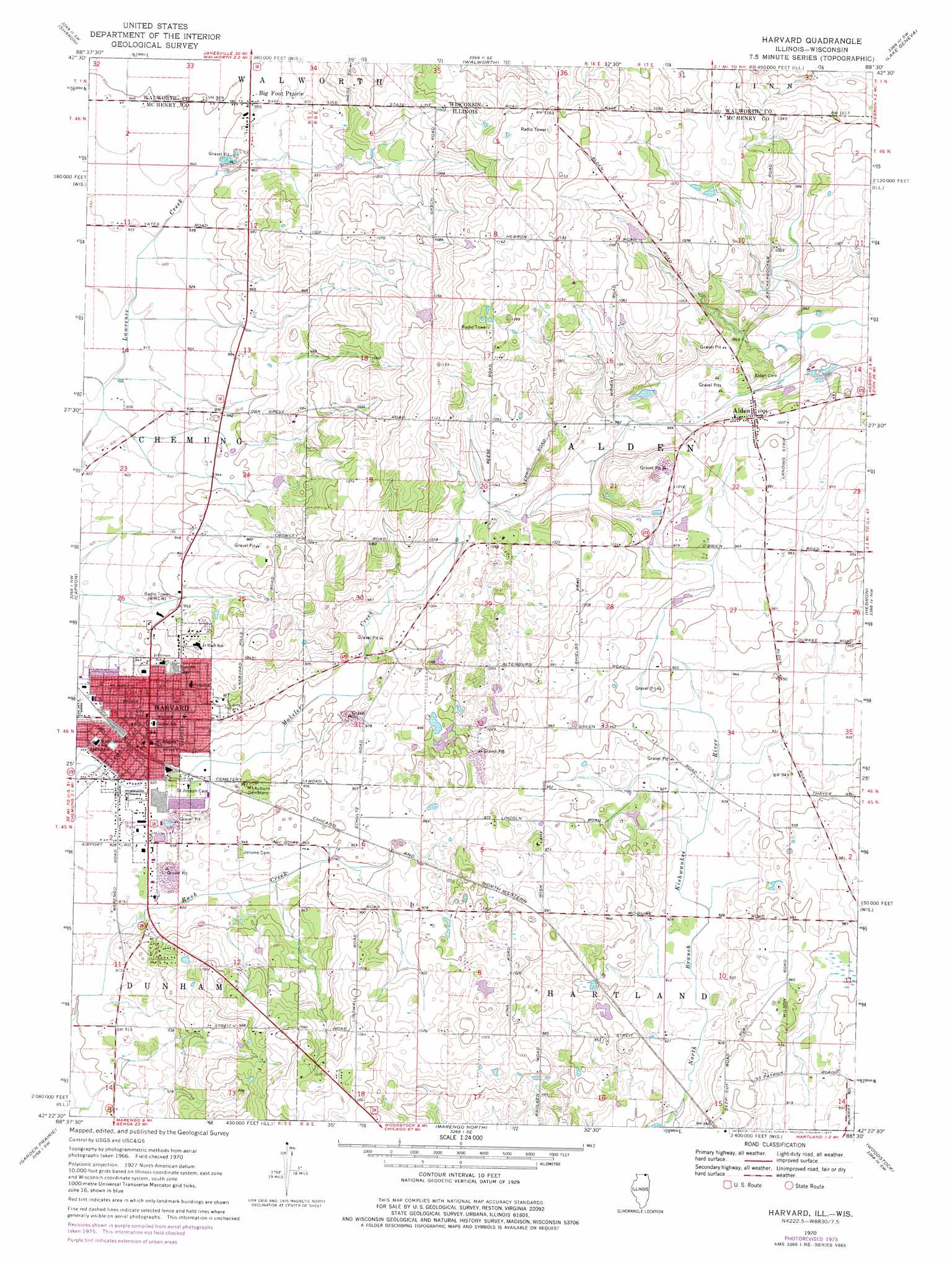
USGS Topo Quad 42088d5 - 1:24,000 scale
| Topo Map Name: | Harvard |
| USGS Topo Quad ID: | 42088d5 |
| Print Size: | ca. 21 1/4" wide x 27" high |
| Southeast Coordinates: | 42.375° N latitude / 88.5° W longitude |
| Map Center Coordinates: | 42.4375° N latitude / 88.5625° W longitude |
| U.S. States: | IL, WI |
| Filename: | o42088d5.jpg |
| Download Map JPG Image: | Harvard topo map 1:24,000 scale |
| Map Type: | Topographic |
| Topo Series: | 7.5´ |
| Map Scale: | 1:24,000 |
| Source of Map Images: | United States Geological Survey (USGS) |
| Alternate Map Versions: |
Harvard IL 1970, updated 1977 Download PDF Buy paper map Harvard IL 2012 Download PDF Buy paper map Harvard IL 2015 Download PDF Buy paper map |
1:24,000 Topo Quads surrounding Harvard
Avalon |
Delavan |
Elkhorn |
Springfield |
Burlington |
Clinton |
Sharon |
Walworth |
Lake Geneva |
Genoa City |
Belvidere Ne |
Capron |
Harvard |
Hebron |
Richmond |
Belvidere North |
Garden Prairie |
Marengo North |
Woodstock |
Mchenry |
Belvidere South |
Riley |
Marengo South |
Huntley |
Crystal Lake |
> Back to 42088a1 at 1:100,000 scale
> Back to 42088a1 at 1:250,000 scale
> Back to U.S. Topo Maps home
Harvard topo map: Gazetteer
Harvard: Airports
Harvard Hospital Heliport elevation 304m 997′Kirkpatrick Airport elevation 296m 971′
Harvard: Dams
Kingsley Lake Dam elevation 327m 1072′Harvard: Parks
Lions Park elevation 304m 997′Mary D Ayer Park elevation 283m 928′
Rush Creek Conservation Area elevation 283m 928′
Harvard: Populated Places
Alden elevation 306m 1003′Big Foot Prairie elevation 292m 958′
Harvard elevation 292m 958′
Hi-Way Mobile Home Park elevation 289m 948′
Sunset View Mobile Home Park elevation 284m 931′
Harvard: Post Offices
Harvard Post Office elevation 290m 951′Harvard: Reservoirs
Kingsley Lake elevation 327m 1072′Harvard digital topo map on disk
Buy this Harvard topo map showing relief, roads, GPS coordinates and other geographical features, as a high-resolution digital map file on DVD:
Northern Illinois, Northern Indiana & Southwestern Michigan
Buy digital topo maps: Northern Illinois, Northern Indiana & Southwestern Michigan