Capron Topo Map Illinois
To zoom in, hover over the map of Capron
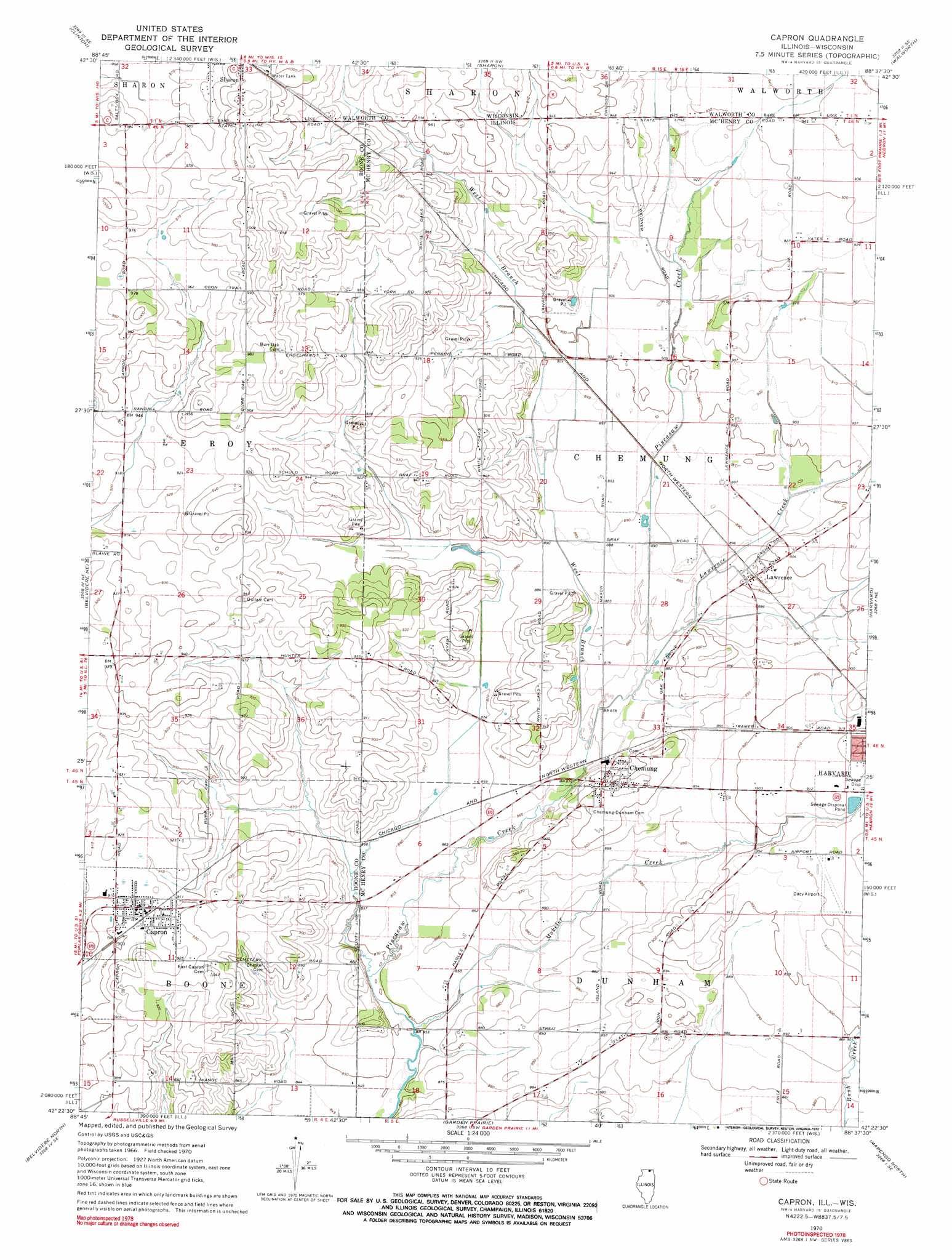
USGS Topo Quad 42088d6 - 1:24,000 scale
| Topo Map Name: | Capron |
| USGS Topo Quad ID: | 42088d6 |
| Print Size: | ca. 21 1/4" wide x 27" high |
| Southeast Coordinates: | 42.375° N latitude / 88.625° W longitude |
| Map Center Coordinates: | 42.4375° N latitude / 88.6875° W longitude |
| U.S. States: | IL, WI |
| Filename: | o42088d6.jpg |
| Download Map JPG Image: | Capron topo map 1:24,000 scale |
| Map Type: | Topographic |
| Topo Series: | 7.5´ |
| Map Scale: | 1:24,000 |
| Source of Map Images: | United States Geological Survey (USGS) |
| Alternate Map Versions: |
Capron IL 1970, updated 1972 Download PDF Buy paper map Capron IL 1970, updated 1972 Download PDF Buy paper map Capron IL 1970, updated 1972 Download PDF Buy paper map Capron IL 2012 Download PDF Buy paper map Capron IL 2015 Download PDF Buy paper map |
1:24,000 Topo Quads surrounding Capron
Janesville East |
Avalon |
Delavan |
Elkhorn |
Springfield |
Shopiere |
Clinton |
Sharon |
Walworth |
Lake Geneva |
Belvidere Nw |
Belvidere Ne |
Capron |
Harvard |
Hebron |
Caledonia |
Belvidere North |
Garden Prairie |
Marengo North |
Woodstock |
Cherry Valley |
Belvidere South |
Riley |
Marengo South |
Huntley |
> Back to 42088a1 at 1:100,000 scale
> Back to 42088a1 at 1:250,000 scale
> Back to U.S. Topo Maps home
Capron topo map: Gazetteer
Capron: Airports
Dacy Airport elevation 277m 908′Munch Heliport elevation 281m 921′
Pine Hill Airport elevation 299m 980′
Twin Gardens Airport elevation 271m 889′
Capron: Populated Places
Capron elevation 277m 908′Chemung elevation 273m 895′
Lawrence elevation 276m 905′
Capron: Streams
Lawrence Creek elevation 267m 875′Mokeler Creek elevation 258m 846′
West Branch Piscasaw Creek elevation 265m 869′
West Branch Piscasaw Creek elevation 265m 869′
Capron: Woods
Becks Woods elevation 264m 866′Capron digital topo map on disk
Buy this Capron topo map showing relief, roads, GPS coordinates and other geographical features, as a high-resolution digital map file on DVD:
Northern Illinois, Northern Indiana & Southwestern Michigan
Buy digital topo maps: Northern Illinois, Northern Indiana & Southwestern Michigan