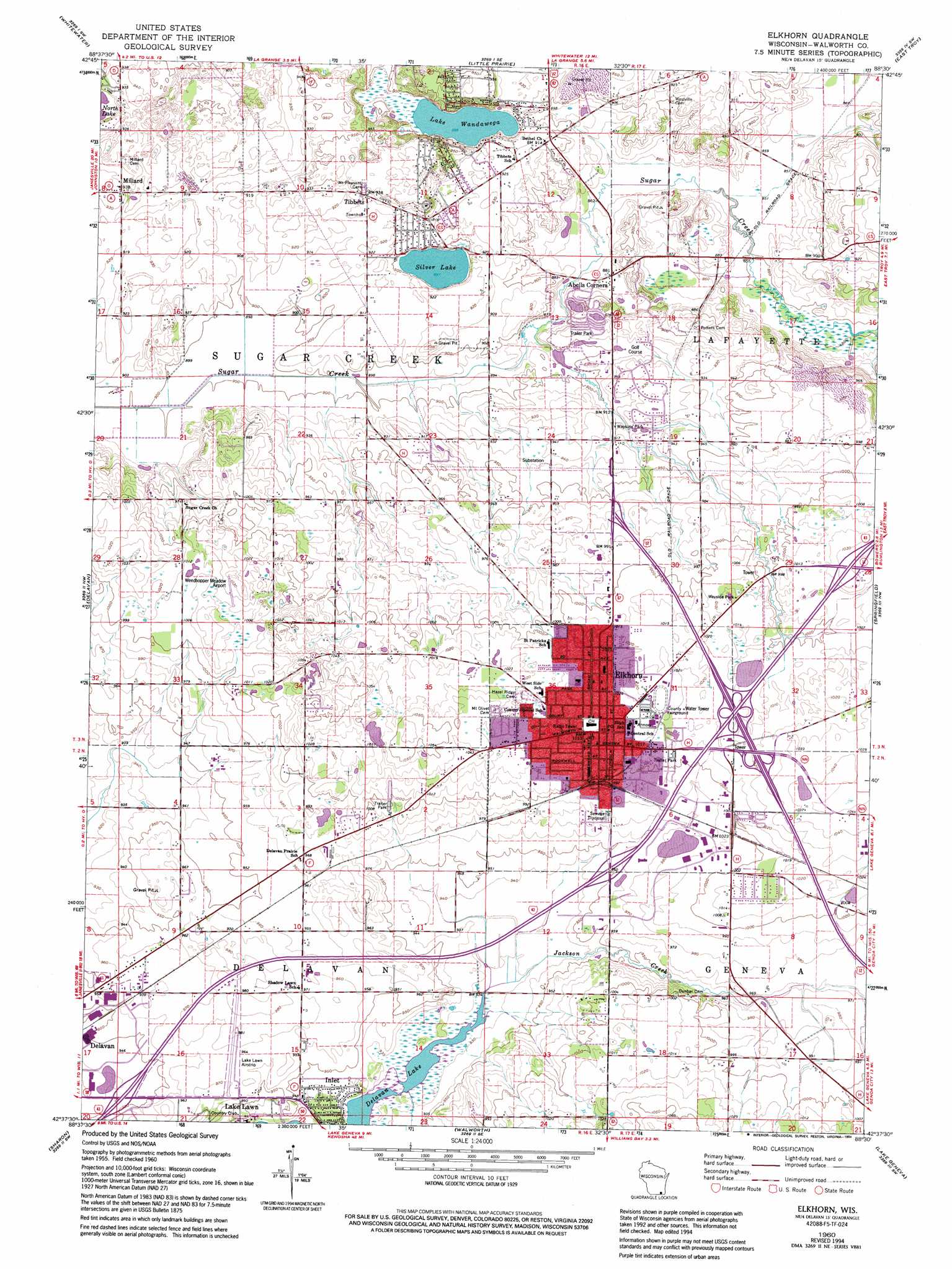
Elkhorn Topo Map Wisconsin
To zoom in, hover over the map of Elkhorn
USGS Topo Quad 42088f5 - 1:24,000 scale
| Topo Map Name: | Elkhorn |
| USGS Topo Quad ID: | 42088f5 |
| Print Size: | ca. 21 1/4" wide x 27" high |
| Southeast Coordinates: | 42.625° N latitude / 88.5° W longitude |
| Map Center Coordinates: | 42.6875° N latitude / 88.5625° W longitude |
| U.S. State: | WI |
| Filename: | o42088f5.jpg |
| Download Map JPG Image: | Elkhorn topo map 1:24,000 scale |
| Map Type: | Topographic |
| Topo Series: | 7.5´ |
| Map Scale: | 1:24,000 |
| Source of Map Images: | United States Geological Survey (USGS) |
| Alternate Map Versions: |
Elkhorn WI 1960, updated 1964 Download PDF Buy paper map Elkhorn WI 1960, updated 1972 Download PDF Buy paper map Elkhorn WI 1960, updated 1994 Download PDF Buy paper map Elkhorn WI 2010 Download PDF Buy paper map Elkhorn WI 2013 Download PDF Buy paper map Elkhorn WI 2016 Download PDF Buy paper map |
1:24,000 Topo Quads surrounding Elkhorn
Fort Atkinson |
Rome |
Palmyra |
Eagle |
Genesee |
Lima Center |
Whitewater |
Little Prairie |
East Troy |
Mukwonago |
Avalon |
Delavan |
Elkhorn |
Springfield |
Burlington |
Clinton |
Sharon |
Walworth |
Lake Geneva |
Genoa City |
Belvidere Ne |
Capron |
Harvard |
Hebron |
Richmond |
> Back to 42088e1 at 1:100,000 scale
> Back to 42088a1 at 1:250,000 scale
> Back to U.S. Topo Maps home
Elkhorn topo map: Gazetteer
Elkhorn: Airports
Lake Lawn Airport elevation 295m 967′Paddock Field elevation 283m 928′
Weedhopper Meadow Airport elevation 313m 1026′
Elkhorn: Lakes
Lake Wandawega elevation 271m 889′Silver Lake elevation 273m 895′
Elkhorn: Parks
Walworth County Fair Grounds elevation 312m 1023′Elkhorn: Populated Places
Abells Corners elevation 268m 879′Elkhorn elevation 314m 1030′
Inlet elevation 287m 941′
Lake Lawn elevation 284m 931′
Land O Lakes Mobile Home Park elevation 306m 1003′
Millard elevation 284m 931′
Tibbets elevation 286m 938′
Elkhorn: Post Offices
Elkhorn Post Office elevation 312m 1023′Elkhorn: Streams
Jackson Creek elevation 283m 928′Elkhorn digital topo map on disk
Buy this Elkhorn topo map showing relief, roads, GPS coordinates and other geographical features, as a high-resolution digital map file on DVD:
Northern Illinois, Northern Indiana & Southwestern Michigan
Buy digital topo maps: Northern Illinois, Northern Indiana & Southwestern Michigan