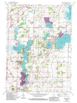
Waterford Topo Map Wisconsin
To zoom in, hover over the map of Waterford
USGS Topo Quad 42088g2 - 1:24,000 scale
| Topo Map Name: | Waterford |
| USGS Topo Quad ID: | 42088g2 |
| Print Size: | ca. 21 1/4" wide x 27" high |
| Southeast Coordinates: | 42.75° N latitude / 88.125° W longitude |
| Map Center Coordinates: | 42.8125° N latitude / 88.1875° W longitude |
| U.S. State: | WI |
| Filename: | o42088g2.jpg |
| Download Map JPG Image: | Waterford topo map 1:24,000 scale |
| Map Type: | Topographic |
| Topo Series: | 7.5´ |
| Map Scale: | 1:24,000 |
| Source of Map Images: | United States Geological Survey (USGS) |
| Alternate Map Versions: |
Waterford WI 1959, updated 1960 Download PDF Buy paper map Waterford WI 1959, updated 1973 Download PDF Buy paper map Waterford WI 1959, updated 1980 Download PDF Buy paper map Waterford WI 1959, updated 1994 Download PDF Buy paper map Waterford WI 2010 Download PDF Buy paper map Waterford WI 2013 Download PDF Buy paper map Waterford WI 2016 Download PDF Buy paper map |
1:24,000 Topo Quads surrounding Waterford
> Back to 42088e1 at 1:100,000 scale
> Back to 42088a1 at 1:250,000 scale
> Back to U.S. Topo Maps home
Waterford topo map: Gazetteer
Waterford: Airports
Horner Farms Airport elevation 236m 774′Simandl Field elevation 244m 800′
Waterford: Canals
Cross Canal elevation 235m 770′Muskego Canal elevation 235m 770′
Wind Lake Drainage Canal elevation 234m 767′
Waterford: Dams
Reischl G9879 Dam elevation 272m 892′Waterford 3WR1680 Dam elevation 236m 774′
Wind Lake 3WR822 Dam elevation 234m 767′
Waterford: Lakes
Bisanabi Lake elevation 245m 803′Buena Lake elevation 236m 774′
Lake Denoon elevation 238m 780′
Long Lake elevation 237m 777′
Waubeesee Lake elevation 236m 774′
Waterford: Parks
Denoon Park elevation 243m 797′Heg Memorial Park elevation 249m 816′
Tichigan State Wildlife Area elevation 237m 777′
Waterford: Populated Places
Buena Park elevation 243m 797′Harbor Heights elevation 241m 790′
McLaughlins Subdivision elevation 241m 790′
Tichigan elevation 242m 793′
Waterford elevation 236m 774′
Wind Lake elevation 242m 793′
Waterford: Reservoirs
0.3 Reservoir elevation 272m 892′Muskego Lake elevation 237m 777′
Tichigan and Buena Lakes 359 elevation 236m 774′
Tichigan Lake elevation 236m 774′
Wind Lake elevation 234m 767′
Wind Lake 35 elevation 237m 777′
Waterford digital topo map on disk
Buy this Waterford topo map showing relief, roads, GPS coordinates and other geographical features, as a high-resolution digital map file on DVD:
Northern Illinois, Northern Indiana & Southwestern Michigan
Buy digital topo maps: Northern Illinois, Northern Indiana & Southwestern Michigan


