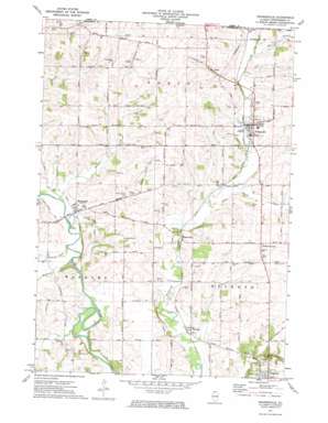
Orangeville Topo Map Illinois
To zoom in, hover over the map of Orangeville
USGS Topo Quad 42089d6 - 1:24,000 scale
| Topo Map Name: | Orangeville |
| USGS Topo Quad ID: | 42089d6 |
| Print Size: | ca. 21 1/4" wide x 27" high |
| Southeast Coordinates: | 42.375° N latitude / 89.625° W longitude |
| Map Center Coordinates: | 42.4375° N latitude / 89.6875° W longitude |
| U.S. State: | IL |
| Filename: | o42089d6.jpg |
| Download Map JPG Image: | Orangeville topo map 1:24,000 scale |
| Map Type: | Topographic |
| Topo Series: | 7.5´ |
| Map Scale: | 1:24,000 |
| Source of Map Images: | United States Geological Survey (USGS) |
| Alternate Map Versions: |
Orangeville IL 1971, updated 1974 Download PDF Buy paper map Orangeville IL 2012 Download PDF Buy paper map Orangeville IL 2015 Download PDF Buy paper map |
1:24,000 Topo Quads surrounding Orangeville
> Back to 42089a1 at 1:100,000 scale
> Back to 42088a1 at 1:250,000 scale
> Back to U.S. Topo Maps home
Orangeville topo map: Gazetteer
Orangeville: Airports
Pleasure Valley Landing Area elevation 239m 784′Orangeville: Mines
Wagner Quarry elevation 259m 849′Orangeville: Parks
Wayside Park elevation 267m 875′Orangeville: Populated Places
Buckhorn Corners elevation 280m 918′Buena Vista elevation 243m 797′
Cedarville elevation 264m 866′
McConnell elevation 237m 777′
Oneco elevation 257m 843′
Orangeville elevation 250m 820′
Red Oak elevation 241m 790′
Orangeville: Post Offices
Orangeville Post Office elevation 248m 813′Red Oak Post Office (historical) elevation 238m 780′
Waddams Center Post Office (historical) elevation 238m 780′
Orangeville: Streams
Brush Creek elevation 239m 784′East Branch Richland Creek elevation 247m 810′
East Branch Richland Creek elevation 247m 810′
East Branch Richland Creek elevation 247m 810′
Muddy Creek elevation 232m 761′
Spring Creek elevation 232m 761′
Waddams Creek elevation 232m 761′
Orangeville digital topo map on disk
Buy this Orangeville topo map showing relief, roads, GPS coordinates and other geographical features, as a high-resolution digital map file on DVD:
Northern Illinois, Northern Indiana & Southwestern Michigan
Buy digital topo maps: Northern Illinois, Northern Indiana & Southwestern Michigan


