Juda Topo Map Wisconsin
To zoom in, hover over the map of Juda
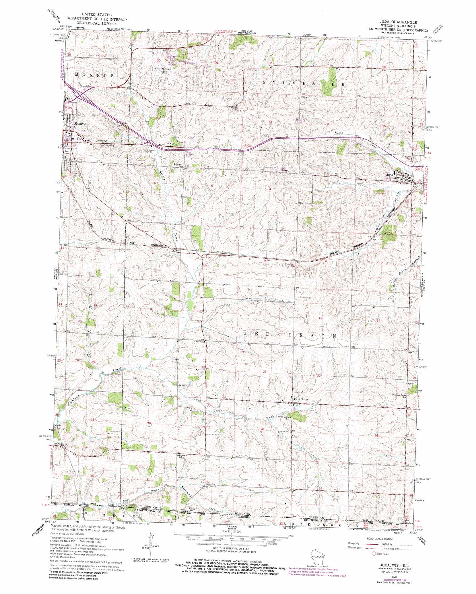
USGS Topo Quad 42089e5 - 1:24,000 scale
| Topo Map Name: | Juda |
| USGS Topo Quad ID: | 42089e5 |
| Print Size: | ca. 21 1/4" wide x 27" high |
| Southeast Coordinates: | 42.5° N latitude / 89.5° W longitude |
| Map Center Coordinates: | 42.5625° N latitude / 89.5625° W longitude |
| U.S. States: | WI, IL |
| Filename: | o42089e5.jpg |
| Download Map JPG Image: | Juda topo map 1:24,000 scale |
| Map Type: | Topographic |
| Topo Series: | 7.5´ |
| Map Scale: | 1:24,000 |
| Source of Map Images: | United States Geological Survey (USGS) |
| Alternate Map Versions: |
Juda WI 1962, updated 1964 Download PDF Buy paper map Juda WI 1962, updated 1972 Download PDF Buy paper map Juda WI 1962, updated 1983 Download PDF Buy paper map Juda WI 2010 Download PDF Buy paper map Juda WI 2013 Download PDF Buy paper map Juda WI 2016 Download PDF Buy paper map |
1:24,000 Topo Quads surrounding Juda
Blanchardville |
New Glarus |
Belleville |
Attica |
Evansville |
Argyle |
Monroe Nw |
Monticello |
Albany |
Orfordville |
Browntown |
Monroe |
Juda |
Brodhead West |
Brodhead East |
Lena |
Orangeville |
Dakota |
Davis |
Durand |
Pearl City |
Freeport West |
Freeport East |
Ridott |
Pecatonica |
> Back to 42089e1 at 1:100,000 scale
> Back to 42088a1 at 1:250,000 scale
> Back to U.S. Topo Maps home
Juda topo map: Gazetteer
Juda: Airports
Monroe Municipal Airport elevation 324m 1062′Juda: Populated Places
Juda elevation 258m 846′Twin Grove elevation 289m 948′
Juda: Streams
North Fork Juda Branch elevation 247m 810′Twin Grove Branch Richland Creek elevation 262m 859′
Juda digital topo map on disk
Buy this Juda topo map showing relief, roads, GPS coordinates and other geographical features, as a high-resolution digital map file on DVD:
Northern Illinois, Northern Indiana & Southwestern Michigan
Buy digital topo maps: Northern Illinois, Northern Indiana & Southwestern Michigan