South Wayne Topo Map Wisconsin
To zoom in, hover over the map of South Wayne
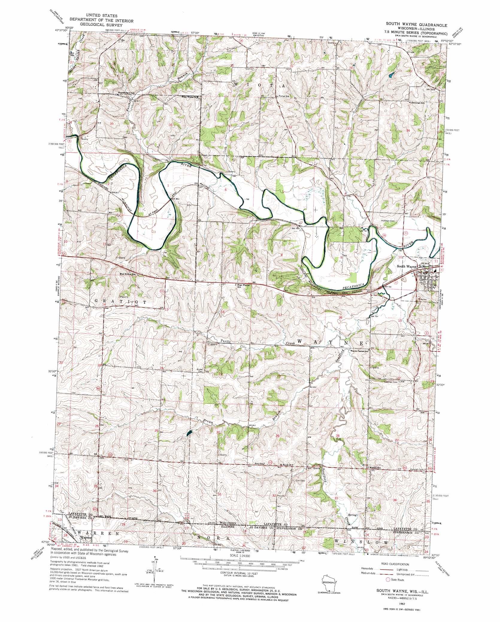
USGS Topo Quad 42089e8 - 1:24,000 scale
| Topo Map Name: | South Wayne |
| USGS Topo Quad ID: | 42089e8 |
| Print Size: | ca. 21 1/4" wide x 27" high |
| Southeast Coordinates: | 42.5° N latitude / 89.875° W longitude |
| Map Center Coordinates: | 42.5625° N latitude / 89.9375° W longitude |
| U.S. States: | WI, IL |
| Filename: | o42089e8.jpg |
| Download Map JPG Image: | South Wayne topo map 1:24,000 scale |
| Map Type: | Topographic |
| Topo Series: | 7.5´ |
| Map Scale: | 1:24,000 |
| Source of Map Images: | United States Geological Survey (USGS) |
| Alternate Map Versions: |
South Wayne WI 1962, updated 1964 Download PDF Buy paper map South Wayne WI 2010 Download PDF Buy paper map South Wayne WI 2013 Download PDF Buy paper map South Wayne WI 2016 Download PDF Buy paper map |
1:24,000 Topo Quads surrounding South Wayne
Mineral Point |
Waldwick |
Yellowstone Lake |
Blanchardville |
New Glarus |
Calamine |
Darlington |
Wiota |
Argyle |
Monroe Nw |
Shullsburg |
Apple River |
South Wayne |
Browntown |
Monroe |
Scales Mound East |
Elizabeth Ne |
Warren |
Lena |
Orangeville |
Elizabeth |
Stockton |
Kent |
Pearl City |
Freeport West |
> Back to 42089e1 at 1:100,000 scale
> Back to 42088a1 at 1:250,000 scale
> Back to U.S. Topo Maps home
South Wayne topo map: Gazetteer
South Wayne: Populated Places
South Wayne elevation 252m 826′South Wayne: Streams
Brown Branch Spafford Creek elevation 240m 787′Feather Branch elevation 239m 784′
Silver Spring Creek elevation 241m 790′
Spafford Creek elevation 237m 777′
Spafford Creek elevation 237m 777′
Turtle Creek elevation 239m 784′
South Wayne digital topo map on disk
Buy this South Wayne topo map showing relief, roads, GPS coordinates and other geographical features, as a high-resolution digital map file on DVD:
Northern Illinois, Northern Indiana & Southwestern Michigan
Buy digital topo maps: Northern Illinois, Northern Indiana & Southwestern Michigan