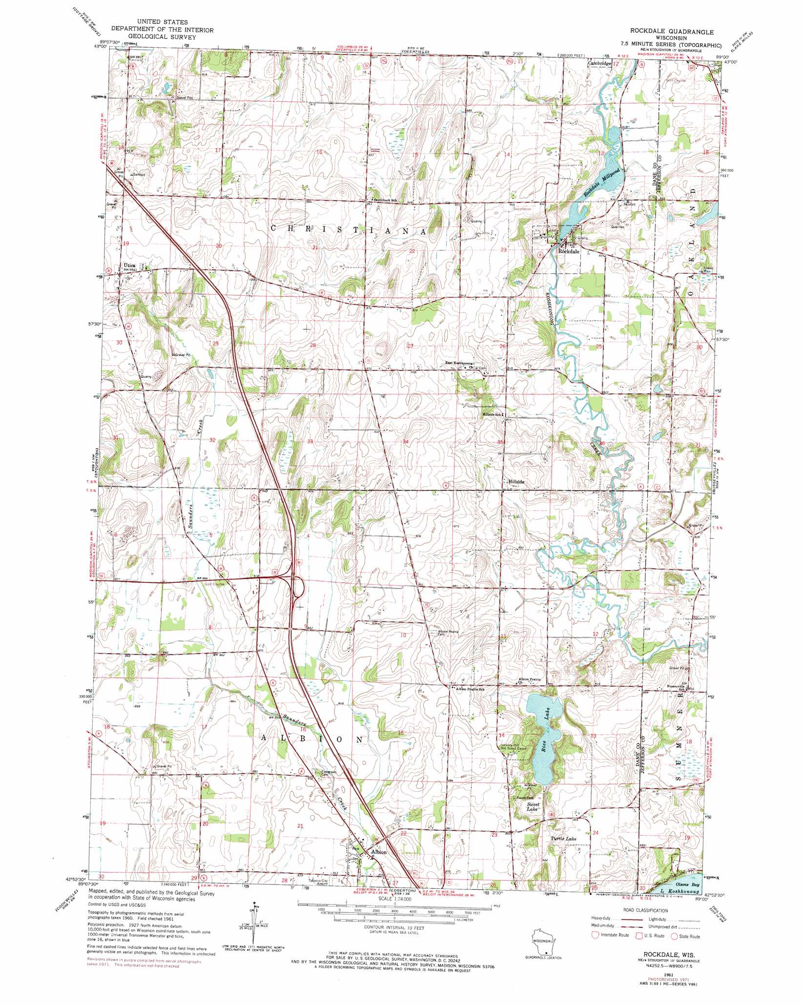
Rockdale Topo Map Wisconsin
To zoom in, hover over the map of Rockdale
USGS Topo Quad 42089h1 - 1:24,000 scale
| Topo Map Name: | Rockdale |
| USGS Topo Quad ID: | 42089h1 |
| Print Size: | ca. 21 1/4" wide x 27" high |
| Southeast Coordinates: | 42.875° N latitude / 89° W longitude |
| Map Center Coordinates: | 42.9375° N latitude / 89.0625° W longitude |
| U.S. State: | WI |
| Filename: | o42089h1.jpg |
| Download Map JPG Image: | Rockdale topo map 1:24,000 scale |
| Map Type: | Topographic |
| Topo Series: | 7.5´ |
| Map Scale: | 1:24,000 |
| Source of Map Images: | United States Geological Survey (USGS) |
| Alternate Map Versions: |
Rockdale WI 1961, updated 1964 Download PDF Buy paper map Rockdale WI 1961, updated 1972 Download PDF Buy paper map Rockdale WI 2010 Download PDF Buy paper map Rockdale WI 2013 Download PDF Buy paper map Rockdale WI 2016 Download PDF Buy paper map |
1:24,000 Topo Quads surrounding Rockdale
De Forest |
Sun Prairie |
Marshall |
Waterloo |
Richwood |
Madison East |
Cottage Grove |
Deerfield |
Lake Mills |
Jefferson |
Rutland |
Stoughton |
Rockdale |
Busseyville |
Fort Atkinson |
Evansville |
Cooksville |
Edgerton |
Milton |
Lima Center |
Orfordville |
Footville |
Janesville West |
Janesville East |
Avalon |
> Back to 42089e1 at 1:100,000 scale
> Back to 42088a1 at 1:250,000 scale
> Back to U.S. Topo Maps home
Rockdale topo map: Gazetteer
Rockdale: Dams
Rockdale Dam elevation 249m 816′Rockdale: Lakes
Rice Lake elevation 248m 813′Rockdale: Populated Places
Albion elevation 256m 839′Hillside elevation 253m 830′
Rockdale elevation 254m 833′
Utica elevation 292m 958′
Rockdale: Reservoirs
Rockdale Millpond elevation 249m 816′Rockdale Millpond 134 elevation 249m 816′
Rockdale: Swamps
Sweet Lake elevation 248m 813′Turtle Lake elevation 248m 813′
Rockdale digital topo map on disk
Buy this Rockdale topo map showing relief, roads, GPS coordinates and other geographical features, as a high-resolution digital map file on DVD:
Northern Illinois, Northern Indiana & Southwestern Michigan
Buy digital topo maps: Northern Illinois, Northern Indiana & Southwestern Michigan