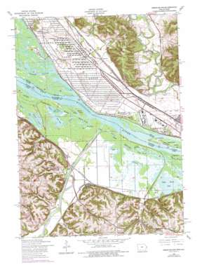
Green Island Topo Map Iowa
To zoom in, hover over the map of Green Island
USGS Topo Quad 42090b3 - 1:24,000 scale
| Topo Map Name: | Green Island |
| USGS Topo Quad ID: | 42090b3 |
| Print Size: | ca. 21 1/4" wide x 27" high |
| Southeast Coordinates: | 42.125° N latitude / 90.25° W longitude |
| Map Center Coordinates: | 42.1875° N latitude / 90.3125° W longitude |
| U.S. States: | IA, IL |
| Filename: | o42090b3.jpg |
| Download Map JPG Image: | Green Island topo map 1:24,000 scale |
| Map Type: | Topographic |
| Topo Series: | 7.5´ |
| Map Scale: | 1:24,000 |
| Source of Map Images: | United States Geological Survey (USGS) |
| Alternate Map Versions: |
Green Island IA 1953, updated 1956 Download PDF Buy paper map Green Island IA 1953, updated 1977 Download PDF Buy paper map Green Island IA 2010 Download PDF Buy paper map Green Island IA 2013 Download PDF Buy paper map Green Island IA 2015 Download PDF Buy paper map |
1:24,000 Topo Quads surrounding Green Island
> Back to 42090a1 at 1:100,000 scale
> Back to 42090a1 at 1:250,000 scale
> Back to U.S. Topo Maps home
Green Island topo map: Gazetteer
Green Island: Bars
Kennedy Bar elevation 180m 590′Green Island: Islands
Apple River Island elevation 179m 587′Island Number 254 elevation 180m 590′
Island Number 256 elevation 180m 590′
Morse Island elevation 185m 606′
Green Island: Lakes
Bonnie Lake elevation 179m 587′Densmore Lake elevation 179m 587′
Fish Lake elevation 179m 587′
Flat Lake elevation 180m 590′
Golden Lake elevation 180m 590′
Goose Lake elevation 180m 590′
Jackson Lake elevation 180m 590′
Little Sawmill Lake elevation 179m 587′
Sawmill Lake elevation 179m 587′
Snider Lake elevation 179m 587′
Twin Lakes elevation 180m 590′
Upper Brown Lake elevation 179m 587′
Western Pond elevation 179m 587′
Green Island: Parks
Hanover Bluff Nature Preserve elevation 280m 918′Upper Mississippi River Wildlife and Fish Refuge elevation 180m 590′
Green Island: Populated Places
Brinksburg (historical) elevation 186m 610′Green Island elevation 189m 620′
Reeceville elevation 240m 787′
Twin Springs elevation 189m 620′
Whitton elevation 185m 606′
Green Island: Post Offices
Green Island Post Office elevation 189m 620′Green Island: Streams
Bar Slough elevation 180m 590′Crooked Slough elevation 180m 590′
Maquoketa River elevation 180m 590′
Smith Creek elevation 179m 587′
Snag Slough elevation 179m 587′
Green Island: Summits
Lost Mound elevation 246m 807′Green Island: Valleys
Eggers Hollow elevation 184m 603′Friday Hollow elevation 181m 593′
Lamborn Hollow elevation 185m 606′
Mooney Hollow elevation 186m 610′
Muskrat Hollow elevation 184m 603′
Schlect Hollow elevation 185m 606′
Shoe Craft Hollow elevation 184m 603′
Sugar Camp Hollow elevation 185m 606′
Green Island digital topo map on disk
Buy this Green Island topo map showing relief, roads, GPS coordinates and other geographical features, as a high-resolution digital map file on DVD:


