Springbrook Topo Map Iowa
To zoom in, hover over the map of Springbrook
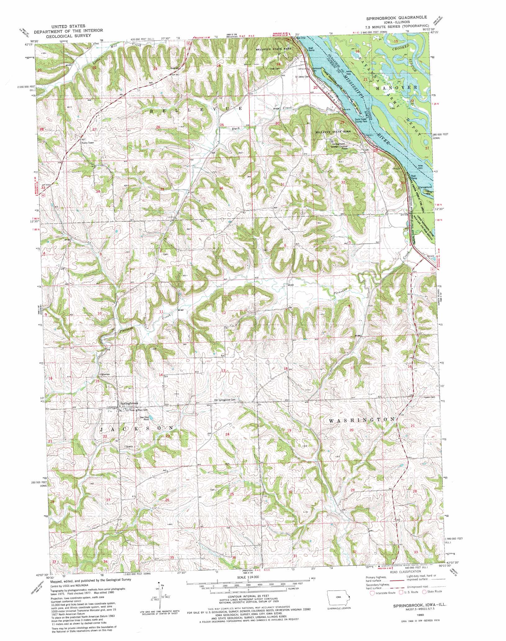
USGS Topo Quad 42090b4 - 1:24,000 scale
| Topo Map Name: | Springbrook |
| USGS Topo Quad ID: | 42090b4 |
| Print Size: | ca. 21 1/4" wide x 27" high |
| Southeast Coordinates: | 42.125° N latitude / 90.375° W longitude |
| Map Center Coordinates: | 42.1875° N latitude / 90.4375° W longitude |
| U.S. States: | IA, IL |
| Filename: | o42090b4.jpg |
| Download Map JPG Image: | Springbrook topo map 1:24,000 scale |
| Map Type: | Topographic |
| Topo Series: | 7.5´ |
| Map Scale: | 1:24,000 |
| Source of Map Images: | United States Geological Survey (USGS) |
| Alternate Map Versions: |
Springbrook IA 1980, updated 1981 Download PDF Buy paper map Springbrook IA 2010 Download PDF Buy paper map Springbrook IA 2013 Download PDF Buy paper map Springbrook IA 2015 Download PDF Buy paper map |
1:24,000 Topo Quads surrounding Springbrook
Dubuque South |
Menominee |
Galena |
Scales Mound West |
Scales Mound East |
Zwingle |
La Motte |
Bellevue |
Hanover |
Elizabeth |
Fulton |
Andrew |
Springbrook |
Green Island |
Blackhawk |
Maquoketa |
Delmar North |
Preston |
Miles |
Savanna |
Elwood |
Delmar South |
Goose Lake |
Andover |
Clinton Nw |
> Back to 42090a1 at 1:100,000 scale
> Back to 42090a1 at 1:250,000 scale
> Back to U.S. Topo Maps home
Springbrook topo map: Gazetteer
Springbrook: Islands
Island Number 249 elevation 181m 593′Springbrook: Parks
Bellevue Butterfly Garden elevation 256m 839′Bellevue State Park elevation 258m 846′
Bellevue State Park elevation 246m 807′
Duck Creek County Park elevation 177m 580′
Pleasant Creek Use Area elevation 180m 590′
Springbrook: Populated Places
Pleasant Creek elevation 181m 593′Springbrook elevation 262m 859′
Springbrook: Post Offices
Springbrook Post Office elevation 262m 859′Springbrook: Streams
Duck Creek elevation 179m 587′Pleasant Creek elevation 180m 590′
Springbrook digital topo map on disk
Buy this Springbrook topo map showing relief, roads, GPS coordinates and other geographical features, as a high-resolution digital map file on DVD: