Leisure Lake Topo Map Iowa
To zoom in, hover over the map of Leisure Lake
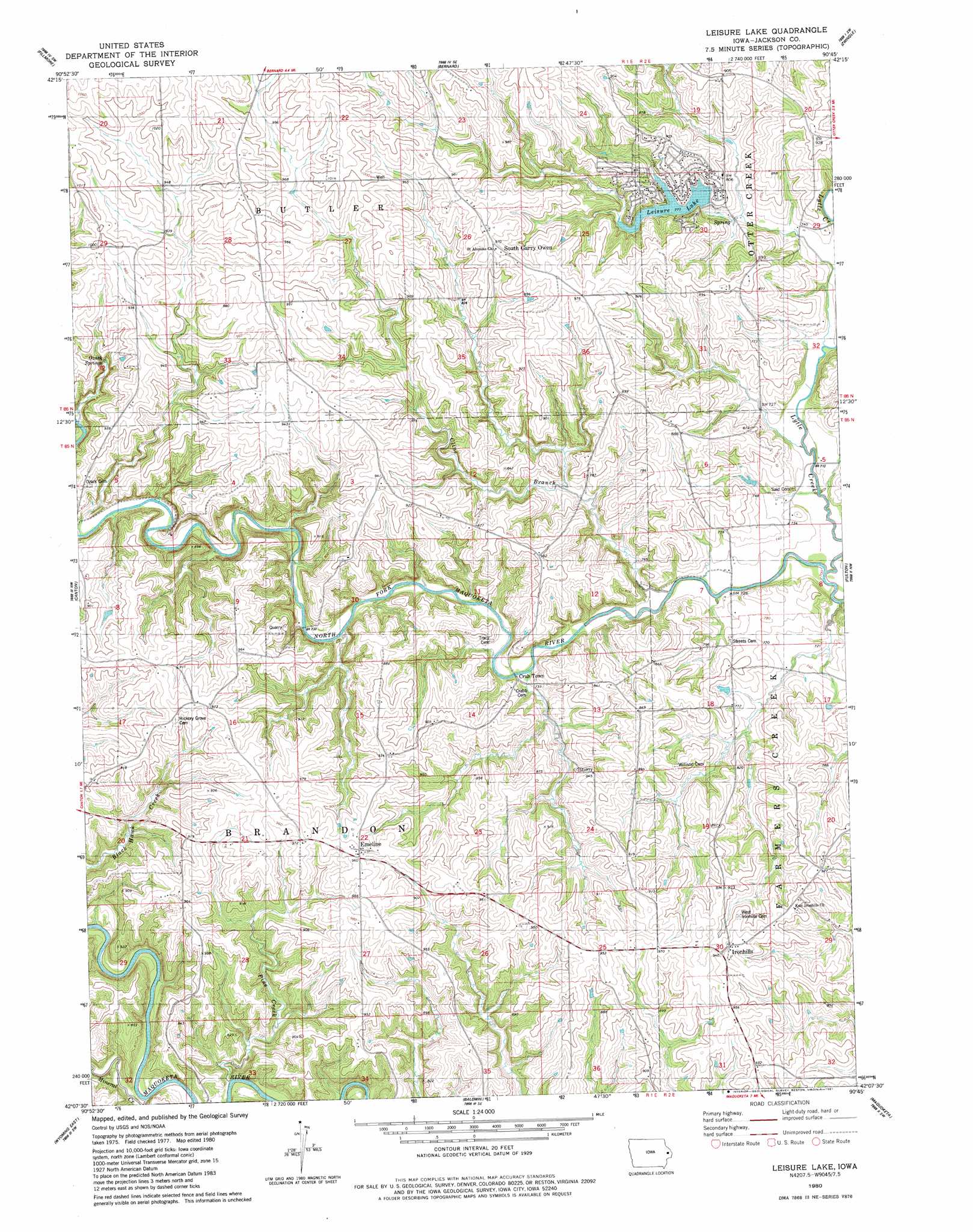
USGS Topo Quad 42090b7 - 1:24,000 scale
| Topo Map Name: | Leisure Lake |
| USGS Topo Quad ID: | 42090b7 |
| Print Size: | ca. 21 1/4" wide x 27" high |
| Southeast Coordinates: | 42.125° N latitude / 90.75° W longitude |
| Map Center Coordinates: | 42.1875° N latitude / 90.8125° W longitude |
| U.S. State: | IA |
| Filename: | o42090b7.jpg |
| Download Map JPG Image: | Leisure Lake topo map 1:24,000 scale |
| Map Type: | Topographic |
| Topo Series: | 7.5´ |
| Map Scale: | 1:24,000 |
| Source of Map Images: | United States Geological Survey (USGS) |
| Alternate Map Versions: |
Leisure Lake IA 1980, updated 1981 Download PDF Buy paper map Leisure Lake IA 2010 Download PDF Buy paper map Leisure Lake IA 2013 Download PDF Buy paper map Leisure Lake IA 2015 Download PDF Buy paper map |
1:24,000 Topo Quads surrounding Leisure Lake
Dyersville East |
Epworth |
Peosta |
Dubuque South |
Menominee |
Cascade |
Fillmore |
Bernard |
Zwingle |
La Motte |
Scotch Grove |
Canton |
Leisure Lake |
Fulton |
Andrew |
Wyoming West |
Wyoming East |
Baldwin |
Maquoketa |
Delmar North |
Clarence |
Oxford Junction |
Lost Nation |
Elwood |
Delmar South |
> Back to 42090a1 at 1:100,000 scale
> Back to 42090a1 at 1:250,000 scale
> Back to U.S. Topo Maps home
Leisure Lake topo map: Gazetteer
Leisure Lake: Dams
Schwenker Lake Dam elevation 268m 879′Leisure Lake: Parks
Buzzard Ridge Wildlife Area elevation 213m 698′Ozark Wildlife Area elevation 263m 862′
William Potter Historical Marker elevation 290m 951′
Leisure Lake: Populated Places
Crab Town elevation 240m 787′Emeline elevation 293m 961′
Ironhills elevation 287m 941′
Ozark (historical) elevation 267m 875′
South Garry Owen elevation 300m 984′
West Iron Hills elevation 291m 954′
Leisure Lake: Post Offices
Alma Post Office (historical) elevation 299m 980′Crabb Post Office (historical) elevation 219m 718′
Crabb's Mills Post Office (historical) elevation 219m 718′
Duggan Post Office (historical) elevation 293m 961′
Emeline Post Office (historical) elevation 293m 961′
Iron Hills Post Office (historical) elevation 287m 941′
Ozark Post Office (historical) elevation 267m 875′
Leisure Lake: Reservoirs
Leisure Lake elevation 246m 807′Leisure Lake: Springs
Ozark Springs elevation 260m 853′Leisure Lake: Streams
Cline Branch elevation 214m 702′Lytle Creek elevation 213m 698′
Mineral Creek elevation 213m 698′
North Spring Branch elevation 226m 741′
Pine Creek elevation 212m 695′
South Spring Branch elevation 226m 741′
Spring Branch elevation 229m 751′
Leisure Lake digital topo map on disk
Buy this Leisure Lake topo map showing relief, roads, GPS coordinates and other geographical features, as a high-resolution digital map file on DVD: