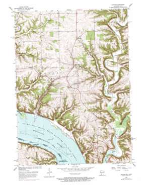
Potosi Topo Map Wisconsin
To zoom in, hover over the map of Potosi
USGS Topo Quad 42090f6 - 1:24,000 scale
| Topo Map Name: | Potosi |
| USGS Topo Quad ID: | 42090f6 |
| Print Size: | ca. 21 1/4" wide x 27" high |
| Southeast Coordinates: | 42.625° N latitude / 90.625° W longitude |
| Map Center Coordinates: | 42.6875° N latitude / 90.6875° W longitude |
| U.S. States: | WI, IA |
| Filename: | o42090f6.jpg |
| Download Map JPG Image: | Potosi topo map 1:24,000 scale |
| Map Type: | Topographic |
| Topo Series: | 7.5´ |
| Map Scale: | 1:24,000 |
| Source of Map Images: | United States Geological Survey (USGS) |
| Alternate Map Versions: |
Potosi WI 1957, updated 1967 Download PDF Buy paper map Potosi WI 1957, updated 1973 Download PDF Buy paper map Potosi WI 2010 Download PDF Buy paper map Potosi WI 2013 Download PDF Buy paper map Potosi WI 2016 Download PDF Buy paper map |
1:24,000 Topo Quads surrounding Potosi
> Back to 42090e1 at 1:100,000 scale
> Back to 42090a1 at 1:250,000 scale
> Back to U.S. Topo Maps home
Potosi topo map: Gazetteer
Potosi: Bridges
Banfield Bridge elevation 184m 603′Steinback Bridge elevation 186m 610′
Potosi: Channels
Potosi Canal elevation 184m 603′Potosi: Dams
Koeller and Klein Dam elevation 259m 849′Potosi: Islands
Island Number Two Hundred Eleven elevation 184m 603′Island Number Two Hundred Twelve elevation 184m 603′
Potosi: Parks
Grant River Recreation Area elevation 186m 610′Potosi: Populated Places
British Hollow elevation 251m 823′Buena Vista elevation 270m 885′
Potosi elevation 242m 793′
Rockville elevation 280m 918′
Tennyson elevation 284m 931′
Van Buren elevation 200m 656′
Potosi: Post Offices
Spechts Ferry Post Office (historical) elevation 184m 603′Potosi: Streams
Blakely Branch elevation 194m 636′Grant River elevation 185m 606′
Little Platte River elevation 184m 603′
Potosi Creek elevation 184m 603′
Willow Creek elevation 237m 777′
Potosi: Valleys
Hog Hollow elevation 191m 626′Yankee Hollow elevation 188m 616′
Potosi digital topo map on disk
Buy this Potosi topo map showing relief, roads, GPS coordinates and other geographical features, as a high-resolution digital map file on DVD:


