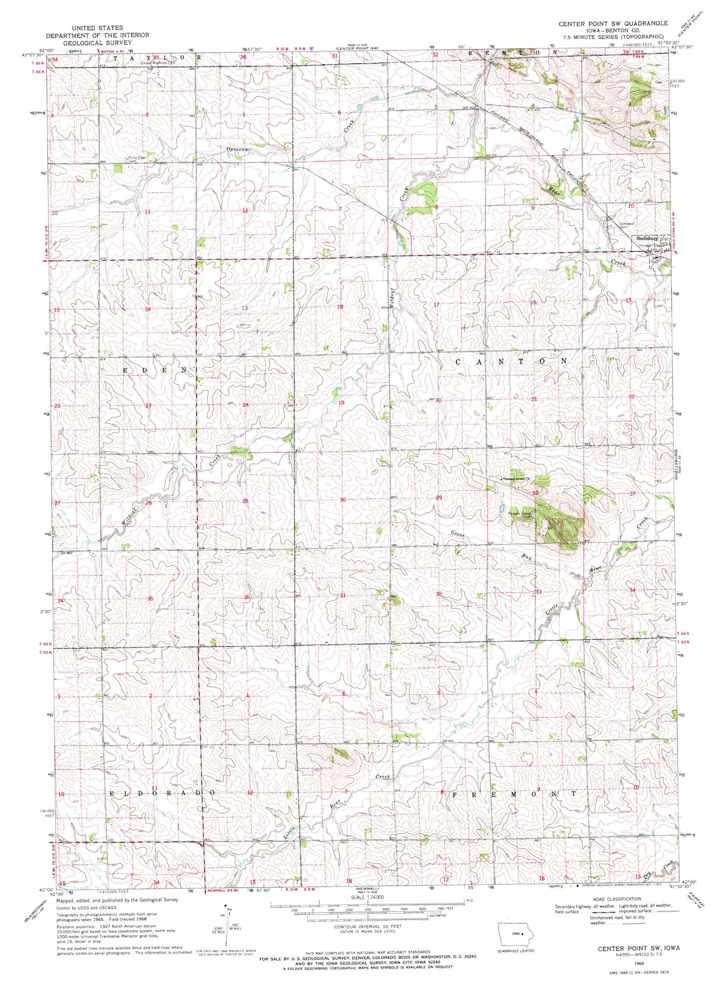
Center Point Sw Topo Map Iowa
To zoom in, hover over the map of Center Point Sw
USGS Topo Quad 42091a8 - 1:24,000 scale
| Topo Map Name: | Center Point Sw |
| USGS Topo Quad ID: | 42091a8 |
| Print Size: | ca. 21 1/4" wide x 27" high |
| Southeast Coordinates: | 42° N latitude / 91.875° W longitude |
| Map Center Coordinates: | 42.0625° N latitude / 91.9375° W longitude |
| U.S. State: | IA |
| Filename: | o42091a8.jpg |
| Download Map JPG Image: | Center Point Sw topo map 1:24,000 scale |
| Map Type: | Topographic |
| Topo Series: | 7.5´ |
| Map Scale: | 1:24,000 |
| Source of Map Images: | United States Geological Survey (USGS) |
| Alternate Map Versions: |
Center Point SW IA 1968, updated 1971 Download PDF Buy paper map Center Point SW IA 2010 Download PDF Buy paper map Center Point SW IA 2013 Download PDF Buy paper map Center Point SW IA 2015 Download PDF Buy paper map |
1:24,000 Topo Quads surrounding Center Point Sw
La Porte City |
Brandon |
Cheney |
Walker |
Troy Mills |
Garrison |
Vinton |
Center Point Nw |
Center Point |
Lafayette |
Keystone North |
Van Horne |
Center Point Sw |
Shellsburg |
Cedar Rapids North |
Keystone South |
Blairstown |
Newhall |
Fairfax |
Cedar Rapids South |
Ladora |
Marengo |
Middle Amana |
Amana |
Swisher |
> Back to 42091a1 at 1:100,000 scale
> Back to 42090a1 at 1:250,000 scale
> Back to U.S. Topo Maps home
Center Point Sw topo map: Gazetteer
Center Point Sw: Parks
Warren H Pangborn Wildlife Area elevation 267m 875′Center Point Sw: Populated Places
Eden elevation 261m 856′Center Point Sw: Post Offices
Summers Post Office (historical) elevation 271m 889′Center Point Sw: Streams
Goose Run elevation 244m 800′Opossum Creek elevation 243m 797′
Wildcat Creek elevation 241m 790′
Center Point Sw digital topo map on disk
Buy this Center Point Sw topo map showing relief, roads, GPS coordinates and other geographical features, as a high-resolution digital map file on DVD: