Dyersville West Topo Map Iowa
To zoom in, hover over the map of Dyersville West
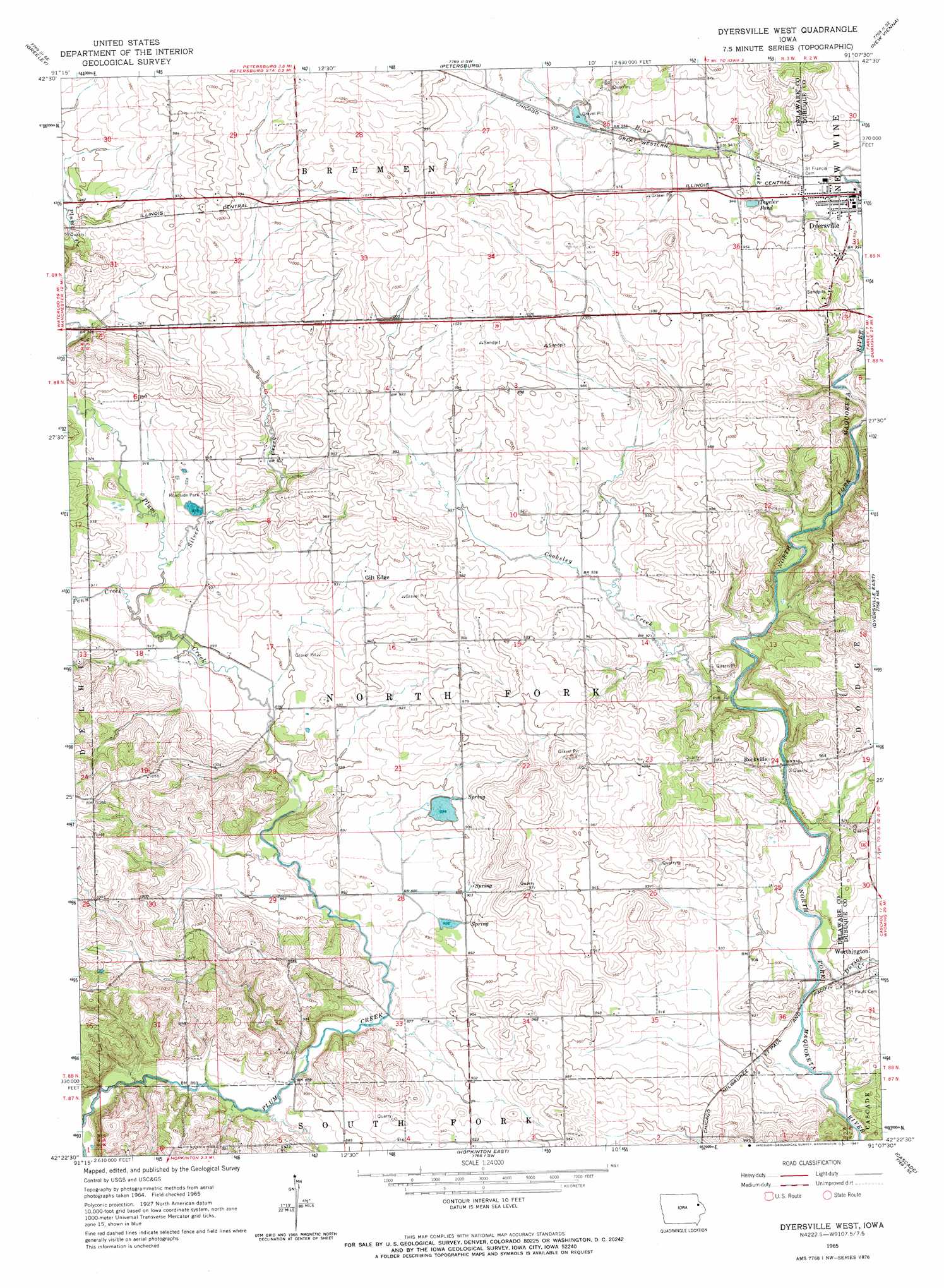
USGS Topo Quad 42091d2 - 1:24,000 scale
| Topo Map Name: | Dyersville West |
| USGS Topo Quad ID: | 42091d2 |
| Print Size: | ca. 21 1/4" wide x 27" high |
| Southeast Coordinates: | 42.375° N latitude / 91.125° W longitude |
| Map Center Coordinates: | 42.4375° N latitude / 91.1875° W longitude |
| U.S. State: | IA |
| Filename: | o42091d2.jpg |
| Download Map JPG Image: | Dyersville West topo map 1:24,000 scale |
| Map Type: | Topographic |
| Topo Series: | 7.5´ |
| Map Scale: | 1:24,000 |
| Source of Map Images: | United States Geological Survey (USGS) |
| Alternate Map Versions: |
Dyersville West IA 1965, updated 1967 Download PDF Buy paper map Dyersville West IA 2010 Download PDF Buy paper map Dyersville West IA 2013 Download PDF Buy paper map Dyersville West IA 2015 Download PDF Buy paper map |
1:24,000 Topo Quads surrounding Dyersville West
Edgewood |
Garber |
Colesburg |
Turkey River |
Cassville |
Thorpe |
Greeley |
Petersburg |
New Vienna |
Holy Cross |
Manchester |
Earlville |
Dyersville West |
Dyersville East |
Epworth |
Ryan |
Hopkinton West |
Hopkinton East |
Cascade |
Fillmore |
Prairieburg |
Anamosa Ne |
Monticello |
Scotch Grove |
Canton |
> Back to 42091a1 at 1:100,000 scale
> Back to 42090a1 at 1:250,000 scale
> Back to U.S. Topo Maps home
Dyersville West topo map: Gazetteer
Dyersville West: Lakes
Tegeler Pond elevation 287m 941′Dyersville West: Populated Places
Gilt Edge elevation 283m 928′Northwind Mobile Home Park elevation 292m 958′
Rockville elevation 282m 925′
Dyersville West: Post Offices
Giltedge Post Office (historical) elevation 283m 928′Rockville Post Office (historical) elevation 282m 925′
Dyersville West: Streams
Bear Creek elevation 282m 925′Cooksley Creek elevation 273m 895′
Durion Creek elevation 269m 882′
Penn Creek elevation 274m 898′
Silver Creek elevation 275m 902′
Dyersville West digital topo map on disk
Buy this Dyersville West topo map showing relief, roads, GPS coordinates and other geographical features, as a high-resolution digital map file on DVD: