Manchester Topo Map Iowa
To zoom in, hover over the map of Manchester
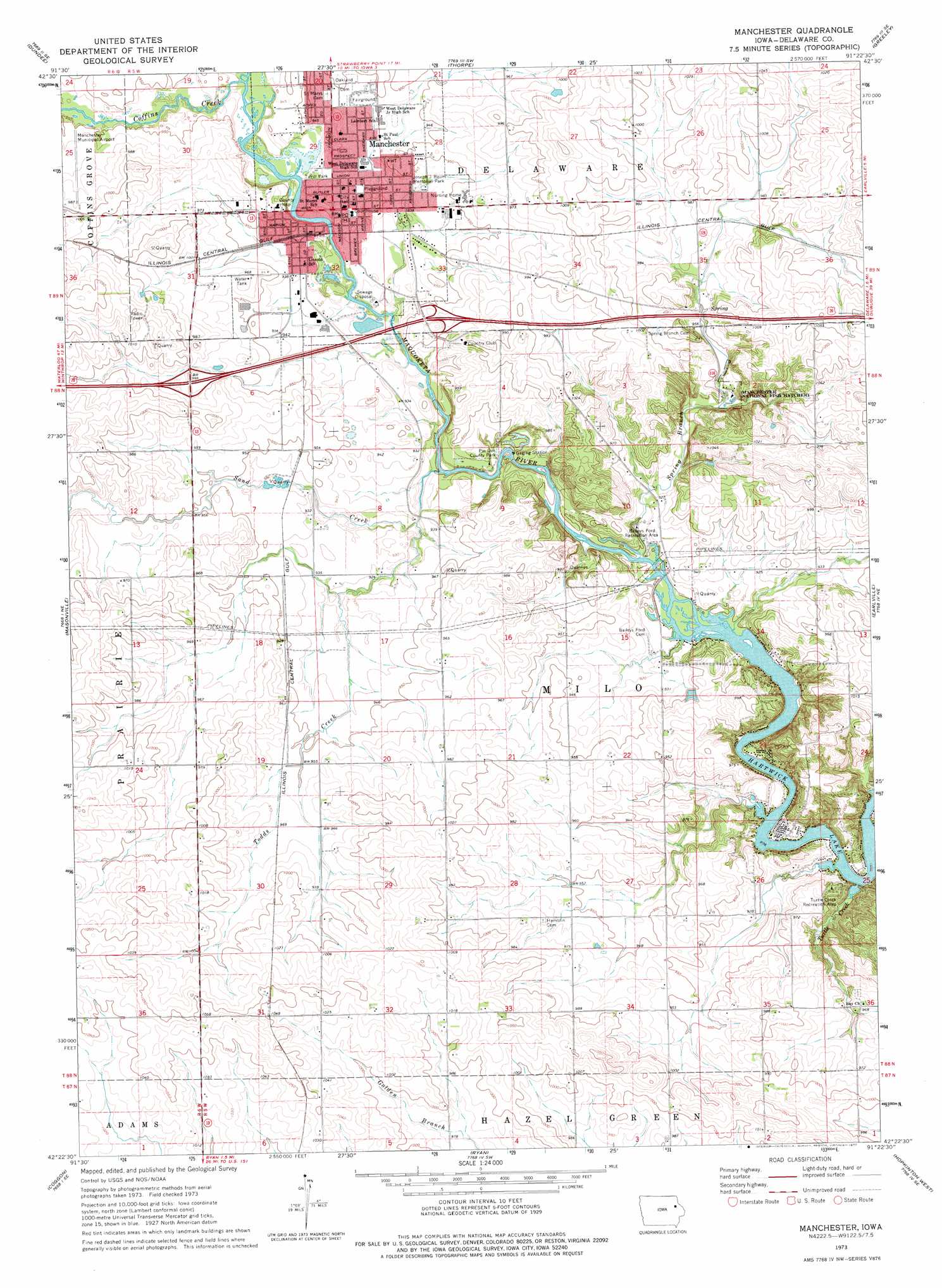
USGS Topo Quad 42091d4 - 1:24,000 scale
| Topo Map Name: | Manchester |
| USGS Topo Quad ID: | 42091d4 |
| Print Size: | ca. 21 1/4" wide x 27" high |
| Southeast Coordinates: | 42.375° N latitude / 91.375° W longitude |
| Map Center Coordinates: | 42.4375° N latitude / 91.4375° W longitude |
| U.S. State: | IA |
| Filename: | o42091d4.jpg |
| Download Map JPG Image: | Manchester topo map 1:24,000 scale |
| Map Type: | Topographic |
| Topo Series: | 7.5´ |
| Map Scale: | 1:24,000 |
| Source of Map Images: | United States Geological Survey (USGS) |
| Alternate Map Versions: |
Manchester IA 1973, updated 1977 Download PDF Buy paper map Manchester IA 2010 Download PDF Buy paper map Manchester IA 2013 Download PDF Buy paper map Manchester IA 2015 Download PDF Buy paper map |
1:24,000 Topo Quads surrounding Manchester
Arlington |
Strawberry Point |
Edgewood |
Garber |
Colesburg |
Lamont |
Dundee |
Thorpe |
Greeley |
Petersburg |
Winthrop |
Masonville |
Manchester |
Earlville |
Dyersville West |
Troy Mills |
Coggon |
Ryan |
Hopkinton West |
Hopkinton East |
Lafayette |
Central City |
Prairieburg |
Anamosa Ne |
Monticello |
> Back to 42091a1 at 1:100,000 scale
> Back to 42090a1 at 1:250,000 scale
> Back to U.S. Topo Maps home
Manchester topo map: Gazetteer
Manchester: Airports
Manchester Municipal Airport elevation 291m 954′Manchester: Crossings
Interchange 275 elevation 298m 977′Interchange 277 elevation 293m 961′
Manchester: Parks
Bailey's Ford Access Historical Marker elevation 281m 921′Baileys Ford Recreation Area elevation 274m 898′
Beckman Sport Complex elevation 289m 948′
Central Park elevation 287m 941′
Denton Park elevation 299m 980′
Joseph J Baum Memorial Park elevation 287m 941′
Pin Oak County Park elevation 282m 925′
Tirrill Park elevation 286m 938′
Turtle Creek Recreation Area elevation 293m 961′
Manchester: Populated Places
Golden elevation 321m 1053′Manchester elevation 287m 941′
Orchard Lane Mobile Home Court elevation 287m 941′
Manchester: Post Offices
Bailey's Ford Post Office elevation 281m 921′Golden Post Office (historical) elevation 315m 1033′
Manchester Post Office elevation 287m 941′
Milo Post Office (historical) elevation 315m 1033′
Spring Branch Post Office (historical) elevation 310m 1017′
Manchester: Streams
Coffins Creek elevation 282m 925′Sand Creek elevation 274m 898′
Spring Branch elevation 274m 898′
Todds Creek elevation 278m 912′
Turtle Creek elevation 273m 895′
Manchester digital topo map on disk
Buy this Manchester topo map showing relief, roads, GPS coordinates and other geographical features, as a high-resolution digital map file on DVD: