Petersburg Topo Map Iowa
To zoom in, hover over the map of Petersburg
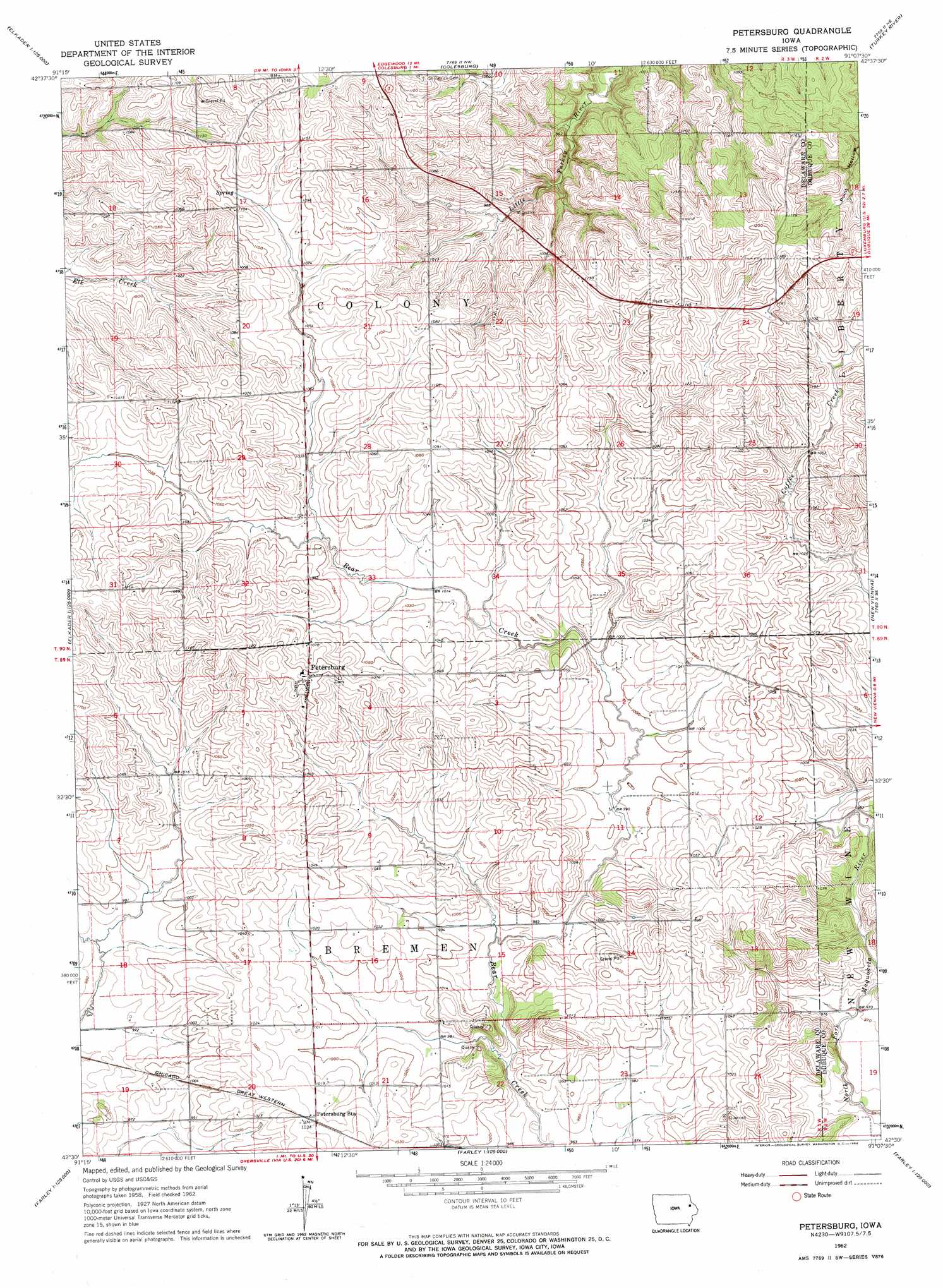
USGS Topo Quad 42091e2 - 1:24,000 scale
| Topo Map Name: | Petersburg |
| USGS Topo Quad ID: | 42091e2 |
| Print Size: | ca. 21 1/4" wide x 27" high |
| Southeast Coordinates: | 42.5° N latitude / 91.125° W longitude |
| Map Center Coordinates: | 42.5625° N latitude / 91.1875° W longitude |
| U.S. State: | IA |
| Filename: | o42091e2.jpg |
| Download Map JPG Image: | Petersburg topo map 1:24,000 scale |
| Map Type: | Topographic |
| Topo Series: | 7.5´ |
| Map Scale: | 1:24,000 |
| Source of Map Images: | United States Geological Survey (USGS) |
| Alternate Map Versions: |
Petersburg IA 1962, updated 1964 Download PDF Buy paper map Petersburg IA 1971, updated 1973 Download PDF Buy paper map Petersburg IA 2010 Download PDF Buy paper map Petersburg IA 2013 Download PDF Buy paper map Petersburg IA 2015 Download PDF Buy paper map |
1:24,000 Topo Quads surrounding Petersburg
Elkader |
Littleport |
Garnavillo |
Guttenberg |
Beetown |
Edgewood |
Garber |
Colesburg |
Turkey River |
Cassville |
Thorpe |
Greeley |
Petersburg |
New Vienna |
Holy Cross |
Manchester |
Earlville |
Dyersville West |
Dyersville East |
Epworth |
Ryan |
Hopkinton West |
Hopkinton East |
Cascade |
Fillmore |
> Back to 42091e1 at 1:100,000 scale
> Back to 42090a1 at 1:250,000 scale
> Back to U.S. Topo Maps home
Petersburg topo map: Gazetteer
Petersburg: Parks
Colesburg Roadside Park elevation 324m 1062′New Wine Park elevation 296m 971′
Petersburg: Populated Places
Holy Cross elevation 327m 1072′Petersburg elevation 339m 1112′
Petersburg: Post Offices
Petersburg Post Office (historical) elevation 339m 1112′Poultney Post Office (historical) elevation 324m 1062′
Petersburg digital topo map on disk
Buy this Petersburg topo map showing relief, roads, GPS coordinates and other geographical features, as a high-resolution digital map file on DVD: