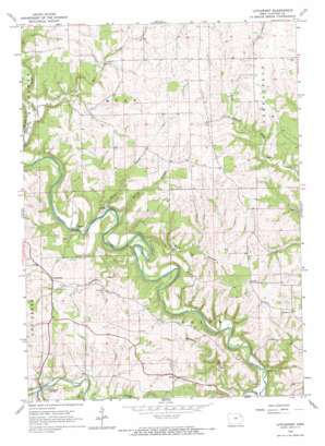
Littleport Topo Map Iowa
To zoom in, hover over the map of Littleport
USGS Topo Quad 42091g3 - 1:24,000 scale
| Topo Map Name: | Littleport |
| USGS Topo Quad ID: | 42091g3 |
| Print Size: | ca. 21 1/4" wide x 27" high |
| Southeast Coordinates: | 42.75° N latitude / 91.25° W longitude |
| Map Center Coordinates: | 42.8125° N latitude / 91.3125° W longitude |
| U.S. State: | IA |
| Filename: | o42091g3.jpg |
| Download Map JPG Image: | Littleport topo map 1:24,000 scale |
| Map Type: | Topographic |
| Topo Series: | 7.5´ |
| Map Scale: | 1:24,000 |
| Source of Map Images: | United States Geological Survey (USGS) |
| Alternate Map Versions: |
Littleport IA 1964, updated 1967 Download PDF Buy paper map Littleport IA 2010 Download PDF Buy paper map Littleport IA 2013 Download PDF Buy paper map Littleport IA 2015 Download PDF Buy paper map |
1:24,000 Topo Quads surrounding Littleport
> Back to 42091e1 at 1:100,000 scale
> Back to 42090a1 at 1:250,000 scale
> Back to U.S. Topo Maps home
Littleport topo map: Gazetteer
Littleport: Bridges
Dry Run Bridge elevation 212m 695′Garnavillo Township Culbert elevation 316m 1036′
Motor Mill Bridge elevation 214m 702′
Read Township Culvert elevation 274m 898′
Littleport: Parks
Rentz Memorial Woods State Preserve elevation 258m 846′Littleport: Populated Places
Communia elevation 251m 823′Littleport elevation 217m 711′
Motor elevation 214m 702′
Littleport: Post Offices
Communia Post Office (historical) elevation 251m 823′Littleport Post Office elevation 217m 711′
Littleport: Streams
Bente Branch elevation 208m 682′Doe Creek elevation 207m 679′
Dry Mill Creek elevation 216m 708′
Honey Creek elevation 210m 688′
Panther Creek elevation 205m 672′
Roberts Creek elevation 213m 698′
Spring Branch elevation 208m 682′
Littleport: Valleys
Beddows Hollow elevation 201m 659′Pine Hollow elevation 208m 682′
Littleport digital topo map on disk
Buy this Littleport topo map showing relief, roads, GPS coordinates and other geographical features, as a high-resolution digital map file on DVD:


