Maynard Topo Map Iowa
To zoom in, hover over the map of Maynard
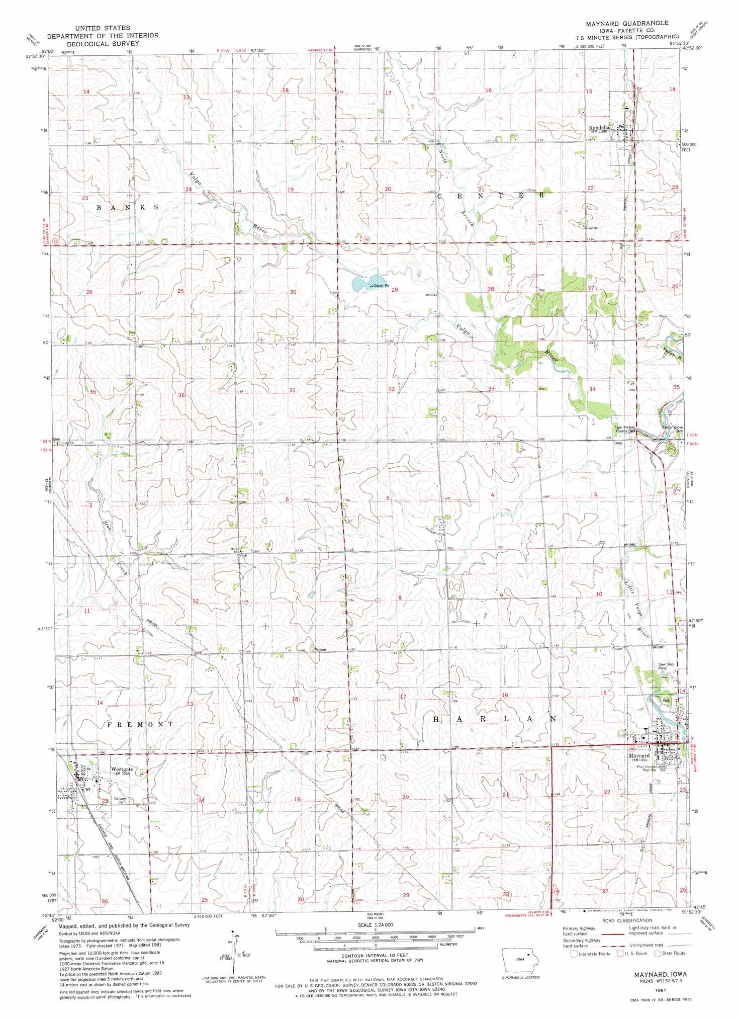
USGS Topo Quad 42091g8 - 1:24,000 scale
| Topo Map Name: | Maynard |
| USGS Topo Quad ID: | 42091g8 |
| Print Size: | ca. 21 1/4" wide x 27" high |
| Southeast Coordinates: | 42.75° N latitude / 91.875° W longitude |
| Map Center Coordinates: | 42.8125° N latitude / 91.9375° W longitude |
| U.S. State: | IA |
| Filename: | o42091g8.jpg |
| Download Map JPG Image: | Maynard topo map 1:24,000 scale |
| Map Type: | Topographic |
| Topo Series: | 7.5´ |
| Map Scale: | 1:24,000 |
| Source of Map Images: | United States Geological Survey (USGS) |
| Alternate Map Versions: |
Maynard IA 1981, updated 1982 Download PDF Buy paper map Maynard IA 2010 Download PDF Buy paper map Maynard IA 2013 Download PDF Buy paper map Maynard IA 2015 Download PDF Buy paper map |
1:24,000 Topo Quads surrounding Maynard
Lawler |
Waucoma |
Saint Lucas |
Festina |
Castalia |
Fredericksburg |
Alpha |
Hawkeye |
West Union |
Elgin |
Sumner Sw |
Sumner |
Maynard |
Fayette |
Wadena |
Readlyn |
Fairbank |
Oelwein |
Stanley |
Arlington |
Dunkerton |
Littleton |
Hazleton |
Oelwein Se |
Lamont |
> Back to 42091e1 at 1:100,000 scale
> Back to 42090a1 at 1:250,000 scale
> Back to U.S. Topo Maps home
Maynard topo map: Gazetteer
Maynard: Bridges
Stoe Creek Bridge elevation 332m 1089′Twin Bridge elevation 319m 1046′
Maynard: Parks
Maynard Park elevation 331m 1085′Twin Bridges County Park elevation 322m 1056′
Maynard: Populated Places
Maynard elevation 337m 1105′Randalia elevation 340m 1115′
Westgate elevation 333m 1092′
Maynard: Post Offices
Maynard Post Office elevation 337m 1105′Randalia Post Office elevation 338m 1108′
Westgate Post Office elevation 333m 1092′
Maynard: Streams
Little Volga River elevation 319m 1046′North Branch Volga River elevation 326m 1069′
Maynard digital topo map on disk
Buy this Maynard topo map showing relief, roads, GPS coordinates and other geographical features, as a high-resolution digital map file on DVD: