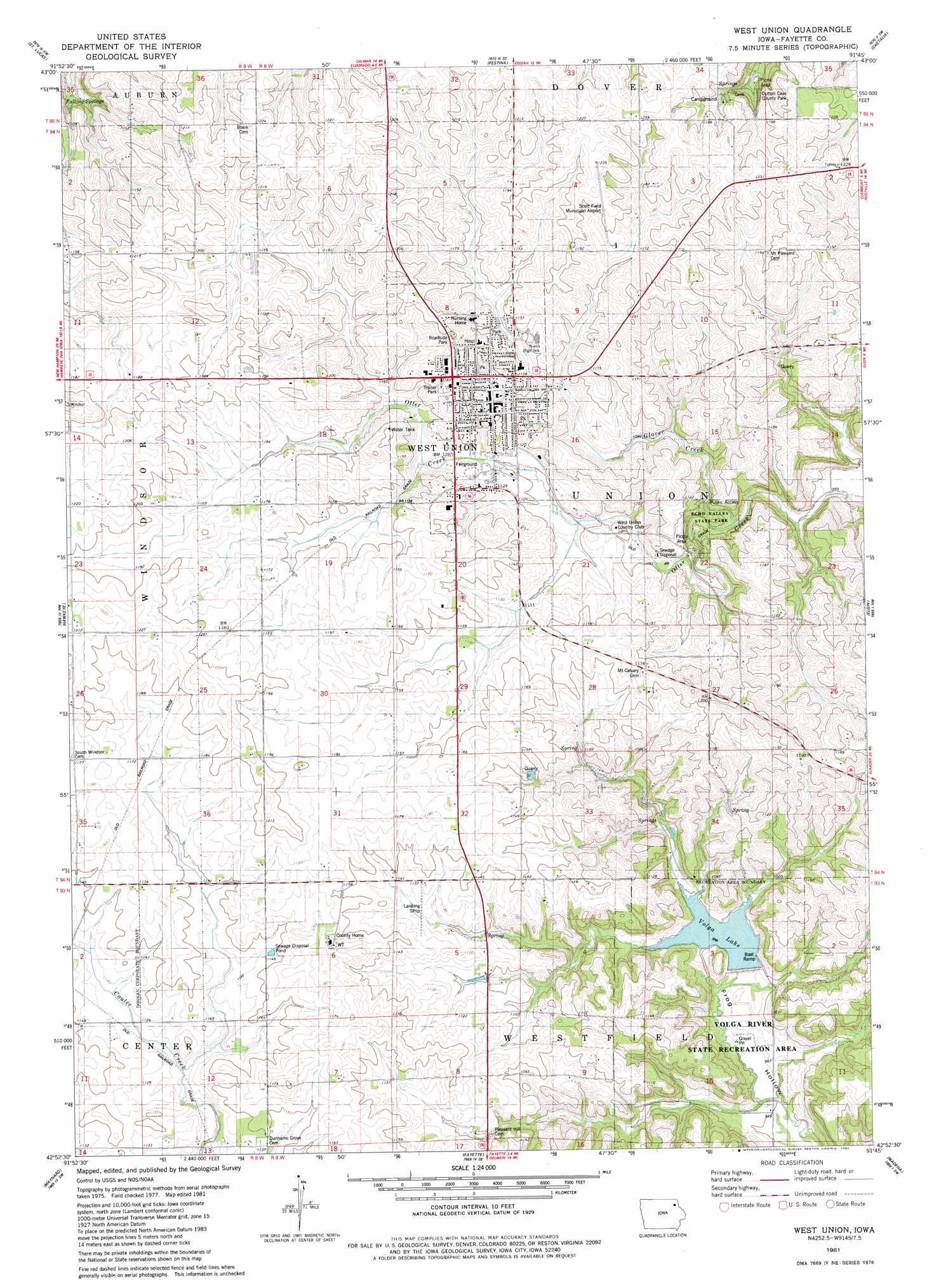
West Union Topo Map Iowa
To zoom in, hover over the map of West Union
USGS Topo Quad 42091h7 - 1:24,000 scale
| Topo Map Name: | West Union |
| USGS Topo Quad ID: | 42091h7 |
| Print Size: | ca. 21 1/4" wide x 27" high |
| Southeast Coordinates: | 42.875° N latitude / 91.75° W longitude |
| Map Center Coordinates: | 42.9375° N latitude / 91.8125° W longitude |
| U.S. State: | IA |
| Filename: | o42091h7.jpg |
| Download Map JPG Image: | West Union topo map 1:24,000 scale |
| Map Type: | Topographic |
| Topo Series: | 7.5´ |
| Map Scale: | 1:24,000 |
| Source of Map Images: | United States Geological Survey (USGS) |
| Alternate Map Versions: |
West Union IA 1981, updated 1982 Download PDF Buy paper map West Union IA 2010 Download PDF Buy paper map West Union IA 2013 Download PDF Buy paper map West Union IA 2015 Download PDF Buy paper map |
1:24,000 Topo Quads surrounding West Union
Protivin |
Fort Atkinson |
Calmar |
Postville Nw |
Frankville |
Waucoma |
Saint Lucas |
Festina |
Castalia |
Postville |
Alpha |
Hawkeye |
West Union |
Elgin |
Gunder |
Sumner |
Maynard |
Fayette |
Wadena |
Volga |
Fairbank |
Oelwein |
Stanley |
Arlington |
Strawberry Point |
> Back to 42091e1 at 1:100,000 scale
> Back to 42090a1 at 1:250,000 scale
> Back to U.S. Topo Maps home
West Union topo map: Gazetteer
West Union: Airports
George L Scott Municipal Airport elevation 371m 1217′Scott Field Municipal Airport elevation 371m 1217′
West Union: Bridges
Vine Street Bridge elevation 336m 1102′West Union: Parks
Clark Park elevation 354m 1161′Dutton Cave County Park elevation 328m 1076′
Echo Valley State Park elevation 357m 1171′
Fayette County Courthouse Twice Burned Historical Marker elevation 363m 1190′
Lions Park elevation 354m 1161′
Rotary Park elevation 346m 1135′
Sunset Park elevation 365m 1197′
Wildwood Nature Center elevation 357m 1171′
West Union: Populated Places
West Union elevation 362m 1187′West Union: Post Offices
Orion Post Office (historical) elevation 342m 1122′West Union Post Office elevation 359m 1177′
West Union: Reservoirs
Volga Lake elevation 306m 1003′West Union: Springs
Falling Springs elevation 322m 1056′West Union: Streams
Glover Creek elevation 328m 1076′West Union digital topo map on disk
Buy this West Union topo map showing relief, roads, GPS coordinates and other geographical features, as a high-resolution digital map file on DVD: