Hawkeye Topo Map Iowa
To zoom in, hover over the map of Hawkeye
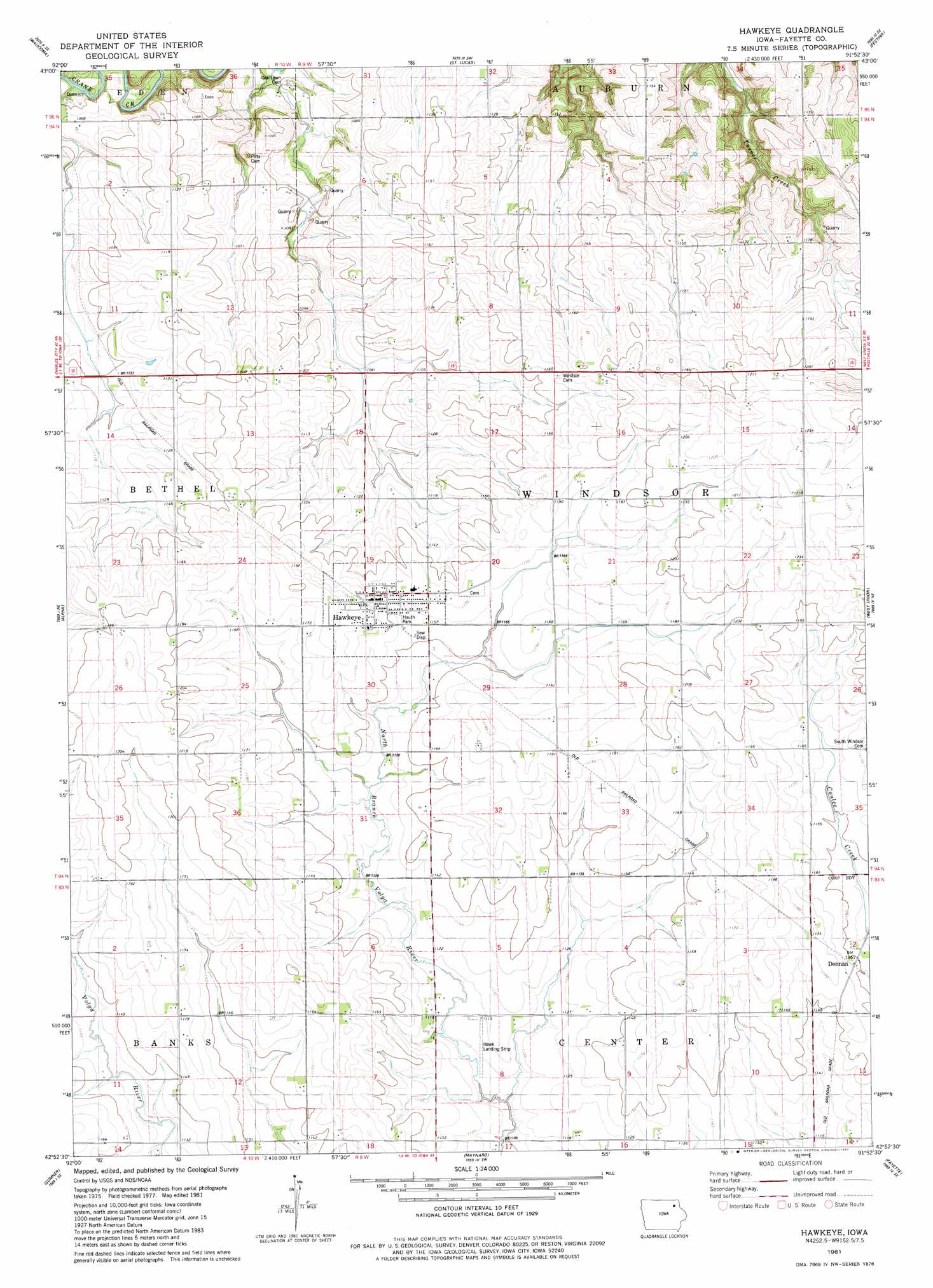
USGS Topo Quad 42091h8 - 1:24,000 scale
| Topo Map Name: | Hawkeye |
| USGS Topo Quad ID: | 42091h8 |
| Print Size: | ca. 21 1/4" wide x 27" high |
| Southeast Coordinates: | 42.875° N latitude / 91.875° W longitude |
| Map Center Coordinates: | 42.9375° N latitude / 91.9375° W longitude |
| U.S. State: | IA |
| Filename: | o42091h8.jpg |
| Download Map JPG Image: | Hawkeye topo map 1:24,000 scale |
| Map Type: | Topographic |
| Topo Series: | 7.5´ |
| Map Scale: | 1:24,000 |
| Source of Map Images: | United States Geological Survey (USGS) |
| Alternate Map Versions: |
Hawkeye IA 1981, updated 1982 Download PDF Buy paper map Hawkeye IA 2010 Download PDF Buy paper map Hawkeye IA 2013 Download PDF Buy paper map Hawkeye IA 2015 Download PDF Buy paper map |
1:24,000 Topo Quads surrounding Hawkeye
Saude |
Protivin |
Fort Atkinson |
Calmar |
Postville Nw |
Lawler |
Waucoma |
Saint Lucas |
Festina |
Castalia |
Fredericksburg |
Alpha |
Hawkeye |
West Union |
Elgin |
Sumner Sw |
Sumner |
Maynard |
Fayette |
Wadena |
Readlyn |
Fairbank |
Oelwein |
Stanley |
Arlington |
> Back to 42091e1 at 1:100,000 scale
> Back to 42090a1 at 1:250,000 scale
> Back to U.S. Topo Maps home
Hawkeye topo map: Gazetteer
Hawkeye: Airports
Hawk Landing Strip elevation 340m 1115′Hawkeye: Parks
Franklin Park elevation 303m 994′Hauth Park elevation 354m 1161′
Hawkeye: Populated Places
Donnan elevation 352m 1154′Hawkeye elevation 356m 1167′
Hawkeye: Post Offices
Donnan Post Office (historical) elevation 352m 1154′Hawkeye Post Office elevation 356m 1167′
Windsor Post Office (historical) elevation 345m 1131′
Hawkeye digital topo map on disk
Buy this Hawkeye topo map showing relief, roads, GPS coordinates and other geographical features, as a high-resolution digital map file on DVD: