Le Grand Topo Map Iowa
To zoom in, hover over the map of Le Grand
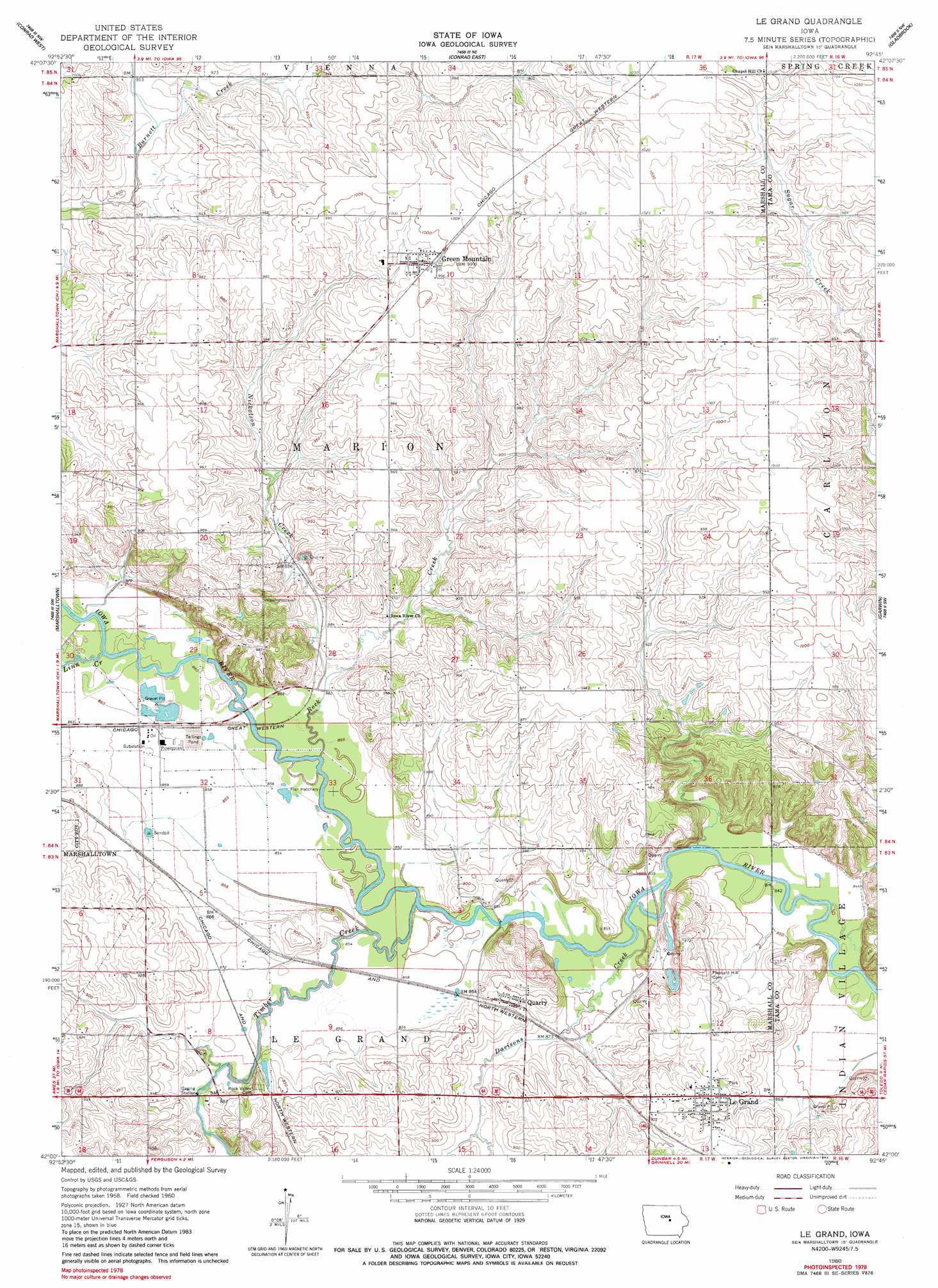
USGS Topo Quad 42092a7 - 1:24,000 scale
| Topo Map Name: | Le Grand |
| USGS Topo Quad ID: | 42092a7 |
| Print Size: | ca. 21 1/4" wide x 27" high |
| Southeast Coordinates: | 42° N latitude / 92.75° W longitude |
| Map Center Coordinates: | 42.0625° N latitude / 92.8125° W longitude |
| U.S. State: | IA |
| Filename: | o42092a7.jpg |
| Download Map JPG Image: | Le Grand topo map 1:24,000 scale |
| Map Type: | Topographic |
| Topo Series: | 7.5´ |
| Map Scale: | 1:24,000 |
| Source of Map Images: | United States Geological Survey (USGS) |
| Alternate Map Versions: |
Le Grand IA 1960, updated 1962 Download PDF Buy paper map Le Grand IA 1960, updated 1983 Download PDF Buy paper map Le Grand IA 2010 Download PDF Buy paper map Le Grand IA 2013 Download PDF Buy paper map Le Grand IA 2015 Download PDF Buy paper map |
1:24,000 Topo Quads surrounding Le Grand
Eldora |
Ivester |
Grundy Center |
Lincoln |
Reinbeck |
Union |
Conrad West |
Conrad East |
Gladbrook |
Gladbrook Ne |
La Moille |
Marshalltown |
Le Grand |
Garwin |
Gladbrook Se |
Melbourne |
Laurel |
Gilman |
Montour |
Tama |
Baxter Se |
Alloway Creek |
Newburg |
Grinnell North |
Sheridan |
> Back to 42092a1 at 1:100,000 scale
> Back to 42092a1 at 1:250,000 scale
> Back to U.S. Topo Maps home
Le Grand topo map: Gazetteer
Le Grand: Bridges
Le Grand Bridge elevation 256m 839′Le Grand Bridge elevation 258m 846′
Quarry Bridge elevation 257m 843′
Le Grand: Parks
Three Bridges County Park elevation 258m 846′Le Grand: Populated Places
Green Mountain elevation 302m 990′Le Grand elevation 284m 931′
Predonia (historical) elevation 302m 990′
Quarry elevation 272m 892′
Rockton elevation 262m 859′
Terrace Manor Mobile Home Court elevation 281m 921′
Le Grand: Post Offices
Gowanda Post Office (historical) elevation 294m 964′Green Mountain Post Office elevation 302m 990′
Green Mountain Post Office (historical) elevation 299m 980′
Le Grand Post Office elevation 284m 931′
Quarry Post Office (historical) elevation 272m 892′
Reedsville Post Office (historical) elevation 299m 980′
Rockton Post Office (historical) elevation 269m 882′
Le Grand: Streams
Davisons Creek elevation 256m 839′Linn Creek elevation 262m 859′
Nickolson Creek elevation 261m 856′
Rock Creek elevation 258m 846′
South Rock Creek elevation 272m 892′
Timber Creek elevation 257m 843′
Le Grand digital topo map on disk
Buy this Le Grand topo map showing relief, roads, GPS coordinates and other geographical features, as a high-resolution digital map file on DVD: