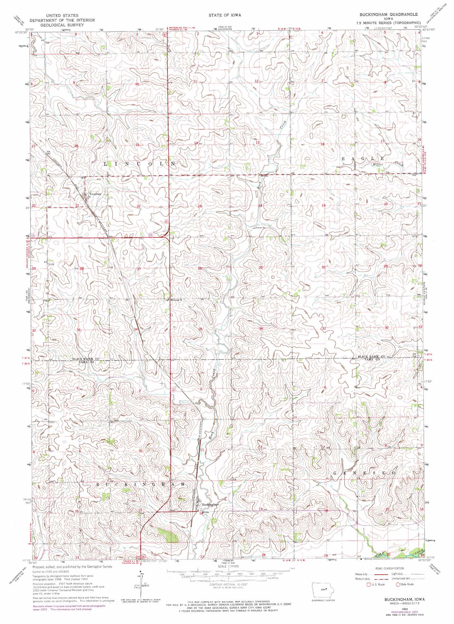
Buckingham Topo Map Iowa
To zoom in, hover over the map of Buckingham
USGS Topo Quad 42092c4 - 1:24,000 scale
| Topo Map Name: | Buckingham |
| USGS Topo Quad ID: | 42092c4 |
| Print Size: | ca. 21 1/4" wide x 27" high |
| Southeast Coordinates: | 42.25° N latitude / 92.375° W longitude |
| Map Center Coordinates: | 42.3125° N latitude / 92.4375° W longitude |
| U.S. State: | IA |
| Filename: | o42092c4.jpg |
| Download Map JPG Image: | Buckingham topo map 1:24,000 scale |
| Map Type: | Topographic |
| Topo Series: | 7.5´ |
| Map Scale: | 1:24,000 |
| Source of Map Images: | United States Geological Survey (USGS) |
| Alternate Map Versions: |
Buckingham IA 1963, updated 1964 Download PDF Buy paper map Buckingham IA 1963, updated 1973 Download PDF Buy paper map Buckingham IA 2010 Download PDF Buy paper map Buckingham IA 2013 Download PDF Buy paper map Buckingham IA 2015 Download PDF Buy paper map |
1:24,000 Topo Quads surrounding Buckingham
Stout |
New Hartford |
Cedar Falls |
Waterloo North |
Dunkerton |
Dike |
Zaneta |
Hudson |
Waterloo South |
Gilbertville |
Lincoln |
Reinbeck |
Buckingham |
Eagle Center |
La Porte City |
Gladbrook |
Gladbrook Ne |
Traer |
Dysart |
Garrison |
Garwin |
Gladbrook Se |
Clutier |
Elberon |
Keystone North |
> Back to 42092a1 at 1:100,000 scale
> Back to 42092a1 at 1:250,000 scale
> Back to U.S. Topo Maps home
Buckingham topo map: Gazetteer
Buckingham: Populated Places
Blessing elevation 304m 997′Buckingham elevation 275m 902′
Voorhies elevation 304m 997′
Buckingham: Post Offices
Blessing Post Office (historical) elevation 304m 997′Bovina Post Office (historical) elevation 279m 915′
Buckingham Post Office elevation 275m 902′
Midland Post Office (historical) elevation 305m 1000′
Voorhies Post Office (historical) elevation 304m 997′
Buckingham digital topo map on disk
Buy this Buckingham topo map showing relief, roads, GPS coordinates and other geographical features, as a high-resolution digital map file on DVD: