Jesup Topo Map Iowa
To zoom in, hover over the map of Jesup
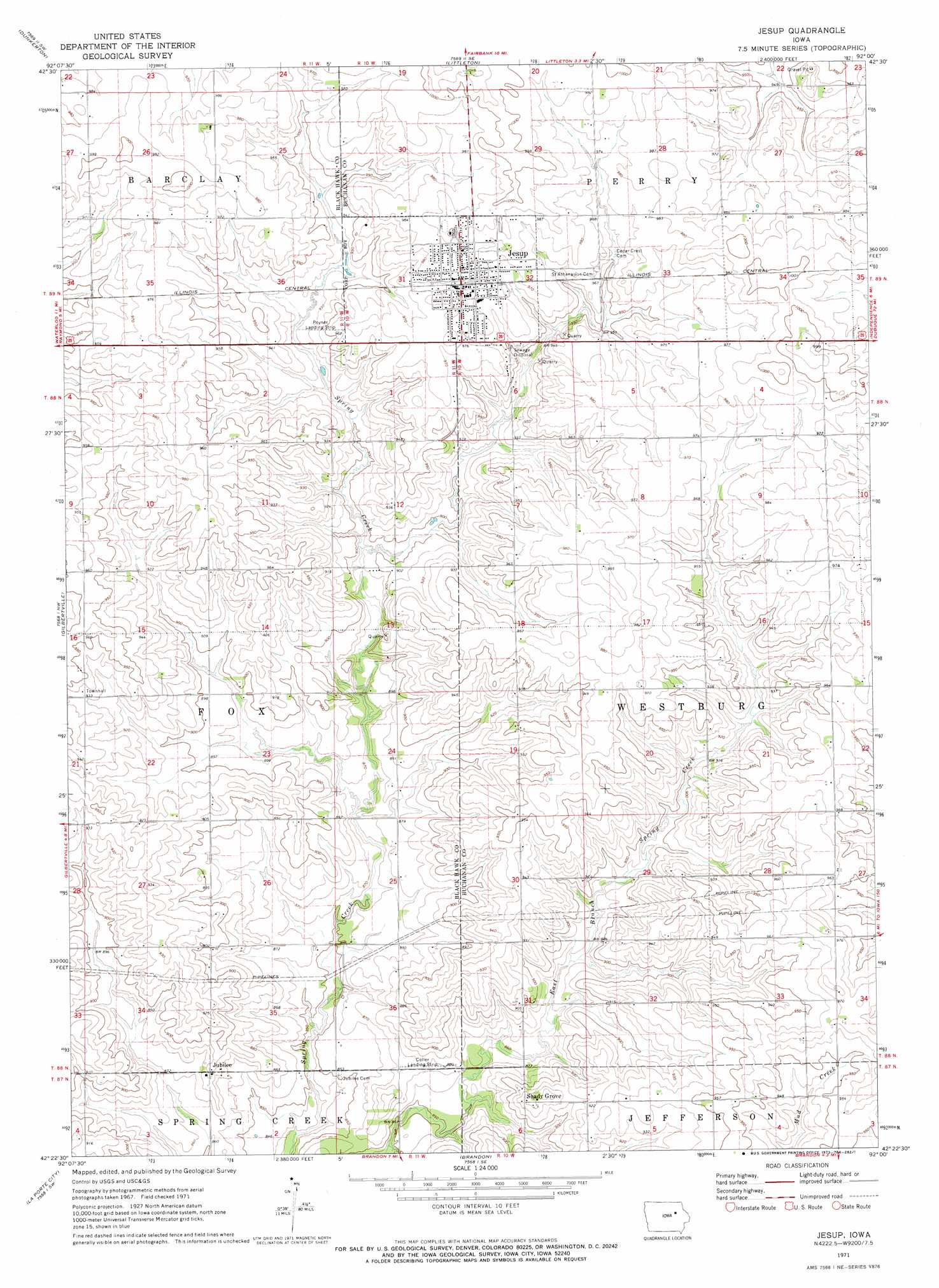
USGS Topo Quad 42092d1 - 1:24,000 scale
| Topo Map Name: | Jesup |
| USGS Topo Quad ID: | 42092d1 |
| Print Size: | ca. 21 1/4" wide x 27" high |
| Southeast Coordinates: | 42.375° N latitude / 92° W longitude |
| Map Center Coordinates: | 42.4375° N latitude / 92.0625° W longitude |
| U.S. State: | IA |
| Filename: | o42092d1.jpg |
| Download Map JPG Image: | Jesup topo map 1:24,000 scale |
| Map Type: | Topographic |
| Topo Series: | 7.5´ |
| Map Scale: | 1:24,000 |
| Source of Map Images: | United States Geological Survey (USGS) |
| Alternate Map Versions: |
Jesup IA 1971, updated 1973 Download PDF Buy paper map Jesup IA 2010 Download PDF Buy paper map Jesup IA 2013 Download PDF Buy paper map Jesup IA 2015 Download PDF Buy paper map |
1:24,000 Topo Quads surrounding Jesup
Denver |
Readlyn |
Fairbank |
Oelwein |
Stanley |
Waterloo North |
Dunkerton |
Littleton |
Hazleton |
Oelwein Se |
Waterloo South |
Gilbertville |
Jesup |
Independence |
Quasqueton |
Eagle Center |
La Porte City |
Brandon |
Cheney |
Walker |
Dysart |
Garrison |
Vinton |
Center Point Nw |
Center Point |
> Back to 42092a1 at 1:100,000 scale
> Back to 42092a1 at 1:250,000 scale
> Back to U.S. Topo Maps home
Jesup topo map: Gazetteer
Jesup: Airports
Coller Airstrip elevation 270m 885′Poyner Airport elevation 280m 918′
Jesup: Populated Places
Jesup elevation 300m 984′Jubilee elevation 272m 892′
Midway Trailer Court elevation 294m 964′
North Street Mobile Home Park elevation 302m 990′
Shady Grove elevation 283m 928′
Wise elevation 299m 980′
Jesup: Post Offices
Energy Post Office (historical) elevation 259m 849′Idlewild Post Office (historical) elevation 287m 941′
Jesup Post Office elevation 298m 977′
Jubilee Post Office (historical) elevation 272m 892′
Shady Grove Post Office (historical) elevation 283m 928′
Jesup digital topo map on disk
Buy this Jesup topo map showing relief, roads, GPS coordinates and other geographical features, as a high-resolution digital map file on DVD: