Gilbertville Topo Map Iowa
To zoom in, hover over the map of Gilbertville
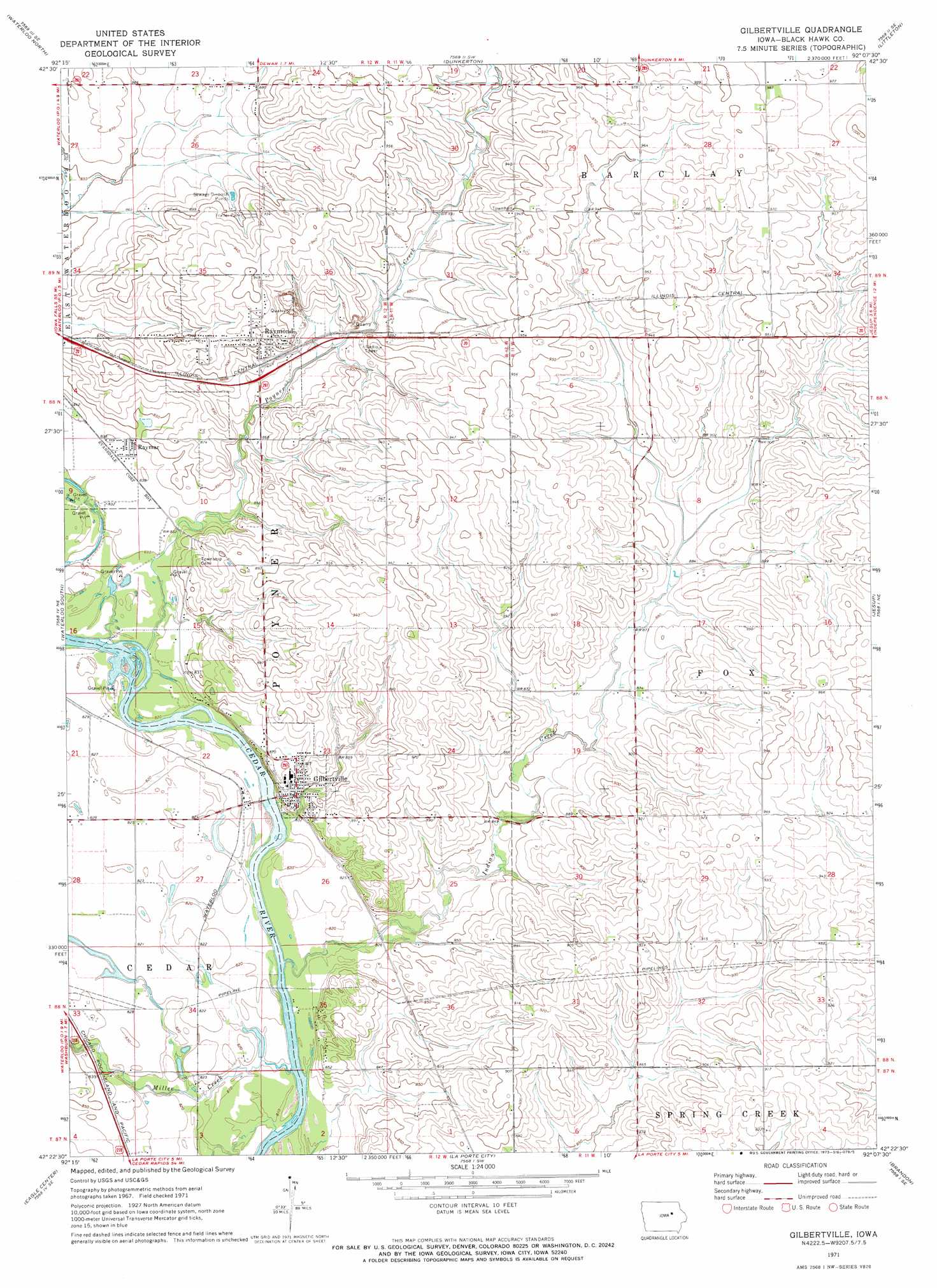
USGS Topo Quad 42092d2 - 1:24,000 scale
| Topo Map Name: | Gilbertville |
| USGS Topo Quad ID: | 42092d2 |
| Print Size: | ca. 21 1/4" wide x 27" high |
| Southeast Coordinates: | 42.375° N latitude / 92.125° W longitude |
| Map Center Coordinates: | 42.4375° N latitude / 92.1875° W longitude |
| U.S. State: | IA |
| Filename: | o42092d2.jpg |
| Download Map JPG Image: | Gilbertville topo map 1:24,000 scale |
| Map Type: | Topographic |
| Topo Series: | 7.5´ |
| Map Scale: | 1:24,000 |
| Source of Map Images: | United States Geological Survey (USGS) |
| Alternate Map Versions: |
Gilbertville IA 1971, updated 1973 Download PDF Buy paper map Gilbertville IA 2010 Download PDF Buy paper map Gilbertville IA 2013 Download PDF Buy paper map Gilbertville IA 2015 Download PDF Buy paper map |
1:24,000 Topo Quads surrounding Gilbertville
Waverly |
Denver |
Readlyn |
Fairbank |
Oelwein |
Cedar Falls |
Waterloo North |
Dunkerton |
Littleton |
Hazleton |
Hudson |
Waterloo South |
Gilbertville |
Jesup |
Independence |
Buckingham |
Eagle Center |
La Porte City |
Brandon |
Cheney |
Traer |
Dysart |
Garrison |
Vinton |
Center Point Nw |
> Back to 42092a1 at 1:100,000 scale
> Back to 42092a1 at 1:250,000 scale
> Back to U.S. Topo Maps home
Gilbertville topo map: Gazetteer
Gilbertville: Parks
Black Hawk County Park elevation 248m 813′Cedar River Natural Resource Area elevation 251m 823′
Public Square Park elevation 251m 823′
Raymond Park elevation 277m 908′
Schmidt Park elevation 265m 869′
Veterans Park elevation 250m 820′
Gilbertville: Populated Places
Gilbertville elevation 258m 846′Prairie View Acres Mobile Home Park elevation 277m 908′
Raymar elevation 255m 836′
Raymond elevation 277m 908′
Gilbertville: Post Offices
Gilbertville Post Office elevation 259m 849′Raymond Post Office elevation 272m 892′
Gilbertville: Streams
Indian Creek elevation 245m 803′Miller Creek elevation 246m 807′
Poyner Creek elevation 249m 816′
Gilbertville digital topo map on disk
Buy this Gilbertville topo map showing relief, roads, GPS coordinates and other geographical features, as a high-resolution digital map file on DVD: