Wellsburg Topo Map Iowa
To zoom in, hover over the map of Wellsburg
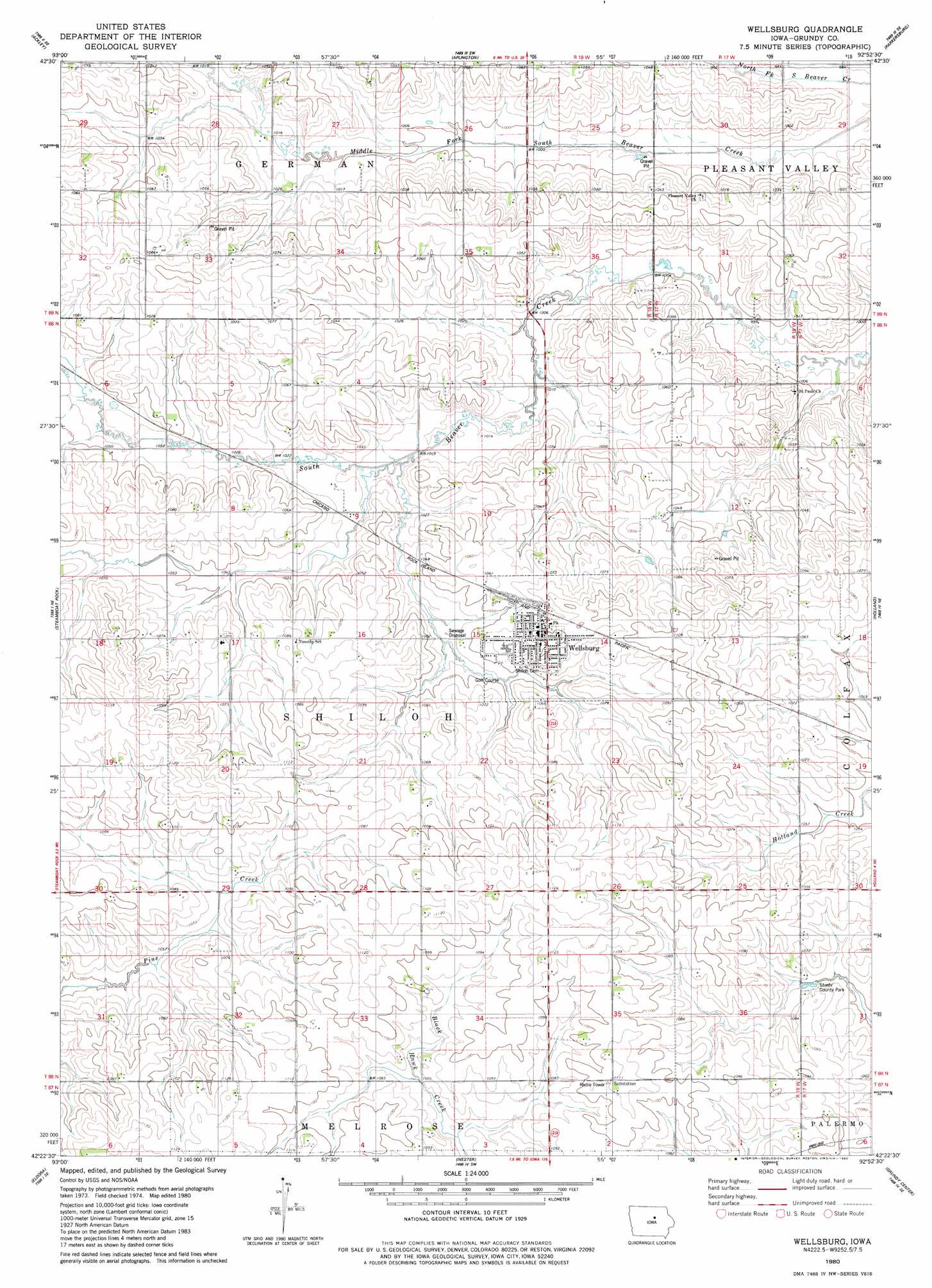
USGS Topo Quad 42092d8 - 1:24,000 scale
| Topo Map Name: | Wellsburg |
| USGS Topo Quad ID: | 42092d8 |
| Print Size: | ca. 21 1/4" wide x 27" high |
| Southeast Coordinates: | 42.375° N latitude / 92.875° W longitude |
| Map Center Coordinates: | 42.4375° N latitude / 92.9375° W longitude |
| U.S. State: | IA |
| Filename: | o42092d8.jpg |
| Download Map JPG Image: | Wellsburg topo map 1:24,000 scale |
| Map Type: | Topographic |
| Topo Series: | 7.5´ |
| Map Scale: | 1:24,000 |
| Source of Map Images: | United States Geological Survey (USGS) |
| Alternate Map Versions: |
Wellsburg IA 1980, updated 1980 Download PDF Buy paper map Wellsburg IA 2010 Download PDF Buy paper map Wellsburg IA 2013 Download PDF Buy paper map Wellsburg IA 2015 Download PDF Buy paper map |
1:24,000 Topo Quads surrounding Wellsburg
Hampton South |
Ackley Ne |
Dumont South |
Butler Center |
Coster |
Iowa Falls East |
Ackley |
Aplington |
Parkersburg |
Stout |
Owasa |
Steamboat Rock |
Wellsburg |
Holland |
Dike |
New Providence |
Eldora |
Ivester |
Grundy Center |
Lincoln |
State Center Nw |
Union |
Conrad West |
Conrad East |
Gladbrook |
> Back to 42092a1 at 1:100,000 scale
> Back to 42092a1 at 1:250,000 scale
> Back to U.S. Topo Maps home
Wellsburg topo map: Gazetteer
Wellsburg: Cliffs
Tower Rock elevation 341m 1118′Wellsburg: Parks
Stoehr County Park elevation 324m 1062′Wellsburg: Populated Places
Wellsburg elevation 307m 1007′Wellsburg: Post Offices
Wellsburg Post Office elevation 335m 1099′Wellsburg digital topo map on disk
Buy this Wellsburg topo map showing relief, roads, GPS coordinates and other geographical features, as a high-resolution digital map file on DVD: