Dunkerton Topo Map Iowa
To zoom in, hover over the map of Dunkerton
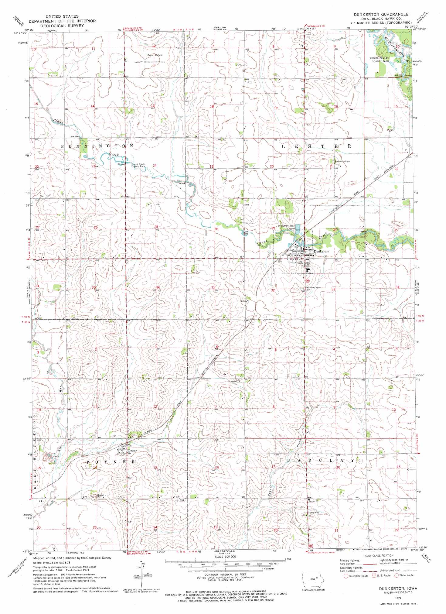
USGS Topo Quad 42092e2 - 1:24,000 scale
| Topo Map Name: | Dunkerton |
| USGS Topo Quad ID: | 42092e2 |
| Print Size: | ca. 21 1/4" wide x 27" high |
| Southeast Coordinates: | 42.5° N latitude / 92.125° W longitude |
| Map Center Coordinates: | 42.5625° N latitude / 92.1875° W longitude |
| U.S. State: | IA |
| Filename: | o42092e2.jpg |
| Download Map JPG Image: | Dunkerton topo map 1:24,000 scale |
| Map Type: | Topographic |
| Topo Series: | 7.5´ |
| Map Scale: | 1:24,000 |
| Source of Map Images: | United States Geological Survey (USGS) |
| Alternate Map Versions: |
Dunkerton IA 1971, updated 1973 Download PDF Buy paper map Dunkerton IA 2010 Download PDF Buy paper map Dunkerton IA 2013 Download PDF Buy paper map Dunkerton IA 2015 Download PDF Buy paper map |
1:24,000 Topo Quads surrounding Dunkerton
Bremer |
Tripoli |
Sumner Sw |
Sumner |
Maynard |
Waverly |
Denver |
Readlyn |
Fairbank |
Oelwein |
Cedar Falls |
Waterloo North |
Dunkerton |
Littleton |
Hazleton |
Hudson |
Waterloo South |
Gilbertville |
Jesup |
Independence |
Buckingham |
Eagle Center |
La Porte City |
Brandon |
Cheney |
> Back to 42092e1 at 1:100,000 scale
> Back to 42092a1 at 1:250,000 scale
> Back to U.S. Topo Maps home
Dunkerton topo map: Gazetteer
Dunkerton: Airports
Davis Field elevation 307m 1007′Dunkerton: Bridges
Dunkerton Bridge elevation 286m 938′Dunkerton: Parks
Childs Access County Park elevation 287m 941′Crane Creek County Park elevation 292m 958′
Dunkerton: Populated Places
Canfield elevation 302m 990′Dewar elevation 271m 889′
Dunkerton elevation 291m 954′
Dunkerton: Post Offices
Blackeville Post Office (historical) elevation 302m 990′Canfield Post Office (historical) elevation 302m 990′
Dewar Post Office elevation 271m 889′
Dunkerton Post Office elevation 291m 954′
Lester Post Office (historical) elevation 301m 987′
Dunkerton digital topo map on disk
Buy this Dunkerton topo map showing relief, roads, GPS coordinates and other geographical features, as a high-resolution digital map file on DVD: