Ames Nw Topo Map Iowa
To zoom in, hover over the map of Ames Nw
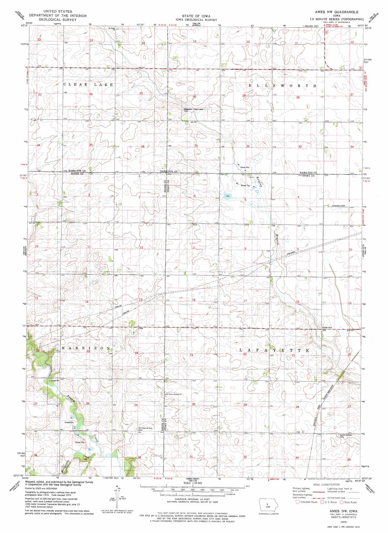
USGS Topo Quad 42093b6 - 1:24,000 scale
| Topo Map Name: | Ames Nw |
| USGS Topo Quad ID: | 42093b6 |
| Print Size: | ca. 21 1/4" wide x 27" high |
| Southeast Coordinates: | 42.125° N latitude / 93.625° W longitude |
| Map Center Coordinates: | 42.1875° N latitude / 93.6875° W longitude |
| U.S. State: | IA |
| Filename: | o42093b6.jpg |
| Download Map JPG Image: | Ames Nw topo map 1:24,000 scale |
| Map Type: | Topographic |
| Topo Series: | 7.5´ |
| Map Scale: | 1:24,000 |
| Source of Map Images: | United States Geological Survey (USGS) |
| Alternate Map Versions: |
Ames NW IA 1975, updated 1978 Download PDF Buy paper map Ames NW IA 2010 Download PDF Buy paper map Ames NW IA 2013 Download PDF Buy paper map Ames NW IA 2015 Download PDF Buy paper map |
1:24,000 Topo Quads surrounding Ames Nw
Duncombe |
Webster City |
Blairsburg |
Williams |
Buckeye West |
Stratford |
Stanhope |
Jewell |
Ellsworth |
Radcliffe |
Fraser |
Mackey |
Ames Nw |
Story City |
Mccallsburg |
Boone West |
Boone East |
Ames West |
Ames East |
Nevada |
Madrid Nw |
Luther |
Slater |
Huxley |
Maxwell |
> Back to 42093a1 at 1:100,000 scale
> Back to 42092a1 at 1:250,000 scale
> Back to U.S. Topo Maps home
Ames Nw topo map: Gazetteer
Ames Nw: Airports
Aerodrome elevation 311m 1020′Ames Nw: Populated Places
Rosedale elevation 335m 1099′Ames Nw: Post Offices
Boardman Post Office (historical) elevation 311m 1020′Rosendale Post Office (historical) elevation 332m 1089′
Summit Post Office (historical) elevation 318m 1043′
Ames Nw digital topo map on disk
Buy this Ames Nw topo map showing relief, roads, GPS coordinates and other geographical features, as a high-resolution digital map file on DVD: