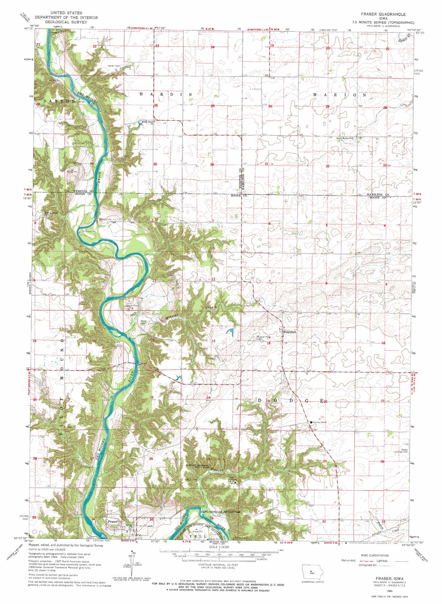
Fraser Topo Map Iowa
To zoom in, hover over the map of Fraser
USGS Topo Quad 42093b8 - 1:24,000 scale
| Topo Map Name: | Fraser |
| USGS Topo Quad ID: | 42093b8 |
| Print Size: | ca. 21 1/4" wide x 27" high |
| Southeast Coordinates: | 42.125° N latitude / 93.875° W longitude |
| Map Center Coordinates: | 42.1875° N latitude / 93.9375° W longitude |
| U.S. State: | IA |
| Filename: | o42093b8.jpg |
| Download Map JPG Image: | Fraser topo map 1:24,000 scale |
| Map Type: | Topographic |
| Topo Series: | 7.5´ |
| Map Scale: | 1:24,000 |
| Source of Map Images: | United States Geological Survey (USGS) |
| Alternate Map Versions: |
Fraser IA 1965, updated 1966 Download PDF Buy paper map Fraser IA 2010 Download PDF Buy paper map Fraser IA 2013 Download PDF Buy paper map Fraser IA 2015 Download PDF Buy paper map |
1:24,000 Topo Quads surrounding Fraser
Fort Dodge South |
Evanston |
Duncombe |
Webster City |
Blairsburg |
Harcourt |
Lehigh |
Stratford |
Stanhope |
Jewell |
Lanyon |
Boxholm |
Fraser |
Mackey |
Ames Nw |
Grand Junction |
Ogden |
Boone West |
Boone East |
Ames West |
Rippey |
Berkley |
Madrid Nw |
Luther |
Slater |
> Back to 42093a1 at 1:100,000 scale
> Back to 42092a1 at 1:250,000 scale
> Back to U.S. Topo Maps home
Fraser topo map: Gazetteer
Fraser: Airports
Stotts Landing Field elevation 355m 1164′Fraser: Parks
Barkley Memorial State Park elevation 336m 1102′Carlson Recreation Area elevation 282m 925′
Rohades Acres elevation 278m 912′
Fraser: Populated Places
Fraser elevation 292m 958′Ridgeport elevation 369m 1210′
Fraser: Post Offices
Carson's Point Post Office (historical) elevation 351m 1151′Fraser Post Office (historical) elevation 292m 958′
Mineral Ridge Post Office (historical) elevation 366m 1200′
Fraser: Streams
Elkhorn Creek elevation 269m 882′Mineral Branch elevation 271m 889′
Fraser digital topo map on disk
Buy this Fraser topo map showing relief, roads, GPS coordinates and other geographical features, as a high-resolution digital map file on DVD: