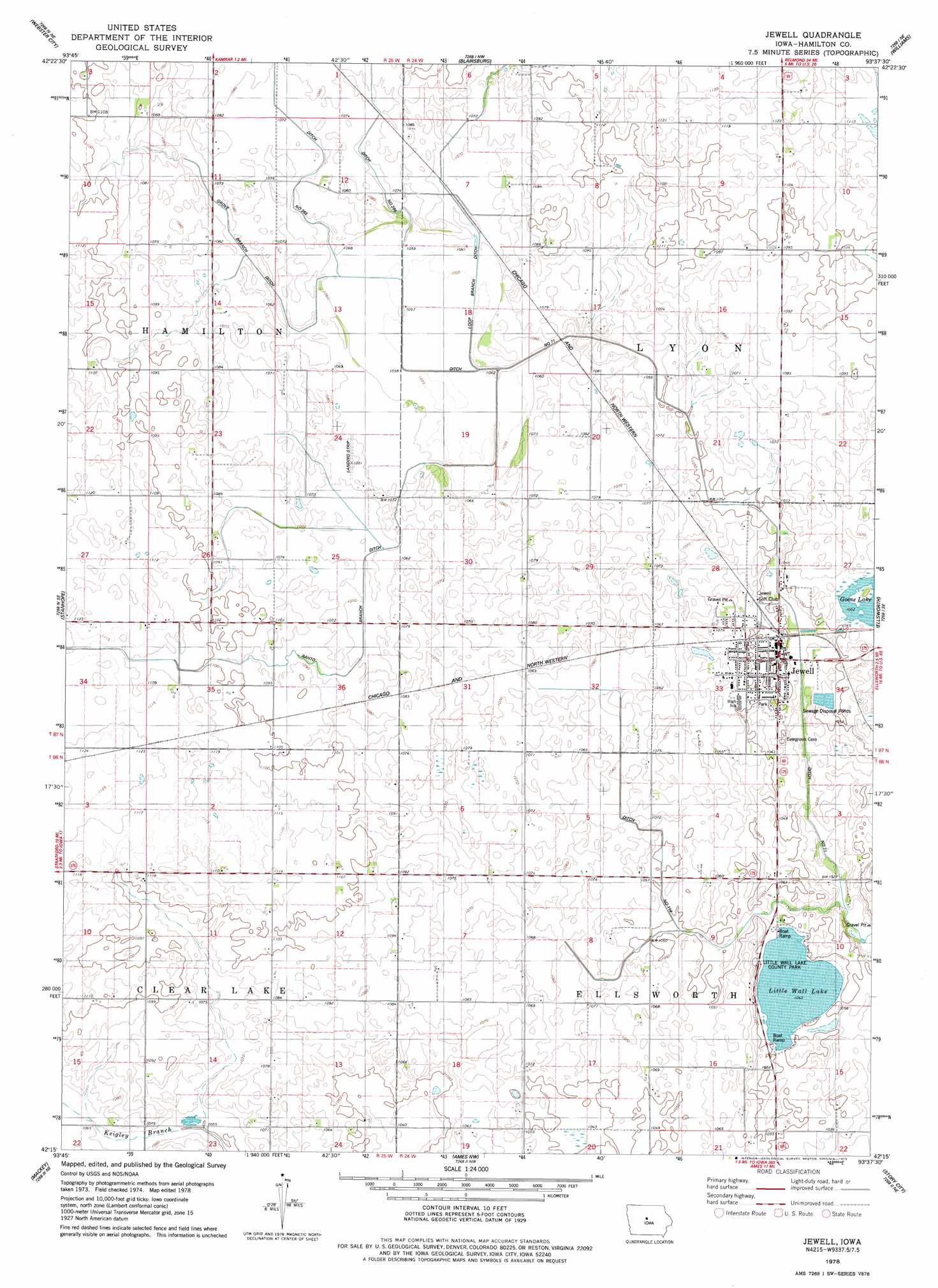
Jewell Topo Map Iowa
To zoom in, hover over the map of Jewell
USGS Topo Quad 42093c6 - 1:24,000 scale
| Topo Map Name: | Jewell |
| USGS Topo Quad ID: | 42093c6 |
| Print Size: | ca. 21 1/4" wide x 27" high |
| Southeast Coordinates: | 42.25° N latitude / 93.625° W longitude |
| Map Center Coordinates: | 42.3125° N latitude / 93.6875° W longitude |
| U.S. State: | IA |
| Filename: | o42093c6.jpg |
| Download Map JPG Image: | Jewell topo map 1:24,000 scale |
| Map Type: | Topographic |
| Topo Series: | 7.5´ |
| Map Scale: | 1:24,000 |
| Source of Map Images: | United States Geological Survey (USGS) |
| Alternate Map Versions: |
Jewell IA 1978, updated 1979 Download PDF Buy paper map Jewell IA 2010 Download PDF Buy paper map Jewell IA 2013 Download PDF Buy paper map Jewell IA 2015 Download PDF Buy paper map |
1:24,000 Topo Quads surrounding Jewell
Eagle Grove Sw |
Woolstock |
Clarion Sw |
Sheldon Creek |
Popejoy |
Duncombe |
Webster City |
Blairsburg |
Williams |
Buckeye West |
Stratford |
Stanhope |
Jewell |
Ellsworth |
Radcliffe |
Fraser |
Mackey |
Ames Nw |
Story City |
Mccallsburg |
Boone West |
Boone East |
Ames West |
Ames East |
Nevada |
> Back to 42093a1 at 1:100,000 scale
> Back to 42092a1 at 1:250,000 scale
> Back to U.S. Topo Maps home
Jewell topo map: Gazetteer
Jewell: Canals
Ditch Number 114 elevation 319m 1046′Ditch Number 71 elevation 320m 1049′
Grove Branch Ditch elevation 323m 1059′
Rahto Branch Ditch elevation 323m 1059′
Jewell: Lakes
Cairo Lake (historical) elevation 324m 1062′Little Wall Lake elevation 318m 1043′
Jewell: Parks
Little Wall Lake County Park elevation 318m 1043′Jewell: Populated Places
Jewell elevation 322m 1056′Jewell: Post Offices
Jewell Post Office elevation 322m 1056′Jewell digital topo map on disk
Buy this Jewell topo map showing relief, roads, GPS coordinates and other geographical features, as a high-resolution digital map file on DVD: