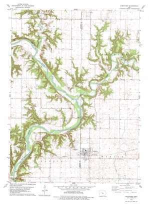
Stratford Topo Map Iowa
To zoom in, hover over the map of Stratford
USGS Topo Quad 42093c8 - 1:24,000 scale
| Topo Map Name: | Stratford |
| USGS Topo Quad ID: | 42093c8 |
| Print Size: | ca. 21 1/4" wide x 27" high |
| Southeast Coordinates: | 42.25° N latitude / 93.875° W longitude |
| Map Center Coordinates: | 42.3125° N latitude / 93.9375° W longitude |
| U.S. State: | IA |
| Filename: | o42093c8.jpg |
| Download Map JPG Image: | Stratford topo map 1:24,000 scale |
| Map Type: | Topographic |
| Topo Series: | 7.5´ |
| Map Scale: | 1:24,000 |
| Source of Map Images: | United States Geological Survey (USGS) |
| Alternate Map Versions: |
Stratford IA 1978, updated 1979 Download PDF Buy paper map Stratford IA 2010 Download PDF Buy paper map Stratford IA 2013 Download PDF Buy paper map Stratford IA 2015 Download PDF Buy paper map |
1:24,000 Topo Quads surrounding Stratford
> Back to 42093a1 at 1:100,000 scale
> Back to 42092a1 at 1:250,000 scale
> Back to U.S. Topo Maps home
Stratford topo map: Gazetteer
Stratford: Areas
Boone Forks Public Hunting Area elevation 326m 1069′Stratford: Parks
Bells Mill Park elevation 291m 954′Benjamin Bell Historical Marker elevation 315m 1033′
Boones Forks Wildlife Management Area elevation 327m 1072′
Boonesfork Wildlife Area elevation 309m 1013′
Stratford: Populated Places
Homer elevation 338m 1108′Stratford elevation 338m 1108′
Stratford: Post Offices
Belleville Post Office (historical) elevation 280m 918′Homer Post Office (historical) elevation 338m 1108′
Hook's Point Post Office (historical) elevation 330m 1082′
McGuire Post Office (historical) elevation 307m 1007′
Stratford Post Office elevation 339m 1112′
Stratford: Streams
Allen Creek elevation 277m 908′Boone River elevation 277m 908′
Brushy Creek elevation 280m 918′
Dry Branch elevation 277m 908′
Prairie Creek elevation 282m 925′
Skillet Creek elevation 276m 905′
Stratford digital topo map on disk
Buy this Stratford topo map showing relief, roads, GPS coordinates and other geographical features, as a high-resolution digital map file on DVD:


