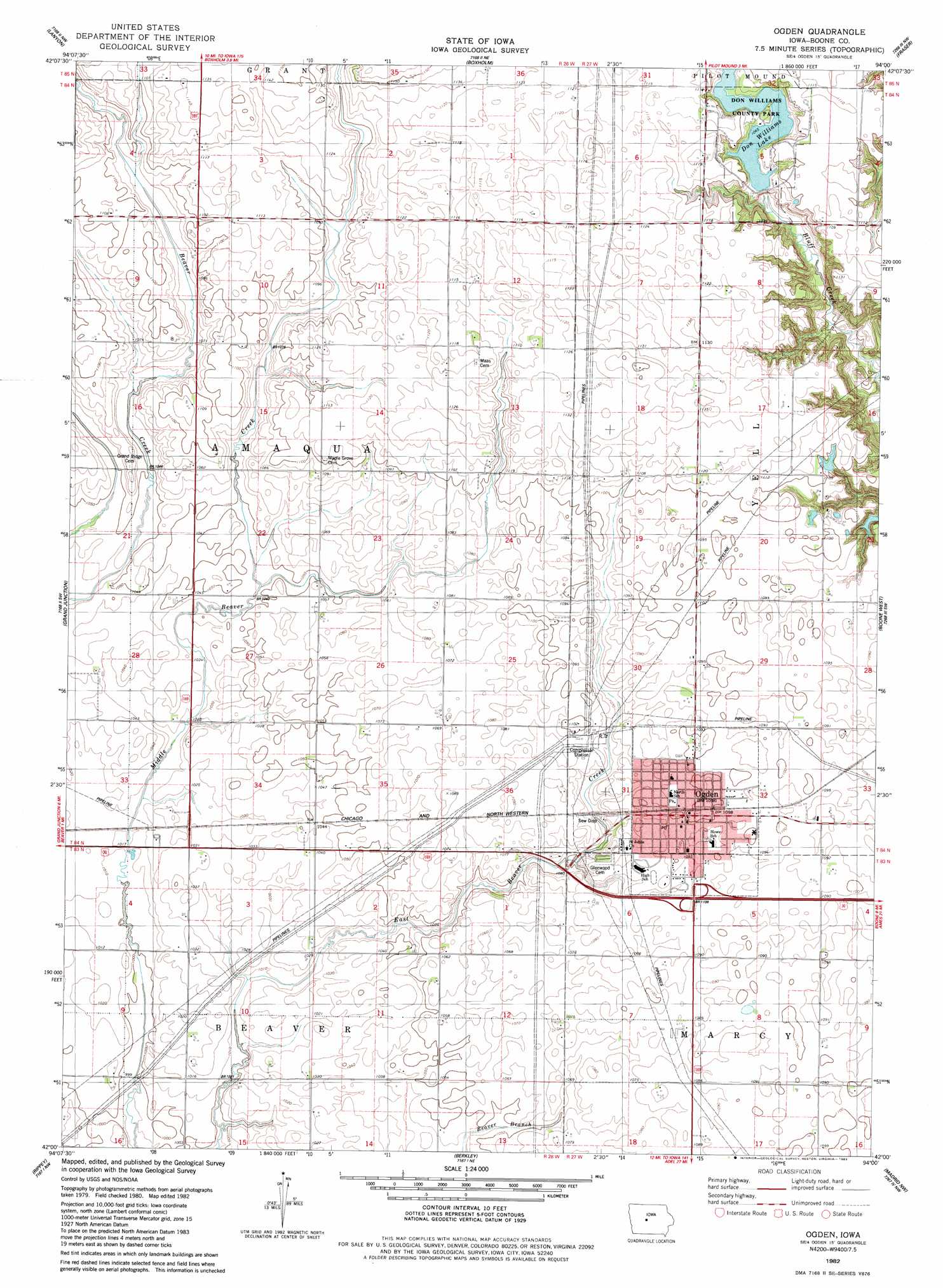
Ogden Topo Map Iowa
To zoom in, hover over the map of Ogden
USGS Topo Quad 42094a1 - 1:24,000 scale
| Topo Map Name: | Ogden |
| USGS Topo Quad ID: | 42094a1 |
| Print Size: | ca. 21 1/4" wide x 27" high |
| Southeast Coordinates: | 42° N latitude / 94° W longitude |
| Map Center Coordinates: | 42.0625° N latitude / 94.0625° W longitude |
| U.S. State: | IA |
| Filename: | o42094a1.jpg |
| Download Map JPG Image: | Ogden topo map 1:24,000 scale |
| Map Type: | Topographic |
| Topo Series: | 7.5´ |
| Map Scale: | 1:24,000 |
| Source of Map Images: | United States Geological Survey (USGS) |
| Alternate Map Versions: |
Ogden IA 1982, updated 1983 Download PDF Buy paper map Ogden IA 2010 Download PDF Buy paper map Ogden IA 2013 Download PDF Buy paper map Ogden IA 2015 Download PDF Buy paper map |
1:24,000 Topo Quads surrounding Ogden
Gowrie |
Harcourt |
Lehigh |
Stratford |
Stanhope |
Paton |
Lanyon |
Boxholm |
Fraser |
Mackey |
Jefferson East |
Grand Junction |
Ogden |
Boone West |
Boone East |
Cooper |
Rippey |
Berkley |
Madrid Nw |
Luther |
Yale |
Dawson |
Perry |
Woodward |
Granger |
> Back to 42094a1 at 1:100,000 scale
> Back to 42094a1 at 1:250,000 scale
> Back to U.S. Topo Maps home
Ogden topo map: Gazetteer
Ogden: Dams
Don Williams Lake Dam elevation 327m 1072′Ogden: Parks
Don Williams County Park elevation 331m 1085′Harrier Marsh elevation 332m 1089′
Ogden: Populated Places
M and S Mobile Home Park elevation 332m 1089′Ogden elevation 338m 1108′
Ogden: Post Offices
Ogden Post Office elevation 332m 1089′Ogden: Reservoirs
Don Williams Lake elevation 324m 1062′Ogden digital topo map on disk
Buy this Ogden topo map showing relief, roads, GPS coordinates and other geographical features, as a high-resolution digital map file on DVD: